Curated OER
More Than One Grain of Rice
Students explore mathematics, geography and agriculture by studying world rice production. In this production of rice lesson, students read One Grain of Rice and use a worksheet grid to calculate how much rice was received. Students...
Curated OER
How to Make a Lake
Students examine the Michigan state quarter and discuss the effects glaciers have on land formation. They perform an investigate using ice cubes and sand to show how glaciers have carved the land.
Curated OER
Gettysburg: The Civil War's Costliest Battle
Students research the Civil War and the Battle of Gettysburg. In this Gettysburg lesson, students analyze journals and letters written by the Gettysburg soldiers. Students define Civil War soldier vocabulary words. Students compare and...
Curated OER
What is the connection between rice and estimation?
Sixth graders investigate estimating. In this estimating lesson, 6th graders estimate how much rice is eaten around the world. Students estimate the percentages of rice eaten by other countries. Students compare rice production to other...
Polar Bears International
Top of the World
Learn about polar bears and the Arctic circle with a lesson about the countries and conditions of the region. After examining how the area differs from Antarctica, kids explore climates, animals, and geographical position of countries in...
Curated OER
Park Brochures
Sixth graders investigate natural environments by researching national parks. In this brochure making lesson plan, 6th graders explore a specific national park and research it's information by utilizing the web. Students create travel...
Curated OER
Meet Meteorology
Students explore meteorology, discuss Earth's atmosphere, create drawings of the water cycle, create meteorology journals, and role play forecasters. Nine lessons on one page; includes unit test.
Curated OER
Town Mouse/ Country Mouse
Students recognize the difference between the city and the country. In this City Mouse, Country Mouse lesson, students listen to a story and describe and map differences between the city and the country. Students understand that people...
Curated OER
Walking Down Main Street: The Changing Times of a Railroad Town
Students explore the historic district via a scavenger hunt. In this community history lesson, students complete a scavenger hunt using historic postcards and clues as guides. Students create a timeline demonstrating changes of the area...
Curated OER
Louisiana Purchase
Students use maps, lecture and discussion to explore the unique contributions to the U.S. resulting from the purchase of the Louisiana Territory. They complete worksheets, label maps and participate in discussion groups.
Curated OER
Trading Faces
Students use addition to determine values of coin combinations. They play a game where they come up with possible trades: two nickels for a dime and complete a tally worksheet. There are other lessons in this unit.
Curated OER
Land Use Over Time
High schoolers view aerial photos and topographic maps of their local area. They compare and contrast major land use patterns over time by comparing these images to maps that are at least 50 years old. They analyze them using the four...
Curated OER
Every Picture Tells a Story
Students examine the ways in which a work of art represents the culture or lifestyle of people living in a state. They analyze the back of the Iowa quarter and discuss how art reflects the time period in which it was created.
Curated OER
PLATE MOVEMENTS AND CLIMATE CHANGE
Pupils label three geological maps with continents provided to analyze the relationships between the movement of tectonic plates and the changes in the climate. In small groups, they discuss their findings and form hypotheses about the...
Curated OER
The Nature of Coins
Pupils examine the Arkansas state quarter and identify natural resources depicted on the quarter. They compare natural resources to man-made resources and identify examples of each.
Curated OER
Dead Sea Investigation: Middle East and African Connections
Learners demonstrate comprehension of the physical characteristics of the Dead Sea region and its connection to the Red Sea and the African Great Rift Valley. They are given students the opportunity to understand the role of plate...
Curated OER
Goods for You!
Students define "goods" and "services" and identify examples of both. They read farm books and discuss what we use from animals and plants on a farm. They observe the Wisconsin quarter reverse and locate Wisconsin on a map.
Curated OER
Introduction to Southeast Asia - Indonesia
Students explore Southeast Asia. In this Indonesia activity, students listen to a lecture about the location of Indonesia and complete map activities. Students also examine Indonesian art forms and explore the process of dying.
Curated OER
NAFTA Trade Unit
Middle schoolers research the geography, economics and government of Canada and how that affects US/Canadian trade relations. In this NAFTA lesson, students play a game, read about Canadian history, and creat a graph.
Curated OER
Air Masses & Fronts
Students use a set of maps depicting a front passing through the state to identify two distinct air masses and the frontal boundary. They then deterine whether the front is moving in time and in what direction the front is moving.
Curated OER
The Distance Between Us and Them: Sea Floor Spreading in the Atlantic Ocean
Students examine how geologists determine rates of sea floor spreading between two tectonic plates. They apply mathematical concepts such as the calculation and use of velocities and conversion from one set of units to another.
Curated OER
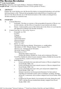
The Russian Revolution
Students complete a matching game based on geographic features of Russia and label a map with these features. In this geography and politics lesson, students identify resources and populations in Russia and complete a T-Chart on a video...
Curated OER
A Coin Out of Water
Students examine the Michigan state quarter and identify land and water on the quarter. They locate the Great Lakes and other bodies of water on a map. They compare and contrast streams, rivers, ponds, lakes, and oceans.
Curated OER
Start with a Chart
Students use a given chart and the 50 state quarters to synthesize information about the 50 states and the dates that they were admitted into the union. Students complete a math worksheet while referring to the chart.


