Curated OER
Worksheet #18 Questions - New World Explorers in Canada
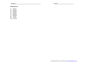
In this New World explorers quiz worksheet, students learn several terms that relate to the early exploration of Canada in order to further their understanding.
Curated OER
Historical Research on Explorers of Canada
Eighth graders study an online atlas of Canada to research an early explorer.
Curated OER
Early Explorers Web Quest
Pupils use the Canadian atlas online to research early explorers and settlers in Canada. They also complete a Web Quest to gather information from maps. They make generalizations about the early settlement patterns as well.
Curated OER
History and Government of the United States
In this U.S. worksheet, students take notes in a graphic organizer as they read several passages, then answer four comprehension questions.
Curated OER
Rabbit and Bear Paws: the Aboriginal Community Then and Now
Students read and discuss a story featuring aboriginal characters in the past and compare/contrast it to how aboriginals live today. They read and discuss information on the Rabbit and Bear Paws website, develop a list of the aboriginal...
Constitutional Rights Foundation
The War of 1812: America’s First Declared War
Free Trade and Sailor's Rights! Pupils dive into America's first declared war, the War of 1812. They analyze the presidencies of Jefferson and Madison through diary entries and historical reasoning. To conclude the lesson, they use their...
Curated OER
New Jersey
In this reading comprehension worksheet, students read a passage about the early history of the state of New Jersey and answer true and false questions. Students write 10 answers.
Curated OER
Major American Water Routes
Sixth graders locate and identify the major bodies of water and waterways in the United States. Through a simulation activity, they describe how early explorers would have described their surroundings. Working in groups, they create...
Curated OER
Maine
In this Maine reading comprehension worksheet, students read a 2-page selection regarding the state and they answer 10 true or false questions pertaining to the selection.
Curated OER
Educational Technology Clearinghouse: Maps Etc: The Early United States, 1790
A map of the United States in 1790 showing the territorial claims of the states at the time, and the British and Spanish possessions and territory disputes. The map shows the frontier lines or extent of settlement from the coast of Maine...


