Curated OER
Orienteering: Map Skills
Students discover orienteering. In this orienteering activity, students search for six specific landmarks. Students brainstorm how maps and landmarks are helpful.
Curated OER
Gingerbread Forest Map Skills #2
Students are read the story "Gingerbread Baby". They work together to develop a 3D map of the journey the baby traveled in the story. They practice their map reading skills to complete the lesson.
Curated OER
Me on the Map Lesson 1
Students use maps, globes, geographic information systems and other
sources of information to analyze the nature of places at a variety of scales. They identify on a map and determine the population
of the city, county, state, country...
Curated OER
Landscape Picture Map
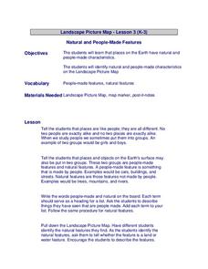
Students discuss differences between man made and natural features on the Earth's surface. For this natural and man made features lesson, learners brainstorm a list of features and categorize them on the board. Students study a landscape...
Curated OER
Landscape Picture Map
Students explore pollution of water sources. In this ecology activity, students define and identify natural resources. Students use map skills to locate local rivers and lakes used for recreation. Students brainstorm ways in which to...
Curated OER
Freshman Project-Part One-Science Concept Map & 4-Questions Strategy
In this project worksheet, students are given a rubric to asses their concept map and their four question strategy completed for their science project.
Curated OER
Writing/Setting/The Adventures of Tom Sawyer--Map Your Childhood Project
Students write using a strong sense of place. In this Adventures of Tom Sawyer lesson, students discuss the importance of setting to the novel. Students brainstorm five specific locations that contribute to their personal history....
Curated OER
Acting as a Pre-write Tool
Second graders use acting to help them in a prewriting activity to develop a story. In this prewriting lesson plan, 2nd graders form a character map and brainstorm ideas for their story.
Curated OER
National Expansion
Students investigate the Manifest Denstiny. They explore how the idea was evident in 19th century American maps. Students brainstorm the relationships between maps and national expansion. They review a map from 1816 that called for...
Curated OER
What's Your Temperature?
Learners take a look at the local newspaper and focus on the weather section. They get into small groups, and each one looks at the same map, but of a different part of the country. They must prepare a presentation that shows how...
Curated OER
The Crash Scene
Fifth graders explore geography by participating in a mapping activity. In this engineering lesson plan, 5th graders identify the differences between latitude and longitude and practice locating precise points on a globe or map. Students...
CK-12 Foundation
Direction on the Earth: Using a Compass
Navigate the world of orienteering in an informative interactive. Earth science scholars learn practical direction skills, such as proper polar coordinates and pairing compasses with maps. The interactive map allows them to practice...
Radford University
The Wheels on the Bus
Find a cheaper way to keep buses going round and round. Small groups use their knowledge of ratios and proportions to find ways to save money on school transportation. The teams determine the number of miles buses currently travel by...
Curated OER
Mapping the Transcontinental Journey
Students develop their geography skills. In this Lewis and Clark instructional activity, students collaborate to calculate the time and distance of different segments of the expedition. Students compare their estimate to Lewis and Clark's.
Curated OER
Mapping the Prairie
Fifth graders study maps of the Chicago area looking at defining characteristics and place names. They investigate settlement patterns by looking at the maps.
Southern Nevada Regional Professional Development Program
Using Maps to Inspire Personal Narratives
A solid description of one way to teach narrative writing, this resource outlines the writing process from concept to completion. Class members create concept maps of moments in their lives and follow the writing process to publish their...
Curated OER
Mapping South America
Students explore South America. In this South American lesson, students use their geography skills to create population, terrain, biomes/vegetation, and major exports maps. Students present their finished maps to their classmates and...
Do2Learn
Ending A Conversation
Sometimes beginning a conversation isn't the hard part—it's ending the conversation that can be challenging. Autistic and mainstream learners alike can benefit from a resource that provides a reference handout with ways to end a...
Curated OER
Sense Poems
Students explore 5 senses poetry. In this poetry writing lesson, students visualize a special day and brainstorm related vivid adjectives and phrases. Students create mindmaps of the five senses to go with their visualization and write...
Curated OER
America: The Land We Live In: Landmarks
Students explore the concept of landmarks. For this landmark lesson, students brainstorm different landmarks around their community and nationally. Students then identify the patterns in Georgia O'Keeffe's paintings or landmarks.
Curated OER
Relief Maps
Learners study geographical maps and their functions. In this geography instructional activity students work in groups to build a map to scale.
Curated OER
Cinderella Map Key
Students design a map key in order to show where the different Cinderella stories have taken place. In this map key lesson plan, students place symbols on a map to show the diversity of the stories.
Curated OER
Introduction of the Lunar Relief Map Project
Students investigate the geographic features of the surface of the moon. For this lunar relief map lesson, students watch and discuss the Apollo II Moon landing and make preliminary plans for their lunar maps.
Curated OER
Forestry and Changing Feelings
Students investigate how the forest affects their daily lives by creating a concept map. In this ecological lesson, students create a concept map linking the forest to the many things they use each day. Students take a field trip in...


