Curated OER
State Symbols
In this social studies worksheet, students examine and analyze each of the state's abbreviations, capitals, birds, flowers, animals and the dates when they became a state.
Curated OER
The City I Live In
Research information about your city and state. Pupils investigate details such as the name of the city mayor, local establishments, and entertainment. For the state, they name the capital, governor, state flower, and flag. There are...
Curated OER
Maryland Map
For this Maryland worksheet, students analyze an outline map of the state of Maryland. Students fill in the state capital, major cities and other state attractions.
Curated OER
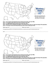
Mystery State # 5
Mystery state number five is none other than Utah! Quiz your kids on state knowledge while building deductive reasoning skills. They use each of the five clues to determine the name of the mystery state. A great warm up when studying...
Curated OER
Animals Inside the Forbidden City
Students research information about China's capital and the area known as The Forbidden City. They identify real and imaginary sculptures displayed on Beijing's streets and rooftops and sculpt and paint replicas of these sculptures. They...
Curated OER
Arkansas Map
In this Arkansas worksheet, students analyze an outline map of the state of Arkansas and label the capital city. Students label other important cities and important attractions and color the map.
Curated OER
California Map
In this California blank outline map worksheet, students examine the political boundaries of the state and then mark the state capital, other cities, and other state attractions on the map.
Curated OER
Idaho Map
In this outline state map of Idaho worksheet, students fill in the map with the state capital, major cities, and other state attractions or teacher created directions. Students draw at least 7 answers.
Curated OER
Connecticut Map
In this state maps worksheet, students identify the state of Connecticut, and fill in the state capital, major cities, and other major attractions.
Curated OER
Colorado Map
In this state maps worksheet, students identify the state of Colorado, and fill in the state capital, major cities, and other attractions for the state.
Curated OER
North Carolina Map
For this state maps worksheet, learners identify the state map of North Carolina. Students fill in the state capital, the major cities, and other state attractions.
Curated OER
Michigan Map
In this state maps activity, students identify the map of Michigan. Students then fill in the capital city, major cities, and other state attractions.
Curated OER
Maine Map
In this state maps worksheet, students identify the map of Maine. Students fill in the capital city, major cities, and other state attractions.
Curated OER
Montana Map
For this state maps worksheet, students identify the state map of Montana. Students fill in the capital city, the major cities, and other state attractions.
Curated OER
North Dakota Map
In this North Dakota worksheet, students study an outline map of North Dakota with the capital city marked. Students color the map and add other important cities and landmarks.
Curated OER
New Mexico Map
In this state maps worksheet, students identify the state of New Mexico. Students fill in the state capital, major cities, and other state attractions.
Curated OER
Ohio Map
In this Ohio activity, 4th graders explore the state of Ohio. Students look at the map of Ohio and fill in the state capital, major cities, and any other important landmark or site on the map.
Curated OER
Vermont Map
In this state maps learning exercise, students identify the map of Vermont. Students fill in the state capital, the major cities, and other state attractions.
Curated OER
Wyoming Map
In this blank outline map worksheet, students fill in the state capital, major cities, landforms, and other places of interest on this map of Wyoming.
Curated OER
Tennessee Map
In this Tennessee outline map, learners examine the political boundaries of the state. Students mark the state capital, major cities, and other state attractions.
Curated OER
Utah Map
In this Utah worksheet, students analyze an outline map of the state of Utah. The capital city is marked. Students add other important cities, bodies of water or other important features. Students color the map.
DC Vote
One Kid, One Vote
Learn about why the citizens of Washington, D.C. feel unrepresented in Congress with an article about D.C voting rights. Individuals read about the movement toward congressional representation in Washington, D.C., before answering...
Carolina K-12
Sample Test: Economics
From scarcity and marginal benefits and costs to economic systems and GDP, this 22-question multiple choice test covers some of the most fundamental concepts of economics.
Carolina K-12
Practice Test of Economics
From scarcity and supply and demand to entrepreneurship and the stock market, here you'll find a multiple-choice assessment that includes 34 questions covering all the major concepts of a traditional economics course.
Other popular searches
- Socialism and Capitalism
- Socialism vs Capitalism
- Capitalism Socialism Communism
- Socialism Capitalism


