Curated OER
Native American History
Fourth graders use a previous and current map of the state of Michigan to compare cities and roads. They look for names that come from the Native American culture. They participate in a class discussion to compare findings.
Curated OER
Carnavals and Colonialization
Ninth graders compare and contrast different Carnavals throughout Latin America. For this Latin American lesson, 9th graders study the geography and colonial history of Latin America.
Curated OER
An Uncertain Future
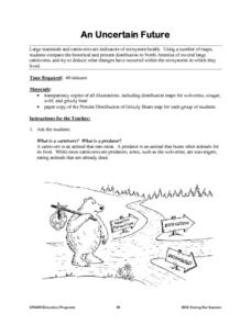
Students study the distribution of large mammals and carnivores in an ecosystem. Using maps and historical data, they examine areas for these animals such as refuges, untouched forests, prairies and grasslands. Students determine actions...
Curated OER
People Who Make A Difference: American Heroes
Students think about the characteristics of a hero so they can later evaluate which historical figures on the heroes chart meet the criteria.
Curated OER
Exploring National Flags
Sixth graders examine the importance of flags throughout the world. Examining different countries, they determine the geographical and historical contributions in the past and modern times. They compare and contrast the flags of five...
Curated OER
Documenting Texas Women’s History through Photographs
Students explore women’s history. In this women’s studies lesson, students will examine seven photographs that depict prominent female figures from Texas’s history. Students will engage in a discussion of the photographs as a mode of...
Curated OER
El Nino Lesson
Students compare graphs of weather occurrences. In this environmental lesson plan, students will being using the website to gather weather related information for a certain time period. The students will then graph the data that will be...
Curated OER
George Winter Lesson Plan 3
Bring language arts and U.S. history together in this lesson, which prompts middle and high schoolers to gather biographical information about Abraham Lincoln. They compare and contrast information written about his childhood and discuss...
Curated OER
Gardens Throughout the World
Fourth graders study various aspects of gardens. In this garden lesson, 4th graders discover the location of famous gardens on a map. Students research historic gardens.
Curated OER
The Family Quilt
Third graders examine the artwork of Faith Ringgold. They create their own quilt pattern on fabric and piece them together to create a class quilt. They compare their similarities with one another.
Curated OER
How Has Transportation Changed Since the 1899 Harriman Alaska Expedition?
Students recognize modes of transportation. They research historical data from a variety of primary and secondary sources including the Harriman expedition journals, related web sites, and photographs from the expedition. Students...
Curated OER
Stewardship of Yosemite National Park
Students devise a plan that would be true to John Muir's spirit of stewardship toward Yosemite. They analyze a core map to determine the original plan and usage of the park and compare the original plan to a current park map.
Curated OER
Down on the Farm
Students are introduced to a map of an Illinois farm. They determine whether the map is of the past, present, or future by looking at features on the map. They also use the map to make a three-dimensional model.
Curated OER
When Maine Was Part of Massachusetts
Pupils analyze a map of Maine to determine its proportions in 1795. They examine Osgood Carleton's map of Maine from 1795 and complete a worksheet. They share their observations with their group and evaluate a present day map of Maine....
Stanford University
Edward Curtis Photographs
A picture is worth a thousand words. The photos of Edward Curtis capture the life and culture of Native American Tribes during the early part of the twentieth century. A presentation first gives background information on Edward Curtis...
Smithsonian Institution
Who's in Camp?
Pupils complete readings, a group activity using cards, and a writing activity to better understand people's lives during the American Revolution. The resource emphasizes people such as the militiamen, women, officers, and children,...
Constitutional Rights Foundation
Refugees from the Caribbean: Cuban and Haitian “Boat People”
Should refugees fleeing poverty be allowed the same entrance into the United States as those fleeing persecution? High schoolers read about US foreign policy in the late 20th century regarding refugees from Cuba and Haiti, and engage in...
Curated OER
Changing Geography
Students visually examine, identify and analyze the components of various images of the automobile. They discern how to use a road map by planning a route, then use road maps to explain how the state has developed over time.
Curated OER
Carbondale: The Biography of a Coal Town
Students use a brief history of the growth and decline of the anthracite region in the state to create a photograph and map "peak shaped" time line. They practice map and photo analysis strategies to "read" photographs and maps.
Curated OER
What Is In A Name?
Fourth graders investigate the meaning of names and how they are used to name geographic places. They conduct research using a variety of resources. Special attention is paid to names given within the Native American culture. Students...
Curated OER
Migration and Immigration in the United States: Three Case Studies
Students examine the early migration of Native Americans, African Americans, and the British Colonists. They conduct Internet research, complete a timeline, label maps, compare/contrast the three groups' experiences, and write an essay.
Curated OER
Conflicting Views
Students complete a Venn diagram comparing the United States and Afghanistan. They research the history of the Taliban and how they relate to the United States and its foreign policy. They write a paper on possible solutions.
Curated OER
Bushy Run: A Decisive Battle of Pontiac's Rebellion
Young scholars study the battle at Bushy Run. In this Pontiac's Rebellion lesson plan, students examine an 1765 map of the Bushy Run battle as well as letters and a modern topographic map of the area in order to simulate the event and...
Curated OER
Louisiana and Canada: Understanding Acadian Cultural connections
Ninth graders investigate why Acadians moved to Lousiana. In this geography lesson, 9th graders research the migration of Acadian to Louisiana and how that influenced the culture. Students analyze a list of cultural and physical...


