Curated OER
Doodles
Here is a fun drawing activity that is sure to develop listening, shape recognition, drawing, skills and eye-hand coordination. The class doodles over an entire page based on the instructions they are given. This resource includes...
Curated OER
Number Pairs
As you introduce graphs and coordinate pairs, use this guided activity to get scholars started. They reference an example before recording number pairs to identify the location of 12 letters on a grid. Next, learners examine shapes on a...
Teach Engineering
Designing a Spectroscopy Mission
In this mind-bending activity, young engineers explore this question of whether or not light actually bends. Using holographic diffraction gratings, groups design and build a spectrograph. The groups then move on research a problem...
Teach Engineering
Where Are the Plastics Near Me? (Field Trip)
With a piece of plastic here and a piece of plastic there, here a piece, there a piece, everywhere a piece. Teams go on a field trip in order to document the locations and kinds of plastic trash in an area near them. The eighth...
Flag House
Play Well with Others…Be Active Against Bullying!
Bully-free is the way every school should be! How can you help create that kind of culture in your school? A well-written teacher's guide containing lessons for grades 6-8 may be just the ticket. Each unit, separated by grade level,...
Missouri Department of Elementary
I Know What You Did This Summer
Developing and maintaining healthy interpersonal relationships is difficult, especially as middle schoolers begin dating. A short activity permits eighth graders to practice their skills as they consider how they should respond to a...
Curated OER
Coordinate Grid: Mapping an Archaeological Site
Students examine how archaeologists preserve context of sites through use of rectangular grid or Cartesian coordinate system, and develop sense of distance by pacing off and estimating distances.
Curated OER
Cartesian Coordinate System
Students explore the Cartesian coordinate plane and plot points on the graph. They interpret coordinates for a point from the graph and give the ratio of rise over run for slope.
Curated OER
Human Coordinate Plane
Students sit in 25 desks arranged in a square array. They are a human coordinate plane and each of them is to receive a card with an ordered pair (x,y) on it. They who are not seated distribute the ordered pair cards to the appropriate...
Curated OER
Shapes and Coordinates
In this shapes and coordinates learning exercise, students identify the shapes that are located and given coordinates on graphs. A reference web site is given for additional activities.
Curated OER
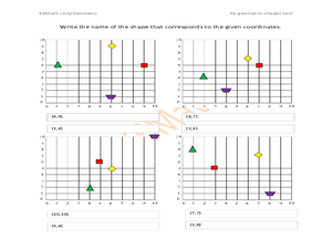
Shapes and Coordinates Practice
In this shapes and coordinates worksheet, students write the name of the shape that corresponds to given coordinates. A reference web site is given for additional activities.
Core Knowledge Foundation
Maya, Aztec, and Inca Civilizations
A 10-lesson unit explores the Maya, Aztec, and Inca civilizations. Over the course of two weeks, scholars read nonfiction excerpts, discuss their findings, and complete activities. An assessment equipped with multiple choice and matching...
Virginia Department of Education
Distance and Midpoint Formulas
Small groups work through two guided activities to derive the distance and midpoint formulas for the coordinate plane. The activities begin with concrete examples and move to abstract.
Curated OER
Map Coordinates: Monkey Map
Here's an engaging, meaningful, and clever lesson on map skills for elementary schoolers. Pupils combine story writing with mapping skills to create an original piece of work. They utilize a worksheet embedded in the plan to guide them...
Noyce Foundation
Granny’s Balloon Trip
Take flight with a fun activity focused on graphing data on a coordinate plane. As learners study the data for Granny's hot-air balloon trip, including the time of day and the distance of the balloon from the ground, they practice...
EngageNY
Searching a Region in the Plane
Programming a robot is a mathematical task! The activity asks learners to examine the process of programming a robot to vacuum a room. They use a coordinate plane to model the room, write equations to represent movement, determine the...
Education Development Center
Finding Triangle Vertices
Where in the world (or at least in the coordinate plane) is the third vertex? Given two coordinate points for the vertices of a triangle, individuals find the location of the third vertex. They read an account of fictional...
EngageNY
Lines That Pass Through Regions
Good things happen when algebra and geometry get together! Continue the exploration of coordinate geometry in the third lesson plan in the series. Pupils explore linear equations and describe the points of intersection with a given...
Mathematics Vision Project
Module 6: Connecting Algebra and Geometry
A geometry module connects algebraic reasoning to geometry. It challenges scholars to investigate the slope criteria for parallel and perpendicular lines, prove theorems involving coordinate geometry, and write equations for circles and...
California Mathematics Project
Reflections
Reflections are the geometric mirror. Pupils explore this concept as they discover the properties of reflections. They focus on the coordinates of the reflections and look for patterns. This is the third lesson in a seven-part series.
Curated OER
Coordinates
Students identify and label the coordinate planes by the four different quadrants. In this geometry lesson, students plot an ordered pair correctly. They identify and differentiate between rational and irrational numbers.
Curated OER
Coordinate Graphing
Students practice basic coordinate graphing and plotting points on the coordinate axis. In this geometry lesson, students are introduced to ordered pairs, and the x and y axis.
Curated OER
Graphing on a Coordinate Plane
Eighth graders explore the coordinate system. They identify the x and y-axis, parts of the coordinate plane, and discuss the process of plotting points. To emphasize the process of plotting points, 8th graders play an ordered pair...
Curated OER
Coordinate Grid: Mapping Archeological Sites
Fourth graders discover how to apply the Cartesian coordinate system by figuring out the length and width of their school playground. They determine that pacing is an important tool for the initial mapping of a site. Students conduct a...


