August House
Go to Sleep, Gecko
Use this multidisciplinary lesson to delve into these subjects: English language arts, math, science, drama, and character education. After reading, discussing, and making interpretations about Go To Sleep, Gecko!: A Balinese Folktale by...
Sunburst Visual Media
Clouds
Support science instruction with a combination of engaging activities and skills-based worksheets that focus on clouds. Learners take part in grand discussions, write an acrostic poem, complete graphic organizers, solve word puzzles, and...
Curated OER
Beary O'Mometer Learns About Careers In Meteorology
Young scholars explore the field of meteorology. In this meteorology lesson, students explore weather-related careers as they research the field of study as well as various weather concepts. Young scholars interview meteorologists, write...
Curated OER
Wind and Wildfire
Emerging scientists research weather-related vocabulary terms, and map out where wildfires are most likely to occur. To bring this lesson to life, you could demonstrate what happens to a fire when you cool or remove the fuel, or cut off...
Curated OER
Hurricanes!
Students access hurricane reports form the national weather service online, and draw hurricane paths. They discuss how hurricanes form and move. The research should be reported in a comprehensive presentation that can be given to a whole...
Living Rainforest
Finding the Rainforests
From Brazil to Indonesia, young scientists investigate the geography and climate of the world's tropical rain forests with this collection of worksheets.
Curated OER
Weather Station
Students create their own barometer, precipitation, rain gauge, anemometer, and more with their weather stations. In this weather station lesson plan, students access on line websites on how to make their own weather tools.
Curated OER
Geology and the Battle of Gettysburg
Young scholars create geologic maps of the Gettysburg battlefield. In this geologic skills lesson, students consider the variations of Earth's surfaces and explore strategies employed by the North and South in the Battle of Gettysburg to...
Science 4 Inquiry
An Investigative Look at Florida's Sinkholes
In May of 1981, the Winter Park Sinkhole in Florida first appeared and is now referred to as Lake Rose. Scholars learn about the causes of sinkholes through an inquiry project. Then, they analyze recent data and draw conclusions to...
Chicago Botanic Garden
Climate Change Around the World
Look at climate change around the world using graphical representations and a hands-on learning simulation specified to particular cities around the world. Using an interactive website, young scientists follow the provided directions to...
Curated OER
Setting the Story: Techniques for Creating a Realistic Setting
“It was a dark and stormy night.” Thus begins the 1830's novel Paul Clifford and, of course, all of Snoopy’s novels! Encourage young writers to craft settings for their stories that go beyond Edward Bulwer-Lytton’s often-mocked phrase...
Curated OER
Where in the World is Cynthia San Francisco? A weather-related challenge
Students investigate concepts of weather using a guided, essential question. They collect data from satellite weather images and create models to track the progress of weather changes.
Curated OER
Weather Or Not
Young scholars use the internet to find pen pals to share in their weather experiment. Individually, they research the high and low temperatures for cities within the United States and email the results to their pen pal. They also...
Curated OER
Monarch Butterfly Migration Map
Students examine the migration patterns of the monarch butterfly. They practice using color-coded maps. They create their own maps based on the butterfly's migration. They share their maps wtih the class.
Curated OER
Strawberry Girl: Life on the Frontier
Students explore geographic changes by researching the state of Florida. In this Florida history lesson plan, students identify the storms and disasters that have created sinkholes in portions of Florida. Students read the book...
Curated OER
Project Jukebox
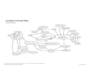
Students analyze an interview with the Climate Change Project Jukebox in order to help them undertand how to use a concept map. In this writing and climate change lesson, pairs of students log onto the Internet site for Climate Change...
Curated OER
Meet Meteorology
Students explore meteorology, discuss Earth's atmosphere, create drawings of the water cycle, create meteorology journals, and role play forecasters. Nine lessons on one page; includes unit test.
Curated OER
River to the Sea
Students investigate the function of wathersheds and weather while they follow Lewis and Clark on their jouney west. They also create a map using acurate measurements and build a model watershed.
Curated OER
Create a Weather Newscast
Fourth graders explore, research and study how to make and give a weather newscast. They assess a variety of weather terms, research skills on the Web and develop an oral presentation on a weather newscast to present to their classmates.
Curated OER
Mapping a Stream
Students map an actual local waterway. They create full color scale drawings that include windfalls, plant cover, streambed composition, and landmarks such as trees, boulders, and slumps. This is a long-term project that involves...
Curated OER
The Magic School bus Inside A Hurricane
Students investigate the concept of a hurricane by using the cartoon series "The Magic Schoolbus" to simulate the fantasy of traveling through a hurricane. The lesson uses a KWL graphic organizer in order to guide student inquiry and as...
Rocklin Unified School District
Spanish Speaking Countries Project
Ask your class members to provide a tour of a Spanish speaking country with a brochure and flag project. Learners research their assigned country, making sure to check off each of the required pieces of information listed on the first...
Curated OER
Measuring Precipitation
A little engineering design is mixed into this lesson on precipitation measurement. Groups plan and construct a rain gauge, and use it to collect precipitation. As part of the PowerPoint presentation, learners view a satellite map of...
Curated OER
Color Enhanced Maps
Learners download or create maps with numerical weather data. They add isolines and color to create regions on their maps. They explore the visual properties of color palettes and create a visualization applying their knowledge.


