Curated OER
Landforms Mobile
Students work together in groups to research the various types of landforms found on the Earth and locate them on a map. As a class, they discuss how the landforms affect the way people live in those areas. To end the lesson, they use...
Curated OER
How to Use Technology to Teach Landforms
Students create a landform table on the computer. In this geography lesson, students use Microsoft Word to design a 3 column table. They list different landforms, examples, and attach a picture of each.
Science Matters
Landforms from Volcanoes
Three major types of volcanoes exist: cinder cone, composite/strata, and shield. The 18th lesson in a 20-part series covers the various landforms created from volcanoes. Scholars work in pairs to correctly identify the three types based...
Curated OER
A Feature Presentation - Geographic Landforms
Students investigate, identify and compare the various geographic terms that can be used to describe the landforms occurring in the Hawaiian islands.
Curated OER
Unique Landforms
Students create a travel route among different landforms and way the cost and benefits of traveling this way. In this traveling lesson plan, students work in groups and analyze their conclusions.
Curated OER
I Can Find that Where? - A Study of Landforms
First graders make landform maps of the United States. In this landform lessons, 1st graders participate in a discussion of local landforms and make a landform map of the United States. They follow the teacher's directions to add plains,...
Curated OER
Landforms of Iowa
Students observe the landscape and different landforms where they live. In this landforms lesson students list and define materials that make up their local landforms.
Curated OER
Our Country's Landforms
Learners investigate the many different landforms that are found throughout the United States. They use the internet and other resources to gather information. The information is used to prepare a multimedia slideshow and to create a...
Curated OER
Changing Landforms
Students investigate different types of landforms. In this landforms lesson, students explore landforms by participating in a WebQuest. Students research the reasons behind landforms changing and create a picture using KidPix.
Curated OER
Mapping Landforms of South Carolina
Third graders analyze South Carolina maps. In this geography lesson, 3rd graders locate the five land regions in the state are and discuss how the regions are different. Students identify the major bodies of water and analyze how they...
Curated OER
Using Different Kinds of Maps
Third graders explore the landforms and population diversity. They read maps and examine geographic terms. Students create their own map of the United States and answer questions about the location of people. After exploring the map, 3rd...
Curated OER
Exploring Landforms
Second graders discuss the different types of landforms throughout the world. They pick one and research and present it to the class.
Curated OER
Landforms Slideshow
Students identify twelve different types of landforms, and create a slideshow about each landform that includes a title, pictures, definitions, conclusions and a reference page.
Curated OER
Looking at Landforms-Based on the Washington Quarter Reverse
Students use a Washington State Quarter to examine different landforms and discuss natural resources. After a class discussion on the items found on a Washington State quarter, students brainstorm a list of natural resources found in...
Curated OER
Oh, the Regions
Focus on the geography of Oklahoma. For this activity, learners compare different geographic regions in Oklahoma, create a collage to share their results, and identify important landforms throughout the United States, such as the Rocky...
Curated OER
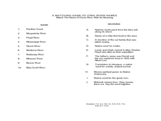
Title: Rivers as Borders
Students are introduced to the concept of borders. They read maps and identify rivers that separate different countries and states. They examine how or why a landform such as a river border might be the reason for different cultures.
Curated OER
I Love the Mountains
First graders discuss and define different landforms. They read the book "Our Land", sing a landform song and perform it with motions and then complete a worksheet.
Curated OER
Geography Terms
Pupils identify different landforms and fill out a worksheet where they explain what each landform is. In this geography lesson plan, students fill in a landform map and then use landform words as they describe the landforms.
Curated OER
The Earth's Crust
Students use clay to form models of the different landforms and then complete a data table using a map, atlas, or the Internet to locate famous landforms in the United States. Students complete various activities, writing down their...
Space Awareness
Valleys Deep and Mountains High
Sometimes the best view is from the farthest distance. Satellite imaging makes it possible to create altitude maps from far above the earth. A three-part activity has your young scientists play the role of the satellite and then use...
Curated OER
Natural Resources
Students explore Iowa geography and topographic maps. In this geography and topographic maps lesson plan, student investigate maps, newspapers, Iowa flora and fauna. Students gain an understanding of how different landforms can be...
Science 4 Inquiry
Let's Get Moving
Rivers top the list of causes of erosion over time. Scholars experiment with wind, water, and ice reshaping sand. They connect the simulations facts about erosion and deposition to understand unique landforms such as the Grand Canyon and...
Curated OER
A Shuttle's Eye View
Students explore the goals of the Shuttle Radar Topography Mission as a springboard to exploring the topographical features of their own state or region. They synthesize their understanding of landforms and topography by mapping their...
Curated OER
Earth Book
After viewing a teacher-led demonstration on a variety of landforms of the Earth, 1st graders create an Earth book. This nicely-done hands-on lesson has students produce books that describe, in pictures and words, different aspects of...


