K5 Learning
Landforms
Valleys, mountains, and plateaus are just a few geographic landforms on our Earth. Read about these types and more in a brief landform passage. After reading, learners respond to six short answer comprehension questions.
Seussville
The Lorax's Earth Day
Add a touch of Dr. Seuss whimsy to your Earth Day celebration with six pages consisting of Earth-friendly, inspiring, and engaging activities designed to enhance the beauty of your school campus and showcase the famous story, The Lorax.
Science Matters
Landforms from Volcanoes
Three major types of volcanoes exist: cinder cone, composite/strata, and shield. The 18th lesson in a 20-part series covers the various landforms created from volcanoes. Scholars work in pairs to correctly identify the three types based...
Curated OER
Regents High School Examination: Physical Setting Earth Science 2009
Junior geologists address 50 multiple choice questions and 35 short answer questions about the earth system. Plenty of visuals are included for interpretation: diagrams, graphs, maps, photographs, laboratory setups, weather symbols, and...
K12 Reader
United States Geography
Encourage reading for information with a text about United States geography. Kids read a short passage about the landforms in the United States, including mountain ranges and natural resources, and answer five reading comprehension...
Curated OER
A Feature Presentation - Geographic Landforms
Students investigate, identify and compare the various geographic terms that can be used to describe the landforms occurring in the Hawaiian islands.
Curated OER
Geological Features: How Weathering & Erosion Help Create Landforms
Students explore how the Earth's surface changes resulting in geological features and landforms. They perform a read-a-loud on Thomas
Locker's Mountain Dance, complete a KWL chart, and create a
landform using plaster of paris.
Curated OER
Earth to Saturn, Earth to Saturn!
Learners compare and contrast the characteristics of Earth and Saturn. They practice writing analogies using those characteristics. They complete a worksheet to end the instructional activity.
K12 Reader
Natural Resources
What natural resources are available in your area? Your learners can consider this question after reading a brief passage about natural and renewable resources. After reading, class members respond to five questions related to the reading.
Curated OER
Appreciating The World By Learning About Landforms
Children can learn about the Earth's landforms and develop a greater appreciation of our world.
Curated OER
Landforms
Students begin their examination of landforms. Using a map, they locate and identify the major landforms on Earth. They discuss how landforms affect the lifestyle of the community and determine which goods and services the community...
Curated OER
I Am A Rock, I Am An Island: Describing Landforms and Bodies of Water
Students identify common landforms and bodies of water from descriptions of distinguishing features. In this landforms and bodies of water lesson plan, students describe the features they see in the pictures given to them.
Curated OER
Tic-Tac-Toe for Layers of the Earth
Eighth graders identify the different layers of the earth. In this earth science instructional activity, 8th graders choose a project to do from a given list according to their learning style. They present their finished project in class.
Curated OER
The Tilting Earth
Fourth graders use a styrofoam ball on a stick to represent earth and a light bulb in the center of the room to represent the sun. They walk around the light, holding their sticks at an angle to show the tilt of the earth's axis. They...
Polar Trec
Create a Topographic Profile of Beacon Valley
Landforms in Beacon Valley, Antarctica, where there is no snow, bear a striking resemblance to landforms found on Mars. Scholars identify landforms found in Beacon Valley through analysis of topographic maps in the activity. They then...
It's About Time
Paleoclimates
How do scientists know what the Earth was like in the past? This second installment of a six-part series focuses on paleoclimates and provides an overview of how geologists determine information about past climates using fossil pollen,...
Curated OER
Planets
In this planets instructional activity, students read about Mercury, Venus, and Earth and then complete 21 multiple choice, 2 true or false, and 1 short answer question.
Curated OER
Earth's Land and Water
Learners describe physical characteristics of bodies of water and landforms. For this land and water lesson plan, students model land and water with modeling clay and also discuss why people live near bodies of water.
Curated OER
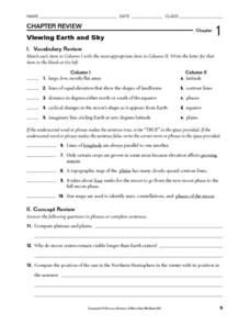
Viewing Earth and Sky
In this earth and sky worksheet, students review terms associated with map reading. Students also review topographic maps and how contour lines represent elevation. This worksheet has 5 matching, 5 true or false, 5 fill in the blank, and...
Curated OER
Common Themes
Tenth graders test usefulness of a model Earth by comparing its predictions to observations in the real world. In this landforms lesson students construct an island from a contour map using model clay then analyze the landscape features...
Curated OER
Working With Electronic Topography Maps
Junior geologists examine topographic maps online and learn how to read them. they answer seven associated follow-up questions. This lesson plan is only a general outline and does not provide the details or the websites that you would...
Curated OER
Landforms And The Oregon Trail
Fourth graders investigate the historical context for the founding of The Oregon Trail. They conduct research to put together the events that led to the geographical route that was taken. The instructional activity also strengthens...
Science 4 Inquiry
Let's Get Moving
Rivers top the list of causes of erosion over time. Scholars experiment with wind, water, and ice reshaping sand. They connect the simulations facts about erosion and deposition to understand unique landforms such as the Grand Canyon and...
National Geographic
Mapping the Shape of Everest
With Mount Everest as the motivator, your earth science class learns about topographic maps. Begin by showing a film clip from The Wildest Dream: Conquest of Everest, featuring fearsome virtual imagery of a path up world's tallest peak....


