Curated OER
Native Americans and Natural Resources
North American Indian civilizations had already been in place for over 10,000 years before the arrival of European settlers. Introduce your young historians to Indian tribes that lived in the Chesapeake region in the early seventeenth...
National Endowment for the Humanities
People and Places in the North and South
North and South: two opposite directions and two opposite economic and social systems in time of the Civil War. Pupils peruse census websites and primary source photographs to understand what life was like for the everyday person before...
Curated OER
John Smith’s Map of the Chesapeake Bay
Young geographers travel back through time with primary source and map analysis and envision Captain John Smith's arrival at the Chesapeake Bay.
Curated OER
Discovering the Physical Geography of Washington
Pupils develop a mental map of the state of Washington and draw it on paper. Using the Virtual Atlas, they identify the physical features of the state and draw them on their map. They also examine the populations and diversity of the...
Curated OER
The Geography of Maine Tourism
Learners study topographical maps of Maine to identify the important physical features. They work in groups to create tourism pamphlet highlighting a region of the state.
Curated OER
Physical Geography- Climate
Sixth graders explore different climates. In this compare and contrast lesson, 6th graders look at the differences in climates of America and Europe. Students use KWL charts and graphic organizers to record information about different...
Curated OER
Geography of the Study of the Spanish-speaking People of Texas
Students identify the physical features, demographic characteristics, and history of the four Texas towns featured in Russell Lee's photo essay, "The Spanish-Speaking People of Texas." They conduct Internet research, and create a travel...
Curated OER
A Study of the United States of America
Students research information about each of the fifty states. They locate information using both the Internet and CD Roms and create databases using the research information. They insert graphics in a multimedia presentation using the...
Curated OER
social Studies: Yesterday, Today, and Tomorow
Sixth graders take an Internet trip back in time to explore ancient cultures. Working in teams, they assume the roles of theologian, cartographer, economist, political analyst, and anthropologist. The same groups then create time...
Curated OER
Geography and World Music
Students are able to demonstrate the ability to identify, contrast and compare the music of different places and regions, and the ability to recognize music as a resource for information about places and regions.
Curated OER
Comparative Geography I
Students use population density and other statistics to compare countries. They find the population density for the countries listed in the table. Students compare findings with a partner, and then share with the class.
Curated OER
Go Maryland! Our State's Geography & Economy
Fifth graders design and create a brochure that may be used by the Maryland Department of Business and Economic Development to attract visitors in the 3 different regions of the state. In this Maryland state lesson, 5th graders research...
Curated OER
Historical Problem Solving Through a Study of Transport
Students research various transportation inventions. They create a transportation game that includes the information learned from the core subjects.
Curated OER
China - the Geography of European Imperialism - Spheres of Influence in China
Ninth graders create a map of China. They identify the various spheres of influence carved out by the Imperialist powers of Europe as well as locating geographical features of china and major cities. They explain the global impact of...
Curated OER
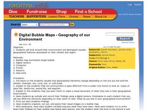
Geography of Our Environment
Students explore geographical elements. In this geographical elements instructional activity, students create a map showing the geographical elements in their area. Students take pictures of these elements to glue to their map and...
Curated OER
Thematic Unit: Beginning Holocaust Studies
Fifth graders discuss concepts of diversity, culture, and prejudice, gain understanding of harm caused by prejudice, and demonstrate ability to think critically and a desire to act morally.
Curated OER
Fall Around the World
What is autumn like in Shanghai? How much rain falls during September in Sydney? Is Moscow cold in October? Take a virtual trip around the world with a research assignment on autumn in different countries. After learners answer questions...
Curated OER
Social Studies:
Students identify various types of breads fromother countries and locate them on maps. In small groups, they make story maps of books that mention bread and make books resembling sandwiches. Students have a bread tasting party and...
Population Connection
Meeting Human Needs
How to meet the needs of people around the globe—a question many ask. The fifth in a six-part series about human population and its effects on the globe, the eye-opening lesson includes discussion, a homework activity, and an in-class...
Population Connection
Where Do We Grow from Here?
Did you know that the population is expected to grow to 11 billion by 2100? The resource serves final installment in a six-part series on the global population and its effects. Scholars interpret data from the United Nations about the...
Population Connection
The Carbon Crunch
Carbon is in the air; should we care? Teach the class why it is important to pay attention to carbon levels and how the world population and various countries across the globe affect the carbon levels in the atmosphere. High schoolers...
Population Connection
The Peopling of Our Planet
How many people live on the planet, anyway? The first resource in a six-part series covers the topic of the world population. Scholars work in groups to conduct research and make population posters after learning about the global...
EduGAINs
Migration—Push and Pull Factors
What causes people to move from one place, one city, or one country to another? Using the provided migration questionnaire, learners interview family members about the factors that cause them to be pushed from an area or pulled to an area.
Curated OER
Our States, My State
Here is a very nice lesson on the shape of the United States, and the shapes of the individual states for your young geographers. They utilize worksheets embedded in the plan to color in a variety of states and to become familiar with...
Other popular searches
- World Geography Studies
- Geography Studies the Sea
- Geography Studies Rocks
- Elementary Geography Studies
- Geography Studies Cd Rom
- Social Studies Geography
- Social Studies Us Geography
- Social Studies and Geography
- Social Studies Maps Geography


