Curated OER
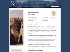
Between the Rivers
Second graders compare and contrast historical American cultures. In this American history lesson, 2nd graders participate in reading, writing, oral, and hands on activities. Students discuss the similarities and differences between...
Curated OER
Arbor Day Across the United States
Students perform research about hardiness zones used to guide planting. They read a hardiness zone color-key map and create their own color-key maps to show when different states celebrate Arbor Day.
Curated OER
The Arctic and Taiga Ecozone of Canada
Students examine the various sub-regions of the Arctic and Taiga zones in Canada. Using the online Canadian Atlas, they locate and describe the characteristics of each zone. They organize their information into a chart and share it with...
Curated OER
Treasure Hunt Region
Students are introduced to new geography related vocabulary words. In groups, they focus on a different region of the school and develop a new name for it. They create a treasure map for another group to use in the region of the school...
Curated OER
A Place Called Fairfax
Students are introduced to the various types of maps of Fairfax County, Virginia. Using the maps, they explain the relative and absolute locations of the county and discuss the importance of both. They also discover how the county is...
Curated OER
The Palestinian/Israeli Peace Process
Young scholars research the history of the conflict in the Middle East and why the peace process is so complex. They step out of their "comfort zone" and examine both the Palestinian and Israeli perspectives of the conflict with an open...
Curated OER
Plate Tectonics: Recycling the Seafloor
Young scholars classify earth's layers and plates using Ocean Seismicity data. In this plate tectonics lesson, students outline where the plate boundaries are on the world map. They then compare these predicted boundaries with USGS map...
Curated OER
Location of Cities 201
Students work in pairs to locate the ancient cities on a world atlas using the longitude and latitude measurements. They examine the physical and human futures that explain their locations.
Curated OER
Lesson 1 Activity 1: Tools of the Ancients
Students examine how Christopher Columbus determined his latitude.
Curated OER
Telecommunications and the Whole Language Program
Young writers use technology and other media to research information on a chosen topic. They explore countries where keypals and e-mail friends are located. Using their writing skills, they correspond with their e-mail friend and...
Curated OER
A Tale of Two Frogs
Second graders locate Russia on a map or globe and work in pairs to complete the Map worksheet. They read the book, A Tale of Two Frogs stopping after page 15. They write an ending to the story and then read more of the book stopping...
Curated OER
Devastation of Indian Quake
Learners read an online article at CNNfyi.com to determine what happened in India after an earthquake. They determine the magnitude of this earthquake and address the issue of relief efforts from other countries.
Curated OER
Climate Change And Disease
Students consider the role of climate change in the occurrence of vector born diseases such as malaria. In small groups, they research a specific vector to complete an information chart on climate changes in the region where the vector...
Curated OER
Maps, Charts, and Graphs
Students define key geographic terms and track a hurricane on a map. They examine various types of maps and find locations on them,including rivers, cities and mountains.
Curated OER
Cartographer on Assignment: Creating a Physical Map of Africa
Students use geographic information to make an outline map of Africa, then demonstrate their understanding of the physical landscape of Africa by using a variety of materials to create a physical map of Africa
Curated OER
Cutting Down Trees
Students research what kind of problems force a city or town to decide to remove trees. Students research what controversy has occurred in other cities or towns. Students interview those responsible for such decisions in your city or...
Curated OER
Aquatic Ecosystems
Students study the diversity of marine life and their habitats. In this aquatic ecosystems lesson students complete a lab activity and experiment.
Curated OER
In Harm's Way: Natural Disasters in My Community
Eleventh graders research and debate natural disasters that have occurred in their community. They assess whether these natural disasters were avoidable or were accidents. They investigate the extent of insurance coverage for disasters.
Curated OER
Let's Go To Mexico
Learners are able to use the Internet to conduct research. They research Mexican culture and traditions. Students compare and contrast Mexican and U.S. food and clothing. They convert United States currency to Mexican pesos. Learners...
Curated OER
States of Fitness
Students participate in physical activities coordinating to divisions on a map.
Curated OER
Native Americans and Topography at Rose Bay
Students visit a wetland ecosystem. While they are there, students explore how to read topography maps of Rose Bay.
Curated OER
Japan and The Ring of Fire
Middle schoolers engage in a study of the volcanic forces and earthquakes associated with The Ring of Fire in the Pacific Ocean. The people of Japan are researched in how they have dealt with living in the area. Also students write in...
Curated OER
Creating Community - A Function Of Design
High schoolers discuss the physical and human impacts of community design. They identify traditional neighborhood design elements and evaluate them with features of conventional suburban development.


