Teach Engineering
Who Can Make the Best Coordinate System?
Working with a map that does not have a coordinate system on it, small, collaborative teams must come up with a coordinate system for their map. Groups then explain their coordinate structure to the class.
Curated OER
Doodles
Here is a fun drawing activity that is sure to develop listening, shape recognition, drawing, skills and eye-hand coordination. The class doodles over an entire page based on the instructions they are given. This resource includes...
Curated OER
Mapping a Site Using a Coordinate Plane
Learners map their playground as if it were an archeological site. They locate objects on the playground and determine their location using coordinate points. A related lesson is Coordinate Grid: Mapping an Archeological Site.
Teach Engineering
Cartesian Diver
Amaze your scholars with an activity that uses a Cartesian diver to demonstrate Pascal's Law, Archimedes' Principle, and the Ideal Gas Law. Groups then repeat the process and make their own diver move up and down in a bottle.
Curated OER
Coordinate Plane
Students use computer applets to demonstrate three dimensional coordinate planes. In this coordinate planes lesson plan, students play a coordinate game and a maze game.
Curated OER
Cornmeal with Powder Paint
Pre schoolers use art to build observational skills and eye-hand coordination. They squeeze art into a ribbon like shape on their paper, then sprinkle cornmeal and powder paint over it. They watch as water is sprayed on top of the...
Teach Engineering
Coordinates and the Cartesian Plane
The plot thickens to get a functional understanding. After a short review of plotting points on the coordinate plane, class members learn the difference between functions and relations in the second lesson in a series of nine. They show...
Teach Engineering
Projections and Coordinates: Turning a 3D Earth into Flatlands
Introduce your class to map projections and coordinates, the basics for the work done in a GIS, with an activity that uses Google Earth to challenge learners to think about the earth's shape.
Teach Engineering
What's Wrong with the Coordinates at the North Pole?
Here is an activity that merges technology with life skills as individuals use Google Earth to explore the differences between coordinate systems and map projections. The self-guided instructional activity is the fourth segment in a...
NTTI
Line 'Em Up!
Coordinate planes and Cartesian graphing systems are the focus of this math lesson. Learners use video, internet activities, and engage in hands-on activities in order to explore coordinate planes. The materials needed for this lesson...
Curated OER
Coordinate Plotting: Shapes
In this math worksheet, students graph ordered pairs on a coordinate grid. They connect the points to create a geometric shape. This worksheet generator allows teachers to select the size of the grid, the complexity of the shapes, and if...
Curated OER
Developing Coordination Skills and Pencil Control Using Mouse Hockey
Students explore motor skills by participating in a drawing activity. In this hand coordination lesson, students utilize activity sheets in which they drag their pencil in a specific direction quickly and efficiently. Students utilize...
Curated OER
Hinges Are a Part of You
Students demonstrate writing readiness addressing dominate hand use, small muscle development, eye-hand coordination, ability to copy, and an orientation to reading readiness. They develop physical skill and personal hygiene.
It's About Time
Adaptations
Congratulations! You exist, thanks to the wonders of biology and adaptations. The focus of the lesson explains many adaptations of plants and animals and how the environment has influenced the process. A hands-on activity demonstrates...
Curated OER
Space Shuttle's Heat Shield Problem
Learners participate in a role-play activity to determine how to replace heat shields on the space shuttle using polar coordinates.
Curated OER
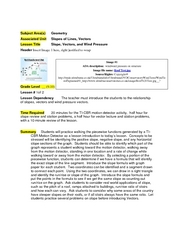
Slope, Vectors, and Wind Pressure
A hands-on lesson using the TI-CBR Motion Detector to provide information to graph and analyze. The class uses this information to calculate the slope of motion graphs and differentiate scalar and vector quantities. There is a real-world...
Kate Stickley
Reading the World: Latitude and Longitude Lesson latitude and longitude, maps, coordinates on a map, prime meridian, reading maps, equator, globes
Find five activities all about longitude and latitude! Use oranges to show the equator and prime meridian, plot birthdays on a map using coordinates, and plan a dream vacation.
Curated OER
Tracing Practice with Straight Lines
In this tracing practice with straight lines activity, pupils trace over 6 thick lines to improve fine motor skills and eye-hand coordination.
National Council of Teachers of Mathematics
Stitching Quilts into Coordinate Geometry
Who knew quilting would be so mathematical? Introduce linear equations and graphing while working with the lines of pre-designed quilts. Use the parts of the design to calculate the slope of the linear segments. The project comes with...
Curated OER
Singing a round
Kids use their hands, bodies, and voices to explore the musical concept of a round. They say vegetable words while stomping and clapping out a rhythm in unison and then in a round. They then sing a round while maintaining a steady beat....
Curated OER
Coordinates Time Game
In this coordinates worksheet, learners solve the time problems in the box that is called out by the coordinate. Students complete 16 problems.
Curated OER
Animal Behavior
Can you train a worm? Biology buffs will have a blast trying! Using planaria or earthworms, they introduce a certain stimulus repeatedly until the desired response happens more quickly. They also explore the response of their own eyes to...
Curated OER
Map Coordinates: Monkey Map
Here's an engaging, meaningful, and clever lesson on map skills for elementary schoolers. Pupils combine story writing with mapping skills to create an original piece of work. They utilize a worksheet embedded in the plan to guide them...
Curated OER
Exploring Area/Perimeter Through Coordinate Geometry
Students explore area and perimeter through coordinate geometry using student literature, hands-on manipulatives, and the Internet.


