Curated OER
Eastern Europe: Passport to Understanding
Seventh graders explore Eastern Europe. They analyze data on select countries. Students prepare a short oral presentation on the country they researched. They locate their country using an interactive map.
Curated OER
Maize to Maquiladoras: Movement from Mexico to Arizona
Fourth graders label maps of Arizona and Mexico to show the people, goods, and ideas that have moved between the two places. In this Arizona and Mexico lesson plan, 4th graders summarize the effects of the movement on Arizona life.
Curated OER
Planning A Railroad Online Lesson
Students plan a route across Donner Summit using topographical maps in order to understand the challenges involved in constructing the railroad in the Sierra Nevada Mountains. For this history lesson, students first discover how to read...
Curated OER
Summertime Travel
Third graders write about a summer event they participated in. In this paragraph writing lesson, the teacher models how to write about a place they have visited. Students then write their own paragraphs. Students will point out on the...
Curated OER
Go Bananas! (Lesson One)
Students research the historical and present movements of bananas. Using maps, they locate the countries in which the fruit is grown and identify common characteristics between the banana-growing countries. They also trace the movement...
Curated OER
Spatial Connections
Students use maps, scales, and describe locations in order to learn about spatial sense. In this spatial sense lesson plan, students participate in many activities for this spatial sense unit that should last throughout the year.
Curated OER
Indianapolis Government
Young scholars read about a girl who takes a trip during the time of the State Capital moving to Indianapolis and then write their own essay about a trip that they took. In this Indianapolis Government lesson plan, students use maps and...
Curated OER
COLONIAL FLYERS/TRAVEL BROCHURES TO THE COLONIES
Students investigate concepts of history and geography in this instructional activity. They create travel brochures for travelers who are crossing the Atlantic Ocean to populate the colonies of early America. The brochure has...
Curated OER
European Agriculture
Students make inferences on how physical geography affected the development of early civilizations and come up with solutions to global issues. For this physical geography lesson plan, students compare maps of the past to maps of today...
Curated OER
Oh My Darling
Students discuss human interaction with the environment and sing "Clementine" with historical fiction lyrics. They create a map or model of a mining camp in which Clementine may have lived. They discuss what might happen to their...
Curated OER
Worksheet for Analysis of a Written Document
In this primary source analysis worksheet, students respond to 16 short answer questions that require them to analyze the provided historical document.
Curated OER
The Hopi Indians
Fourth graders read and look at maps of the Hopi Indians and compare and contrast their lives with the Hopi Indians. In this Hopi Indians lesson plan, 4th graders learn about different cultures and answer short answer questions.
Curated OER
Westward Expansion and the Frontier
Young scholars explore U.S. history by researching a historic map. In this westward expansion lesson plan, students discuss the mystery of the western U.S. in the early 1800's and the impact expansion had on Native Americans and...
Curated OER
Tooling Around Arizona: Reading Arizona Maps
Students study geography. In this Arizona maps lesson, students develop their map reading skills. They have class discussions and work independently with various copies of Arizona maps to practice those skills. This lesson mentions...
Curated OER
How Far Away
Students investigate how a historic map drawn in the early days of interstate automobile travel represented distances. They measure distance within their personal space.
Indian Land Tenure Foundation
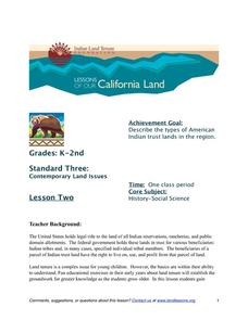
Indian Trust Lands
An important aspect of studying Native American history is understanding the nature of trust lands. Budding historians will learn that as Native Americans were removed from their home lands, trust lands were provided in the form of...
Miama-Dade County Public Schools
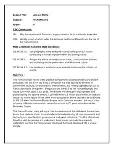
Ancient Rome
This resource outlines several general activities for a study of Ancient Rome, and includes guiding questions, a handout on the story of Romulus and Remus, and ideas for incorporating mapping and timeline activities into your review.
Multieducator
Battle of Gettysburg
On July 1, 1863 the Army of Northern Virginia, under the command of General Robert E. Lee met the Army of the Potomac, under the leadership of Major General George Meade. Considered the turning point of the war, the Battle of Gettysburg...
Curated OER
Famous Afro-Americans Historical Sites Recognized by the National Park System
Learners use the library to find historical information about each Afro-American. They use magazines, articles from newspapers, and oral histories from video tapes and slide presentations to write biographical sketches about each...
Curated OER
TOPSY TURVY MAPS
Eighth graders use the data analyzer and motion detector to collect data and measure distances. They create topographic maps drawn to scale of a given setup and relate the concepts to the creation of historical ocean maps.
Curated OER
Savannah, Georgia Historic District
Students complete a variety of activities that go along with the study of and possible fieldtrip to the Savannah, Georgia Historic District.
Curated OER
Women's Rights Historic Sites
Students use maps, readings, floor plans, photos and cartoons to research the conditions of upstate New York in the first half of the 19th century, examine the issues that led to Women's Rights Convention of 1848 and consider current...
Curated OER
MAP UNIT
First graders investigate how maps are used to identify different locations. They will also appreciate how there are different types of maps for their purposes. Finally students study how maps contain symbols that represent real places.
Other popular searches
- Historical Maps Explorers
- Historical Maps Wwi
- Historical Maps Trade Routes
- Historical Maps Rome
- Historical Maps Mesopotamia
- Historical Maps Pirate
- Comparing Historical Maps
- Carthage Historical Maps
- Historical Maps Imperialism
- Historical Maps Inauguration
- Historical Maps Ussr
- Historical Maps" Ptolemy


