Curated OER
Landforms
Students research landforms created by tectonic movement. For this landforms lessons, students discuss caves, canyons, mountains, valleys, and undersea vents and the ecosystems unique to these environments.
Alabama Learning Exchange
Landforms Acrostic Poetry
Fourth graders apply scientific information about various landforms. They use the information to write and word process acrostic poems which they illustrate with clip art or pictures from magazines.
Curated OER
The Earth's Layers: Day 6: Landforms II
Students closely examine the earth's crust and various landforms. In this Earth's layers instructional activity students work in cooperative groups and analyze their roles and responsibilities therein. Each group is assigned a specific...
Curated OER
From Coast to Coast
Students identify and describe characteristics of natural landforms such as mountains, islands, rivers, and inlets, research information about landforms that would be encountered on imaginary trip from one place to another, and design...
Curated OER
Google Earth Geology Field Trip
Students take a virtual field trip around California using Google Earth. In this geology field trip lesson, students explore landforms and a variety of rocks located in California. Students compare environments where rocks are formed....
Curated OER
Landforms in a Tub
Fifth graders use common household items to build landforms and simulate weathering and erosion.
Curated OER
Landforms: Geomorphology of Arkansas
Second graders create large, salt dough maps of Arkansas and the natural regions in the state created by geographical and morphological features.
Curated OER
Mapping Landforms of South Carolina
Third graders analyze South Carolina maps. In this geography lesson, 3rd graders locate the five land regions in the state are and discuss how the regions are different. Students identify the major bodies of water and analyze how they...
Polar Trec
Create a Topographic Profile of Beacon Valley
Landforms in Beacon Valley, Antarctica, where there is no snow, bear a striking resemblance to landforms found on Mars. Scholars identify landforms found in Beacon Valley through analysis of topographic maps in the activity. They then...
Curated OER
Tall as a Mountain, Flat as a Plain
Students examine a variety of landforms that are found on the Earth and compare and contrast the distinguishing qualities of these forms. A topographical model of the landforms is made.
Curated OER
Springfield Digital Storytelling Project: Landform Riddle
Creative projects and collaborative learning are hallmarks of 21st Century learning skills. Using an iphone, 6th graders create an iMovie which shows a student composed riddle. The riddle needs to be about one of the landforms they have...
Curated OER
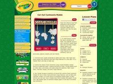
Cut-Out Continents Mobile
Students research major natural features on all seven continents. They compare and contrast continents, their sizes, shapes, and major landforms. Students create a unique display of the continents to show major landforms.
Science Matters
Seismic Activity and California Landforms
By the 19th instructional activity in the 20-part series, scholars realize volcanoes and earthquakes are related to plate boundaries. The instructional activity extends and applies the knowledge by having individuals create a bumper...
Curated OER
Oh, the Regions
Focus on the geography of Oklahoma. For this activity, learners compare different geographic regions in Oklahoma, create a collage to share their results, and identify important landforms throughout the United States, such as the Rocky...
Curated OER
Landforms E-mail Project
Students identify and explain geographic terms. They write descriptions of the terms. Students discuss landforms and draw pictures to illustrate them. Students compose and present oral reports about landforms.
Curated OER
Digital Photography and Landforms
Fifth graders create a picture book of local landforms using digital cameras. They also illustrate two vocabulary terms by hand and locate pictures of other geography vocabulary terms in magazines. Students take picture-taking field...
Curated OER
Looking at Landforms-Based on the Washington Quarter Reverse
Students use a Washington State Quarter to examine different landforms and discuss natural resources. After a class discussion on the items found on a Washington State quarter, students brainstorm a list of natural resources found in...
Curated OER
Changing Energy: Landforms and Dance
Third graders choreograph a dance to represent the changes in nature. In this dance and nature lesson plan, 3rd graders use sharp quick movements to demonstrate changes.
Curated OER
Carve That Mountain
Students investigate major landforms (e.g., mountains, rivers, plains, hills, oceans and plateaus). They build a three-dimensional model of a landscape depicting several of these landforms. Once they have built their model, they act as...
Curated OER
A Shuttle's Eye View
Students explore the goals of the Shuttle Radar Topography Mission as a springboard to exploring the topographical features of their own state or region. They synthesize their understanding of landforms and topography by mapping their...
Curated OER
Is There Water on Mars?
Young scholars decide whether or not there is or has even been water on Mars. They analyze temperature and pressure data from the Pathfinder mission to Mars, and then they analyze images of Mars, interpreting the landforms they see and...
Curated OER
Cold As Ice
Fourth graders investigate how glaciers cause the weathering of landforms. They observe a brick that has been placed on a frozen slab of ice, and discuss the results, comparing them to the movements of a glacier. In small groups, they...
Curated OER
Sub-Sahara Africa
Students listen to a lecture on the geography of sub-Sahara Africa. They then make a poster that illustrates the various landforms and climates that can be found in Africa. Students listen to a lecture on the diversity of African...
Curated OER
Common Themes
Tenth graders test usefulness of a model Earth by comparing its predictions to observations in the real world. In this landforms lesson students construct an island from a contour map using model clay then analyze the landscape features...
Other popular searches
- Landforms and Water Forms
- Canada Geography (Landforms)
- Earths Landforms
- Landforms Lesson Plans
- Landforms of Colombia
- Ocean Floor Landforms
- Definitions of Landforms
- Different Landforms
- Canada Geography Landforms
- Google Earth Landforms
- Geographic Landforms
- Landforms on Neptune


