Curated OER
Where in the world is...
Pupils identify locations around the world. For this mapping lesson, students place tag board pieces with names of locations on a wall map of the world. Initially, pupils identify states, then cities, then continents, eventually adding...
Curated OER
Where in the World Is…
Students identify countries, oceans, states, and more on a globe and on a flat map. In this geography lesson plan, students also locate places around their school.
Curated OER
Globe Skills Lesson 2: Paving the Way for Columbus
Students explore the expedition of Christopher Columbus. In this geography skills lesson, students consider the technological advances that made Columbus's expedition possible as they complete a latitude and longitude activity.
National Geographic
The Monsoon
Few things are as fascinating as the challenge of climbing Mount Everest. This lesson investigates how monsoon weather impacts climbers. To begin, you are instructed to show various video clips. The only one directly provided, however,...
Curated OER
Climatic Zones
Third graders recognize and locate Frigid, Temperate, and Torrid climatic zones on the word map or globe. They explain that plants, animals, and human societies display adaptations to the climates they live in .
Curated OER
CLASSROOM MAPS
Pupils do a blind tour of their school by responding to verbal commands. They look and discuss various maps in the classroom. They locate the direction of the sunrise and discuss the compass directions of North, South, East, and West.
Curated OER
Map of the Ottawa Valley
Pupils locate Ottawa Valley on a map. They then answer questions in reference to the map such as: What was the first use of timber in the Ottawa Valley?, What occurred first in Gatineau?, and On the Ontario side of Ottawa River, how many...
Curated OER
Where in the World is Mr. Fultz?
Students use maps and other geographic resources to learn about their world while problem solving. They read clues each day and use classroom resources to narrow down where the prize is located.
Curated OER
Exploring an Atlas
Students explore global geography by participating in an atlas activity. In this countries of the world lesson plan, students collaborate in small groups and analyze an atlas while researching continents, countries and demographics....
Curated OER
Mapmaking
Students examine the craft of cartography and how the Lewis and Clark expedition created and used maps. They analyze maps, read a handout, create a map, participate in a mini expedition and map out a route based on travel directions,...
Curated OER
Absolute Location
Fifth graders examine the geographic concept of absolute location. Using a variety of resources, they create a life-size classroom grid and locate the coordinates of a point, identify latitude and longitude of different locations, and...
Curated OER
Mexico: One Land, Many Cultures
Students, through a variety of activities, discover the geography and culture of Mexico. They make maps, read folktales, write a journal, create pinatas and other artistic pieces, and review the history of Mexico.
Curated OER
Volcanic Activity in the U.S.
Students locate and map ten volcanoes in United States, create chart comparing volcanoes by last eruption, type of volcano, location, and interesting fact, and create Powerpoint slide show describing basic
information about volcanoes and...
Curated OER
Cacao Tree Geography
Learners use a map to learn about where chocolate comes from. In this lesson on the cacao tree, students locate various regions where the cacao tree grows. They will discuss why the cacao tree grows more favorably in particular climates...
Curated OER
Geography Puzzles
Students study the continents of the world. In this Internet geography instructional activity, students connect to online mapping games. Students collaborate in order to develop their understanding of world geography, including countries...
Curated OER
Map Making
Students use a tennis ball and paper to construct a student-made globe. They sketch in continents and major map features and then compare a flat map to a globe.
Curated OER
Where in the World Is ...
Learners locate and place countries and continents on a large map using tag board and yarn. They locate a new geographic location on the map each morning.
Curated OER
What do Maps Show?
Eighth graders practice the skill of reading maps. In this geography instructional activity, 8th graders participate in a classroom lecture on how to read a map.
August House
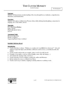
The Clever Monkey
Your clever kindergartners will enjoy a series of activities based on the West African folktale, The Clever Monkey, adapted by Rob Cleveland. They sequence the story with pictures, copy sentences, illustrate idioms about cats, and taste...
August House
The Contest Between the Sun and the Wind
Learn the moral of the story with a series of activities about Aesop's fables. Focusing on The Contest Between the Sun and the Wind, learners complete a graphic organizer to discuss who, what, how, and why the events occur. Additionally,...
August House
How Tiger Got His Stripes
How did the tiger get its stripes? Kindergartners read a Vietnamese folk tale, "How the Tiger Got His Stripes," retold by Rob Cleveland, and work through several reading comprehension and literary analysis activities.
It's About Time
Where are the Volcanoes?
Middle school geologists map the volcanoes closest to themselves, learn about map distortion, and infer possible future volcano locations. A focus on latitude, longitude, and volcanoes beneath the ocean helps connect the lesson.
Curated OER
Storm Clouds-- Fly over a Late Winter Storm onboard a NASA Earth Observing Satellite
Students study cloud data and weather maps to explore cloud activity. In this cloud data lesson students locate latitude and longitude coordinates and determine cloud cover percentages.
Sea World
Whales
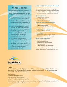
A whale of a lesson is sure to intrigue your elementary oceanographers! Learn about the mammals of the sea with a series of activities about whales, dolphins, and porpoises. Kids complete worksheets about the anatomy of a whale, create a...


