Curated OER
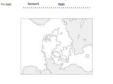
Denmark Outline Map
In this blank outline map learning exercise, students explore the political boundaries of Denmark located in Europe. This map may be used in a variety of classroom activities.
Curated OER
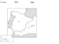
Spain Outline Map
For this blank outline map worksheet, students explore the political boundaries of Spain located in Europe. This map may be used in a variety of classroom activities.
Curated OER
European Country Map
In this Europe political map worksheet, students examine the national boundaries. The country names are labeled on the map.
Curated OER
The borders of Europe. Geographically location or cultural artifice?
Twelfth graders discuss where they regard the boundaries of Europe to be. They raise their awareness that "Europe" may be more of a cultural construct than geographical defined continent.
Curated OER
Europe: Political Map
In this Europe political map instructional activity, students examine each country's boundaries. The map also highlights each of the nation's capitals with a star.
Curated OER
European Map
In this blank outline map worksheet, students explore the political boundaries of the continent of Europe and those of the countries located there.
Curated OER
Europe Outline Map (Labled)
In this blank outline map worksheet, students study the political boundaries of the labeled European nations.
Curated OER
Europe Map Quiz
In this Europe map quiz worksheet, students examine an outline map of the continent and label the names of each of the countries.
Curated OER
Europe
Students examine the reasons how and why the European Union was formed. They locate Europe on a map and identify the countries in the European Union. They create a tourist brochure for one of the countries.
Curated OER
Europe Physical Map
In this Europe physical map activity, students make note of the major landforms and bodies of water located on the continent.
Beverly Hills High School
Congress of Vienna 1815
Europe was changing in the early nineteenth century, and the Congress of Vienna largely sought to slow and contain those sweeping changes. A slideshow presentation illustrates the details of the Congress of Vienna, including its three...
Curated OER
Europe 1914
In this Europe 1914 map worksheet, students note the 9 regions of the Europe labeled on the map and their relevance to World War II.
Curated OER
Open Cities: Europe
For this European cities worksheet, 10th graders find the countries of Europe on a map, match countries with capital cities, categorize different types of cities and identify cities from pictures and on a map.
Curated OER
Europe Map Quiz (Easy)
In this online interactive geography quiz worksheet, learners respond to 35 identification questions regarding the countries of Europe.
Curated OER
The Interconnectedness of Ancient Peoples Map Study
Seventh graders begin this lesson by viewing various maps of the Ancient World. As a class, they take notes on the changes of different areas in Europe and Asia as their teacher lectures to them. They answer questions about the...
Curated OER
Mapping World War II: During and After
In this World War II learning exercise, students follow the provided instructions to mark 2 maps according to events and outcomes of the war.
Curated OER
Map of Italy
In this map of Italy worksheet, students find, color and label cities, surrounding countries, bodies of water and landforms in the country of Italy.
Curated OER
The Influence of The Byzantine Empire on Russia and Eastern Europe
Students examine the influence on Russian and Eastern European language, religion, art, and architecture by the Byzantine Empire. They define key vocabulary terms, listen to a lecture and participate in a class discussion, and label a map.
Curated OER
Map Skills: Explorers, Continents, and Oceans
Third graders use a software program to make and label a map of the world. On the map, they locate the seven continents, oceans and the countries of Europe. They also draw the routes of Christopher Columbus, Juan Ponce de Leon and...
Curated OER
Map Skills
Students construct a road map using map pieces precut by the teacher. They apply geometric terms such as rotation and turns. Students apply the use of ordinal directions. They apply a variety of map keys.
Curated OER
European Language Groups, 1850
Document the linguistic diversity and major language groups common to Europe in 1850. A map and a list of regions, countries, and water ways is provided.
Curated OER
Europe Outline Map
In this outline map instructional activity, students examine the political boundaries of the continent of Europe. The map may be used in variety of activities that individual teachers create to accompany it.
Curated OER
Europe Outline Map
For this blank outline map worksheet, students explore the political boundaries of the continent of Europe and those of the countries located there.
Curated OER
Travel in Europe
In this European travel instructional activity, students respond to 11 short answer questions that require them to research travel throughout the countries in Europe.
Other popular searches
- Blank Maps of Europe
- Outline Maps of Europe
- Geography Maps of Europe
- Maps of Europe 1914
- Maps of Europe Political
- Maps of Europe Ppt
- Maps of Europe Pot
- Maps of Europe 1919
- Europe Maps
- Europe Outline Maps
- Europe Geography Maps
- Western Europe Maps


