Georgia Department of Education
Ga Virtual Learning: Ap European: World War Ii
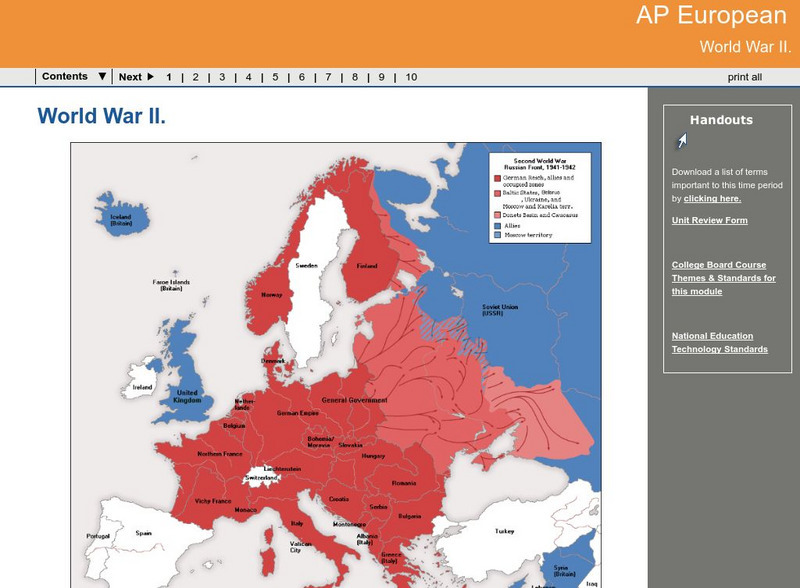
AP European History learning module on World War II traces the beginnings of the war from a dissillusioned Europe through the course of the war. Module includes assignments, enrichment activities, downloads, maps and assessment for...
Pamela Seed
Rice: Latitude: The Art and Science of 15th Century Navigation
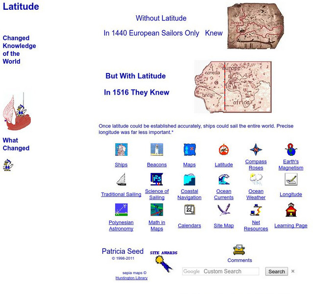
This is a great site to read about how navigation began in Europe and what tools were used. Make sure to read the segments on coastal navigation, maps, and ocean currents.
Other
Manitobia Life and Times: World War 1 .. The War at Home
All Canadians were greatly affected by the war in Europe. The situation at home, enlistments, conscription, alien immigrants, and the changes occurring after the war ended are each reviewed in detail.
Virginia Tech
Digital History Reader: 1917 Did the War Cause a Revolution?
A comprehensive unit evaluating what factors led to the Russian revolution in 1917. Understand the circumstances in Russia during WWI, timelines, maps, photos, writing assignments, and a bibliography for further studies.
Other
Normandie Tourisme: D Day and the Battle of Normandy
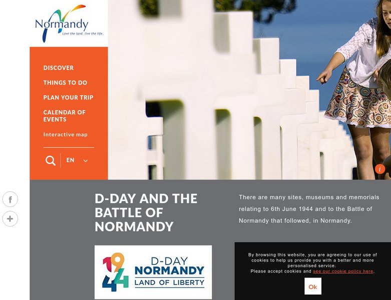
This official site provides a history of D-Day, photos, chronology, and excellent interactive maps.
ClassFlow
Class Flow: European Capitals Quiz
[Free Registration/Login Required] Using the Activote system, students will look at a map of Europe to identify the country and then select that country's capital city. There are 28 questions.
Lonely Planet
Lonely Planet: France
This Lonely Planet map of France shows the rivers and mountain ranges as well as major cities. Clicking on a site labeled in color brings the reader to information about that site. Includes Corsica.
Curated OER
Etc: Maps Etc: Russia in Europe and Caucasia, 1920
A map of European Russia and the Caucasia at the end of World War I, showing province boundaries at the time, and the conjectural boundaries of the new states at the time the map was made given in red outline. These new states include...
Curated OER
Educational Technology Clearinghouse: Maps Etc: North America, 1858
A map from 1858 of North America showing the boundaries at the time for Russian America (Alaska), Greenland, British America or New Britain, Canada East and Canada West, the United States, Mexico, Central America, and the West Indies...
Curated OER
Etc: Division of the Ottoman Empire in Europe, 1912 1913
A map of the Ottoman Empire and the division of its European territories after the two Balkan Wars between 1912 and 1913. The map shows the Turkish territories as the Balkan League (Bulgaria, Greece, Serbia, and Montenegro) intended to...
Curated OER
Educational Technology Clearinghouse: Maps Etc: Pre Colonial Africa, 1872
A map of Africa showing the continent prior to the Berlin Conference of 1885, when the most powerful countries in Europe at the time convened to make their territorial claims on Africa and establish their colonial borders at the start of...
Curated OER
Etc: Maps Etc: Africa Before the Berlin Conference, 1884
This is an interesting map of Africa showing the continent before the Berlin Conference of 1885, when the most powerful countries in Europe at the time convened to make their territorial claims on Africa and establish their colonial...
Curated OER
Etc: Maps Etc: Africa Before the Berlin Conference, 1882
A map of Africa as it was known in 1882 before the Berlin Conference of 1885, when the most powerful countries in Europe at the time convened to make their territorial claims on Africa and establish their colonial borders at the start of...
Curated OER
Educational Technology Clearinghouse: Maps Etc: British Isles, 1906
A map of the British Isles from 1906, showing the terrain, rivers, and coastal features of Ireland, Scotland, England, and Wales. Major cities are shown, and the map includes an inset map of the Shetland and Orkney Islands, a locator map...
Curated OER
Etc: Maps Etc: Commercial Map of the United States, 1872
A commercial map from 1872 of the United States showing the principal railroad and steamship routes in the region at the time. The map shows state boundaries and capitals, major cities and ports, submarine telegraph cables to Europe,...
Curated OER
Educational Technology Clearinghouse: Maps Etc: Pre Colonial Africa, 1885
A map of the African continent prior to the Berlin Conference of 1885, when the most powerful countries in Europe at the time convened to make their territorial claims on Africa and establish their colonial borders at the start of the...
Curated OER
Educational Technology Clearinghouse: Maps Etc: Asia, 1899
A map of Asia from 1899 showing country boundaries at the time, foreign possessions, capitals and major cities, rivers, canals, lakes, deserts, terrain, and coastal features. This map shows the principal railways and caravan routes of...
Curated OER
Educational Technology Clearinghouse: Maps Etc: England, Ad 550
A map of England and Wales in AD 550, after the departure of the Romans (AD 410) and during the migration of the Angles, Saxons, and Jutes from Europe. The map is color-coded to show the territories of the native Britons or Welsh,...
Curated OER
Educational Technology Clearinghouse: Maps Etc: The Barbary States, 1802 1805
A map of the Mediterranean Sea region showing the Barbary States and southern Europe at the time of the Tripolitan War (First Barbary War - 1801-1804) between the United States and the North African Ottoman Empire regencies. The map...
Curated OER
Educational Technology Clearinghouse: Maps Etc: Asia, 1920
A map of Asia from 1920 showing country boundaries at the time, foreign possessions, major cities, rivers, lakes, terrain, islands, and coastal features. This map shows the principal railways of the region with connections to Europe, and...
Curated OER
Educational Technology Clearinghouse: Maps Etc: Asia, 1912
A map of Asia from 1912 showing country boundaries at the time, foreign possessions, major cities, rivers, lakes, terrain, and coastal features. This map shows the principal railways of the region with connections to Europe. This map...
Curated OER
Educational Technology Clearinghouse: Maps Etc: The Railways of Asia, 1919
A map from 1919 of the railways networks in Asia at the time, showing trunk or main railways with heavy black lines, and lesser railways with lighter lines. A chart at the bottom of the map shows a comparison of the number of square...
Curated OER
Educational Technology Clearinghouse: Maps Etc: North America, 1763
A map of eastern North America and the Greater Antilles showing the territorial possessions adjusted by the Peace of 1763 (Treaty of Paris) at the end of the French and Indian War (and the Seven Year War in Europe). The map is...
Other popular searches
- Blank Maps of Europe
- Outline Maps of Europe
- Geography Maps of Europe
- Maps of Europe 1914
- Maps of Europe Political
- Maps of Europe Ppt
- Maps of Europe Pot
- Maps of Europe 1919
- Europe Maps
- Europe Outline Maps
- Europe Geography Maps
- Western Europe Maps


