Curated OER
The Legacy of the "Great War"
Students study how the map of Europe changed as a result of the Treaty of Versailles at the end of World War I. They examine the results of the end of the Cold War.
Curated OER
The "Sick Man of Europe"
An all-encompassing view of the Ottoman Empire, this presentation takes a 300 year journey through the history, culture, and fate of the original "sick man of Europe." Grand photos and detailed maps provide the necessary context to...
Curated OER
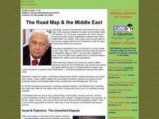
The Road Map & the Middle East
Will walls help? Read to learn how Prime Minister Ariel Sharon proposes to build walls around Isreal in hopes of isolation from Palestine. Complete an online Webquest, analyze maps, listen to audio clips, answer discussion questions, and...
Curated OER
City Life In Europe
Middle schoolers explore Paris. In this geography skills lesson, students watch "City Life in Europe," and conduct further research on the city of Paris and the country of France. Middle schoolers create postcards that feature Parisian...
Curated OER
Europe Lakes Map Quiz
In this online interactive geography quiz worksheet, learners respond to 10 identification questions about major lakes located in Europe.
Curated OER
Europe Mountain Ranges Map Quiz
In this online interactive geography quiz worksheet, students respond to 6 identification questions regarding the mountain ranges of Europe.
Curated OER
The Protestant Reformation Through Maps
A series of maps and photographs guide viewers through the spread and influence of the Protestant Reformation in Europe in these slides. With several bullet points detailing the causes of the Reformation, the presentation covers the...
Curated OER
Absolutism in Central Europe
Supplementing a class lesson on the Holy Roman Empire and Prussia and the Austrian Empire, this series of images will help contextualize the time period and historical figures for students. Maps and portraits both flesh out the details...
Curated OER
Crime in Europe
Pupils investigate the relationship between theft and drug offenses in a European context. They establish whether there is a relationship between crime and drugs on a national basis within the EU. Each student produces and interprets...
Curated OER
Getting to Know France
In this map skills worksheet, students answer 14 questions about the geography of France. Students then draw a rough map of France. It is assumed that access to an atlas is available.
Curated OER
Early European Explorers Map
Fifth graders create an explorer's map. In this explorers lesson students use a map of the world as reference to draw their own map of Europe, North America, Central America, and the Caribbean Islands. The students use their maps to show...
Delegation of the European Union to the United States
Cultural Identity
How does cultural diversity impact political identity? That is the question researchers face as they continue their examination of the European Union and the programs it has developed in its attempt to achieve unity in diversity. To gain...
Curated OER
Radio Program #2: Ethnic Mix
Students examine patterns of migration into the area. They complete various map activities and interviews. Students partake in family histories as well. On a map of Europe, identify the countries of immigrant origin mentioned in the...
Curated OER
Eastern Europe Map Quiz
For this online interactive geography quiz worksheet, learners respond to 25 identification questions regarding the nations of Eastern Europe.
Curated OER
Western Europe Map Quiz
In this online interactive geography quiz worksheet, students respond to 35 identification questions regarding the countries of Europe.
Curated OER
Europe Map Quiz (Hard)
In this online interactive geography quiz worksheet, students respond to 40 identification questions regarding European countries.
Curated OER
Mapping Population Changes In The United States
Students create a choropleth map to illustrate the population growth rate of the United States. They explore how to construct a choropleth map, and discuss the impact of population changes for the future.
Curated OER
The Path of the Black Death
High schoolers are able to show on a map how the Black Death moved through Europe. They summarize the direct effects of the Black Death in Europe. Students cite evidence from firsthand accounts in developing an argument that...
Curated OER
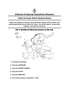
European History
For this world history worksheet , 5th graders look for information related to the history of Europe. They view the facts from a map and apply them to different activities.
Curated OER
Where Is Rome?
Third graders discover Ancient Rome through maps and worksheets. In this world history lesson, 3rd graders locate Rome on a world map and identify the scope of the Roman Empire. Students label an entire map of Italy after printing one...
Curated OER
World War I
High schoolers justify how alliances lead to war. They compare the conflicts of war that arose because of imperialist interest. Students explain the cause of World War I. They compare and contrast European maps before and after World...
World Maps Online
Introduction to the World Map
Students identify the differences between maps and globes. In this map skills instructional activity, students are shown a globe and a map and recognize the differences. Students use post-it notes to locate several locations on the world...
Curated OER
Crossing Time Zones
High schoolers explore the concept of differing time zones. Students refer to maps to identify the time zones in particular regions. They role play phone calls from different time zones. This instructional activity is intended for...
Curated OER
European Elevation Sort
Given a prepared database of European countries, sixth graders sort the countries in ascending order by elevation and identify the five countries with the highest elevations. This cross-curricular lesson combines elements of computer...
Other popular searches
- Blank Maps of Europe
- Outline Maps of Europe
- Geography Maps of Europe
- Maps of Europe 1914
- Maps of Europe Political
- Maps of Europe Ppt
- Maps of Europe Pot
- Maps of Europe 1919
- Europe Maps
- Europe Outline Maps
- Europe Geography Maps
- Western Europe Maps


