Curated OER
World Map and Globe - Lesson 15 Mountains of the World
Students locate major world mountain ranges. In this geography lesson, students identify major mountain ranges on 6 on of the 7 continents on a large world physical map.
Curated OER
First World War Maps
Tenth graders examine the First World War. In this Global History lesson plan, 10th graders analyze various maps of this time. Students construct maps of each front of the war by answering various questions.
Curated OER
Country: United Kingdom
Students use the Internet to examine the food, sports and history of England, Scotland, Wales and Northern Ireland. They view photographs and maps.
Curated OER
The Panorama Of The European Union
Sixth graders investigate the existence of the European Union with the help of a map publication. They also brainstorm to think of terms related to the Union. Students write a summary that should conclude the European Union is a...
Curated OER
People Power
High schoolers view a television program that explores many Eastern European residents' discontentment with communism. They work in groups to research living conditions in an Eastern European country before communism, under communism and...
Curated OER
Reading the World, Then and Now
Students distinguish geographic features using Ptolemy's map of the world.
Curated OER
Getting to the Core of World and State Geography
Students create topography relief maps. In this geography skills lesson, students review geography core knowledge skills, design and make a state relief map, and compile a student atlas.
Curated OER
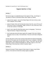
Regional identities in Italy
In this Italy map activity worksheet, learners complete 2 map activities that require them to identify major cities and landforms in the country.
Curated OER
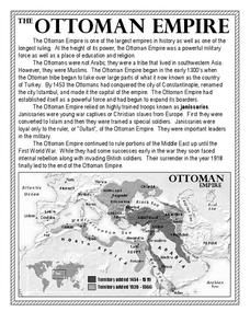
The Ottoman Empire
In this Ottoman Empire worksheet, students read a 1-page selection about the empire and examine a map. Students then respond to 5 short answer questions about the reading selection and the map.
Curated OER
Globe Skills Lesson 4 The Colonial Period
Students practice their map skills. In this Colonial geography lesson, students complete an activity that requires them to locate English colonial locations using latitude and longitude coordinates.
Curated OER
World Map Labels
In this geography skills worksheet, students identify the countries and bodies of water labelled on the maps of the world, Africa, Asia, Canada, Europe, the Caribbean, the Middle East, North America, Australia, and South America.
Curated OER
Sixth Grade Social Studies Quiz
In this social studies worksheet, 6th graders complete multiple choice questions about economics, climate, maps, and more. Students complete 15 questions.
Curated OER
British Isles
In this map learning exercise of Britain, students study a detailed outline map of the British Isles. No labels are provided and there are no directions.
Curated OER
Marie Antoinette: The Tragic Queen
Students view a documentary on Marie Antoinette, who became a symbol of the reviled monarchy. After viewing, students discuss what they saw then create a family line of Marie Antoinette. They compare maps of Europe from her time to ours.
Curated OER
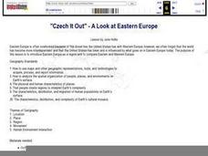
"Czech It Out" - A Look at Eastern Europe
Students research several countries in Eastern Europe. Students compare and contrast several Eastern European countries and then choose a specific country to research and prepare a class presentation with their findings.
Curated OER
Pieces of the Puzzle: Countries of Europe
Students practice interpreting a map identifying both geographical and political features on various countries in Europe. They create and evaluate a country profile as well as conduct online and library research on the countries located...
Curated OER
Geomnemonics: Facilitating the Teaching of Social Studies Content with Geography Skills
Students explore how to draw a world map by hand and how to locate countries.
Curated OER
Western Europe
Students engage in a variety of activities to comprehend more about the region of Western Europe. They use maps to read and highlight important information. The different countries are looked at individually highlighting geographical...
Curated OER
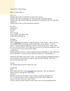
Colonial Maps
Students discover the history of America by identifying the traditional colonies. In this U.S. history lesson plan, students examine a world map and identify where the voyagers left from Europe to arrive at the United States. Students...
Curated OER
Fractions: Jewish Population of Europe during WWII
Students evaluate population maps and convert fractions to percentages. In this WWII lesson, students use statistics on the Holocaust to determine population loss and change. Students create their own math questions and answers using the...
Curated OER
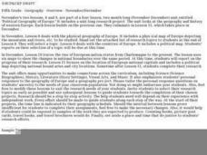
Political Geography of Europe
Fifth graders listen to a lecture that traces the political geography of Europe from 814 through 1997. They incorporate these themes into a research project on Western Europe.
Edline
How Did the Unification of Germany Change the Course of World History?
Here you'll find a nice guided notes worksheet on Otto von Bismarck, which details Bismarck's plan to unify Germany, as well as asks learners to analyze his motivations and overall impact.
Curated OER
Where Do I Come From?
Students research immigration from Europe to the United States. In this immigration instructional activity, students read the book, The Long Way to a New Land. Students use a world map to locate Sweden and other countries in Europe....
Curated OER
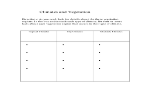
Physical Geography- Climate
Sixth graders explore different climates. In this compare and contrast lesson, 6th graders look at the differences in climates of America and Europe. Students use KWL charts and graphic organizers to record information about different...
Other popular searches
- Blank Maps of Europe
- Outline Maps of Europe
- Geography Maps of Europe
- Maps of Europe 1914
- Maps of Europe Political
- Maps of Europe Ppt
- Maps of Europe Pot
- Maps of Europe 1919
- Europe Maps
- Europe Outline Maps
- Europe Geography Maps
- Western Europe Maps


