Curated OER
We've got the whole world in our hands
Students explore spatial sense in regards to maps about the globe. In this maps lesson plan, students label oceans, locate the continents and poles, follow directions, and explain the symbols on a map.
Curated OER
Romans in Britain, or Classical Colonialism
Learners identify the extent of the Roman Empire on a map of Europe and North Africa. They discuss the reasons behind Roman expansion and occupation. They read Cymbeline and write about the attitudes of 3 characters. Groups stage the scene.
Curated OER
Europe – Religion and Reformation
Ninth graders examine the Reformation. In this European history lesson, 9th graders explore the 95 theses of Martin Luther and discuss the reaction of the Roman Catholic Church to his ideas. Students then take a quiz based on the lesson.
Curated OER
Traveling Through Europe with Brochures
Students research a chosen European country. They create travel brochures and expression booklets to present their information to the class.
Curated OER
World War I
Using maps, diagrams, and lists, this resource is a wonderful way to review the main concepts involving WWI. There are charts with a comparison of imperialism and nationalism, and other key ideas that explain how Europe plunged into this...
AGSSS
World Regions
Help your learners to visualize where historical events have taken place around the globe with a map that details the major regions of the seven continents.
Curated OER
Traveling Cat Flown Home to Family
Young scholars locate Wisconsin and Belgium on a world map, then read a news article about a cat that stowed away on ship from the U.S. to Europe. In this current events lesson, the teacher introduces the article with map and vocabulary...
Curated OER
Anne Frank: One of Hundreds of Thousands
Middle schoolers conduct research to put Anne Frank's diary into historical context. They use maps, timelines, essays and websites to examine the early victories of the German army, paying special attention to the Netherlands and...
Curated OER
World War I - The War Ends
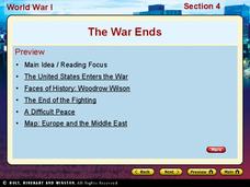
Your class is in for a treat with this outstanding PowerPoint on World War I. The presentation is loaded with facts, maps, important personalities, and discussion questions on the war. Additionally, there is a wonderful video called,...
Curated OER
Liverpool Lights Up
Students explore the culture of Liverpool. In this World History lesson, students research a variety of events and activities in Liverpool, then they work in groups to prepare a class presentation to share their findings.
Echoes & Reflections
Rescuers and Non-Jewish Resistance
What does it mean to be a rescuer during the time of the Holocaust? Learners consider the role of those who resisted the Nazi invasions, including hiding Jewish people, throughout Europe. Activities include listening to the testimony of...
Curated OER
The Congress of Vienna
What was the Congress of Vienna? This slideshow tells a bit about each of the members, their countries, and the impact the Congress had on Europe at the time. A set of review questions are included to help learners pick out important...
Curated OER
Wild Habitats
Students research and Illustrate the natural habitats of giraffes and other animals imported into ancient Rome. They draw a map of Europe, North Africa, and West Asia and draw the animals that come from each region in their proper places.
Curated OER
Animal Invasion
Middle schoolers research and illustrate the natural habitats and evolution of giraffes and other animals imported into ancient Rome. They draw a map of Europe, North Africa, and West Asia and draw the animals from each region in their...
Curated OER
Brave New World
Students view a video about the effects of World War II on the map of Europe. They discuss the video and answer questions. They work together to identify accomplishments that best represent American culture.
Curated OER
2 Cities: Europe's Capital Cities
In this European cities worksheet, students label the countries and then provide an alphabetical key for each country. Students then label each capital city and provide a numerical key for each city.
Curated OER
The Race to Dominate the Known World
Students describe cause/effect relationship of a European country's need for resources, exploration, colonization, and settlement of different regions of the world beginning in the 14th Century, and role play representatives of assigned...
Curated OER
Exploring an Atlas
Students explore global geography by participating in an atlas activity. In this countries of the world lesson plan, students collaborate in small groups and analyze an atlas while researching continents, countries and demographics....
Curated OER
On a Pilgrimage
Sixth graders engage in a variety of learning experiences surrounding the study of the Middle Ages. They construct a map of Europe, create a graphic organizer for the hierarchy of feudalism, design their own family crest, and write their...
Curated OER
Number the Stars Geography
In this geography and literature worksheet, learners explore the location of the 3 countries mentioned repeatedly in Lois Lowry's novel Number the Stars. Students color the countries on a map of Europe and create a key to match the...
Curated OER
The Geography of Renaissance
Students use the internet to research the geography of the Renaissance. Using maps of Europe, they identify at least three key cities during the time period and discuss the main types of transportation. They research the various customs...
Curated OER
Ottoman Lyric Poetry
Students explore the Ottoman style of poetry. They view a video, Suleyman the Magnificent, and view maps of Europe, Asia, Africa and the Mediterranean Sea. They research the Ottoman Empire and keep a journal. They read various Ottoman...
Curated OER
NATO Geography & Language
The class receives background information on NATO, an atlas, and a blank world map. They color the original 1949 countries in red, the 1952 additions in green, and the 1990 additions in blue. This exercise would be a good starting point...
Curated OER
Mountains
An informative and well-designed presentation on mountains awaits your geographers. Excellent photographs from mountain ranges around the world are includedin this terrific PowerPoint. The last slide effectively sums up what pupils have...
Other popular searches
- Blank Maps of Europe
- Outline Maps of Europe
- Geography Maps of Europe
- Maps of Europe 1914
- Maps of Europe Political
- Maps of Europe Ppt
- Maps of Europe Pot
- Maps of Europe 1919
- Europe Maps
- Europe Outline Maps
- Europe Geography Maps
- Western Europe Maps


