Curated OER
Location, Location, Location!
Twelfth graders locate cities, states and countries on maps. They use the cardinal directions to locate places on maps. They describe where they were born by giving clues without naming the exact state. They trade papers and try to guess...
Curated OER
In Mr. Lincoln's Shoes
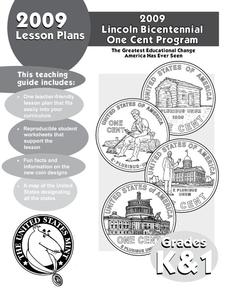
Students demonstrate basic map skills. In this US history lesson, students review cardinal directions and use a compass rose while at the same time discuss what life was like for Abraham Lincoln.
Curated OER
Indianapolis Government
Young scholars read about a girl who takes a trip during the time of the State Capital moving to Indianapolis and then write their own essay about a trip that they took. In this Indianapolis Government lesson plan, students use maps and...
Curated OER
The Southeast Region
Students write a song about the southeast region. In this southeast region lesson plan, students view pictures of landforms, hear music, look at maps of states, and more.
Curated OER
Drawing a Bird's Eye View Map
Students make birds-eye view maps and place the compass rose on the map.
Curated OER
Discovering New Mexico
Seventh graders discuss the elements of maps and using basic linear measurement. They calculate the distance between the cities and create a simulated journey around New Mexico using a road map. They write out the directions for their...
Curated OER
American Civil War
Eighth graders read a collection of stories about the Civil War. Based upon their readings, they perform various activities to reinforce facts about the Civil War. Students create time lines, maps and reports about the war. They...
Curated OER
Mystery State #31
In this mystery state learning exercise, students answer five clues to identify the state in question. They then locate that state on a map.
Curated OER
Mystery State #17
In this mystery state worksheet, students answer five clues in an attempt to identify the state in question. Then, they locate it on a map.
Curated OER
Mystery State #16
In this mystery state worksheet, students answer five clues in an attempt to identify the state in question. Then, students locate it on a map.
Curated OER
Mystery State #20
In this mystery state worksheet, students answer five clues to identify the state in question. They then locate that state on a map.
Curated OER
Mystery State #7
In this mystery state worksheet, students answer five clues to identify the state in question. They then locate that state on a map.
Curated OER
Mystery State #8
In this mystery state worksheet, young scholars answer five clues to identify the state in question. They then locate that state on a map.
Curated OER
Mystery State #9
For this mystery state worksheet, students answer five clues to identify the state in question. They then locate that state on a map.
Curated OER
Mystery State #22
In this mystery state worksheet, students answer five clues to identify the state in question. They then locate that state on a map.
Curated OER
Mystery State #48
In this mystery state activity, students answer five clues to identify the state in question. They then locate that state on a map.
Curated OER
Mystery State #50
In this mystery state worksheet, students answer five clues to identify the state in question. They then locate that state on a map.
Curated OER
How the West Was One: A Layered Book
Students create a layered book about the information they learn about the Western region of the United States. In this Western states lesson plan, students create a book about the land, economy, and culture.
Curated OER
Weather Prediction 2
In this weather worksheet, students are given a weather map of the United States and they answer four questions. They predict the weather in two cities based on the map.
Curated OER
At Home On The Range
Young scholars explore the history and domestication of the Bovidae family and their importance to our prairie ecosystem. Using a map of the United States, students located the American Great Plains. They complete worksheets and...
Curated OER
AT HOME ON THE RANGE
The student will learn how ranchers on the western frontier helped saved the bison from extinction.Hand out student worksheets. Have students read the information about bison on Student Worksheet A before completing Student Worksheet...
Curated OER
Duck Flyways Quiz
In this science quiz worksheet, students read about ducks migrating along flyways. They answer 5 questions based on a map of the United States. They answer true and false, and multiple choice questions.
Curated OER
Where Do You Live?
Students identify their state and city on a map. After completing a reading of Zoom, students identify various landmarks on a globe and on a map. They begin by identifying the United States and refine their identification until they have...
Curated OER
Mapping Martin Luther King Jr.
Students examine geographic locations that were important in Martin Luther King Jr.'s life. They research Martin Luther King Jr., and create U.S. maps that show the locations important to him.
Other popular searches
- United States Maps
- United States Maps Regions
- Northeast United States Maps
- 50 United States Maps
- Create United States Maps
- Western United States Maps
- Custom United States Maps
- Outline Maps United States
- Blank United States Maps
- United States Landforms Maps
- United States Geography Maps
- United States Political Maps


