Curated OER
Looking at Human Struggle Through The Language Arts Curriculum: The Faces of Slavery
Sixth graders examine the use of slavery in the United States. Using a map, they draw the route of the Tecora and Amistad voyages. Individually, they write an essay describing their opinions on whether the Africans on the ships should be...
Discovery Education
Architects in Action
Hands-on and real-world applications are great ways to teach mathematical concepts. Creative thinkers examine how ratios are used to create scale models of buildings and structures. They practice working with ratios by looking at a map...
Curated OER
The Great Lakes
In this Great Lakes worksheet, students observe the Great Lakes location on a partial U.S. map, write their names in the acronym HOMES, list them in order from largest to smallest, and identify states that border them. Students write...
Curated OER
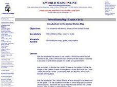
Introduction to the United States Map
Learners explore the United States using a map. In this map lesson, students discover how to use a United States map and a globe to locate places.
Curated OER
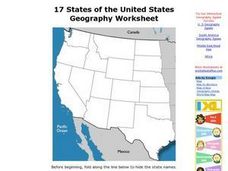
17 states
In this states worksheet, students label states in the United States that are on the west side of the country. Students label 17 states.
Curated OER
USA Map
In this United States political map worksheet, students examine state boundaries. The map may be used in a variety of classroom activities.
Curated OER
USA Capitals Map
In this United States political map worksheet, students examine state boundaries and locations of each of the state capitals.
Curated OER
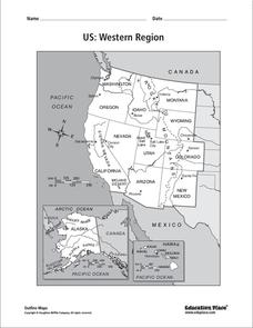
US: Western Region Map
In this United States Western Region worksheet, students examine the state boundaries and landforms found in this region. The map also highlights each of the state capitals.
Curated OER
Blank Map: The United States of America
In this map worksheet, students use the blank outline map of the United States to label the 50 states or for any other study purpose. Each state boundary is shown with no name labels.
Curated OER
Mystery State # 41
Kids use their deductive reasoning skills, state knowledge, and five clues to determine mystery state #41. They'll follow the clues to locate the mystery state on a US map. Note: This is a warm-up activity, so it includes two short...
Curated OER
Simple Symbols
Have your class learn about Texas and the uses of a glyph. After listening to stories about Texas, they identify state symbols and engage in a glyph activity.
Curated OER
Do We Still Need the Electoral College?
One of the most confusing aspects of any presidential election year is the role of the Electoral College. Learners read a bit about how the Electoral College works and then they hold a mock election in their classroom. They'll redraw a...
Curated OER
The Four Corners Region of the United States Cultures, Ruins and Landmarks
Learners who live in the inner city are introduced to the four corners region of the United States. In groups, they examine how the region differs compared to where they live and their culture. They develop maps of the area and locate...
Curated OER
Spanish Influence in the U.S.
Eighth graders research the role of the first Spanish conquistadors who explored the now United States. Using the internet, they gather information on different explorers and write a paper about why he is important in American history. ...
Curated OER
States/capitals
Students identify the geographic locations of each state of the United States. Working cooperatively, they put togehter a giant puzzle of the United States using their individual pieces.
EngageNY
Mid-Unit Assessment: Research Simulation
As part of a mid-unit assessment, scholars complete a research simulation about food deserts to mimic the research process. Afterward, they engage in a think-pair-share to discuss what they've learned throughout the unit.
Curated OER
From Sea to Shining Sea
Students determine the top 5 commodities for each state. For this agricultural commodities lesson, students label a map of the United States with the state capitals and the top 5 agricultural commodities for each. They compile the...
Curated OER
United States Map - Lesson 2 Introduction to Symbols
Students explore the United States using a map. For this map lesson, students discover how to use map symbols in order to read maps.
Curated OER
United States Outline Map
In this United States outline map worksheet, students note the political boundaries of the states that are labeled with state capitals.
Curated OER
United States of America Map: Capitals
In this United States outline map learning exercise, students note the political boundaries of the states that are labeled with postal abbreviation codes as well the labeled state capitals.
Curated OER
United States of America: 1860
In this United States historical map activity, students examine the boundaries of the states and territories of the nation in 1860. This map is unlabeled.
Curated OER
Midwestern States
In this United States geography instructional activity, students study the image of the Midwestern states. Student then label the states with the following choices: Missouri, Iowa, South Dakota, Minnesota, Nebraska, Illinois, North...
Curated OER
United States of America: 1860
In this United States historical map worksheet, students examine the boundaries of the labeled states and territories of the nation in 1860.
Curated OER
What State Are You In?
Students identify the major U.S. cities. In this U.S. geography lesson plan, students work in pairs and use game cards to name various cities in the United States.
Other popular searches
- United States Maps
- United States Maps Regions
- Northeast United States Maps
- 50 United States Maps
- Create United States Maps
- Western United States Maps
- Custom United States Maps
- Outline Maps United States
- Blank United States Maps
- United States Landforms Maps
- United States Geography Maps
- United States Political Maps


