Curated OER
Community Map
Second graders engage in a lesson about their own community. They map the community and are assessed by the creativity of the document. The maps are produced using an example made with the teacher. Students make the cognitive connection...
Curated OER
Where Is Hoku?
Young scholars are introduced to map making and reading. Using maps, they identify the cardinal directions and discuss the importance of a legend. They analyze the human characteristics of the classroom and create overhead view maps of...
Curated OER
America the Beautiful
Young scholars listen to a read-aloud discussing the landmarks of the United States. In pairs, they use the internet to research a landmark of their choice. They create a visual aid to be given with a presentation sharing the...
Curated OER
Introduction to the Barnegat Bay Estuary
Students research estuaries. In this estuaries lesson, students discuss the differences in a bay and an ocean. Students watch a PowerPoint of the properties of the estuaries and geography of Barnegat Bay. Students complete a worksheet...
Curated OER
Star Quest
Students engage in a lesson of using maps in order to find constellations in the night sky. They also conduct research using three constellations. The research is used to create a project to inform others. The teacher also leads the...
Curated OER
Historical Research on Explorers of Canada
Eighth graders study an online atlas of Canada to research an early explorer.
Curated OER
Displaying The Data
Students engage in a research project to find information about one's personal family heritage. They collect information by conducting family interviews. Students use the data to create a graph, map, and timeline. Then students take part...
Curated OER
Underground Sleuths Discover Riches Beneath the Plains
Students identify Alberta, Saskatchewan, and Manitoba on map, and use Canadian Atlas to locate regions of natural resources in Central Plains, which have vital impact upon the economy. Students then complete scavenger hunt worksheet.
Curated OER
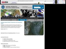
Linkages Between Surface Temperature And Tropospheric Ozone
Students organize and analyze data regarding changes in tropospheric ozone and then hypothesize about the consequences of these changes.
Curated OER
Polar Food Web Comparison
Seventh graders practice the evaluation component of the scientific method while comparing and contrasting the similarities and differences of the food chains and webs of polar animal life. They study about classification and ecology...
Curated OER
Language Arts: Mississippi River Brochure
Students create brochures about recreational activities along the Mississippi River. Focusing on points of interest, they research attractions and create maps of the surrounding area. Once students write descriptions of their...
Curated OER
Explorers of the Mighty North
Students access the Internet to research the journey made by Rear Admiral Peary and Matthew Alexander Henson to the North Pole. They locate the North Pole on maps and globes. They present oral reports to classmates on their research.
Curated OER
It's Not My Problem!
Young scholars examine how rivers flow through the country to sea level. Students study how upstream pollution effects the water and people downstream.
Curated OER
Global Citizenship: Our Links Around the World
Students study the world's cultures and learn about various country's values and beliefs. In this cultures lesson, students use the worksheet and work in pairs to discuss each culture question. Students then discuss the worksheet as a...
Curated OER
Monarch Butterflies
First graders listen to books about butterflies and look at pictures of butterflies. Students review the stages of butterflies and learn the migratory path the monarch takes in its adult stage.
California Academy of Science
Which Way is North?
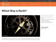
Who needs a compass to find cardinal directions? Just place a stick in the ground and record the movement of its shadow over the course of a day. Then, measure the shadow lengths in order to determine a north-south line. A simple...
Curated OER
Video Boxes
Students create a video box about a Central American country. In this world history lesson, student research Central America and pick a country they want to investigate. They work in groups to create a video box that shows images about...
Curated OER
Tango Stories
Students listen to tango music and research the country it came from. In this music lesson plan, students find that tango music comes from Argentina. They listen and dance to the music and then write stories.
Curated OER
Using 4 main directions in a classroom
Students use the four directions of a compass rose to locate classroom features. In this directions lesson plan, students locate the features by identifying directions.
Curated OER
Ticky Plans His Trip to Antarctica to See Tacky
First graders participate in creative problem solving activity to get from Utah to the Atlantic Ocean.
Curated OER
2nd Grade - Act. 22: The World Game
Second graders play World Game to become more familiar with continents, oceans, countries and states.
Curated OER
True North, Magnetic North
Students explain why compass angles need to be corrected for regional magnetic variation. They observe the difference between magnetic and true north. Each student measures the angle of variation for a town in a different state.
Curated OER
"The Clever Monkey"
Second graders complete a variety of activities related to the book "The Clever Monkey" by Rob Cleveland. They answer story comprehension questions, and rewrite the story. Students also complete a comprehension and fact or opinion...
Curated OER
Civil War Prison Camps
Fourth graders work with a partner to create a puppet show that demonstrates the condition of the prisoners in Andersonville, Georgia during the Civil War.


