Miama-Dade County Public Schools
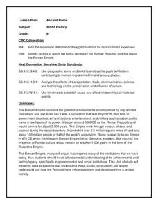
Ancient Rome
This resource outlines several general activities for a study of Ancient Rome, and includes guiding questions, a handout on the story of Romulus and Remus, and ideas for incorporating mapping and timeline activities into your review.
Curated OER
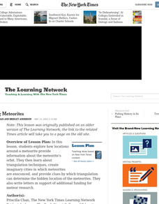
Mapping Meteorites
After reading an article, "Cameras Capture a 5-Second Fireball and Its Meteorite's Secrets," space science superstars use the triangulation method to determine the location of a distant object. In-class activities and homework are...
Curated OER
Migration of the African American Family
Students investigate the influence Africa has had on African-American families as they have migrated from Africa to various sections of the United States. They utilize map skills to locate regions in Africa and in the United States.
Curated OER
Adventure to Alaska
Students use their imagination and research skills to create a virtual tour of the "Land of the Midnight Sun." They are told that Alaska is the largest state in the United States. Students gather information about Alaska to help them...
Curated OER
Native Pottery Replicas
Students study ancient Native American traditions and practices. They select one type of Native American pottery to duplicate in a hand-made replica. Afterward, they create a map of the United States and label where indigenous peoples...
Curated OER
Drawing a Bird's Eye View Map
Students make birds-eye view maps and place the compass rose on the map.
Curated OER
Discovering New Mexico
Seventh graders discuss the elements of maps and using basic linear measurement. They calculate the distance between the cities and create a simulated journey around New Mexico using a road map. They write out the directions for their...
Curated OER
American Civil War
Eighth graders read a collection of stories about the Civil War. Based upon their readings, they perform various activities to reinforce facts about the Civil War. Students create time lines, maps and reports about the war. They...
Curated OER
Mystery State #31
In this mystery state learning exercise, students answer five clues to identify the state in question. They then locate that state on a map.
Curated OER
Mystery State #17
In this mystery state worksheet, students answer five clues in an attempt to identify the state in question. Then, they locate it on a map.
Curated OER
Lesson Nine: Size and Scale
Young scholars investigate scale as it is related to maps. In this map instructional activity, students read Jack and the Beanstalk by Carol North. Young scholars then compare the setting in the story to a landscape picture map to help...
Curated OER
Mystery State #16
In this mystery state worksheet, students answer five clues in an attempt to identify the state in question. Then, students locate it on a map.
Curated OER
Mystery State #20
In this mystery state worksheet, students answer five clues to identify the state in question. They then locate that state on a map.
Curated OER
Mystery State #7
In this mystery state worksheet, students answer five clues to identify the state in question. They then locate that state on a map.
Curated OER
Mystery State #8
In this mystery state worksheet, young scholars answer five clues to identify the state in question. They then locate that state on a map.
Curated OER
Mystery State #9
For this mystery state worksheet, students answer five clues to identify the state in question. They then locate that state on a map.
Curated OER
Mystery State #22
In this mystery state worksheet, students answer five clues to identify the state in question. They then locate that state on a map.
Curated OER
Mystery State #48
In this mystery state activity, students answer five clues to identify the state in question. They then locate that state on a map.
Curated OER
Mystery State #50
In this mystery state worksheet, students answer five clues to identify the state in question. They then locate that state on a map.
Curated OER
Financial Planning: Your Road Map Unit
Students examine steps of financial planning and goal setting, determine difference between needs and wants, and prioritize, which sometimes requires opportunity costs and delayed gratification.
Curated OER
How the West Was One: A Layered Book
Students create a layered book about the information they learn about the Western region of the United States. In this Western states lesson plan, students create a book about the land, economy, and culture.
Curated OER
Mapping Martin Luther King Jr.
Students examine geographic locations that were important in Martin Luther King Jr.'s life. They research Martin Luther King Jr., and create U.S. maps that show the locations important to him.
US Apple Association
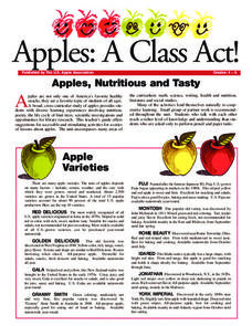
Apples: A Class Act! (Grades 4–6)
Middle schoolers have a bushel of fun as they engage in activities and research core facts about apples. Packed with suggestions for in-class activities and out-of-class research, the colorful 6-page packet is sure to satisfy hungry...
Echoes & Reflections
Studying The Holocaust
While many young scholars are familiar with the Holocaust, they may not understand the specific history that led to the unprecedented atrocity. The first lesson in the unit helps teachers gauge their pupils' background knowledge. A...
Other popular searches
- United States Maps
- United States Maps Regions
- Northeast United States Maps
- 50 United States Maps
- Create United States Maps
- Western United States Maps
- Custom United States Maps
- Outline Maps United States
- Blank United States Maps
- United States Landforms Maps
- United States Geography Maps
- United States Political Maps


