Houghton Mifflin Harcourt
Voyagers: Challenge Activities (Theme 5)
Young voyagers face the challenge of the wide dark sea, travel with Yunmi and Halmoni, and even get trapped by the ice as they explore the reading selections offered in these enrichment activities designed for the Houghton Mifflin...
Curated OER
Where Do You Live?
Students identify their state and city on a map. After completing a reading of Zoom, students identify various landmarks on a globe and on a map. They begin by identifying the United States and refine their identification until they have...
Curated OER
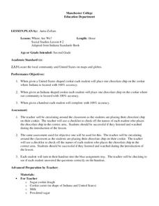
Where Are We?
Second graders identify the correct location of their city and state on a map. Through a matching activity, 2nd graders correctly identify their state on a shaped cookie map of the Unites States. They identify their city on a shaped...
Curated OER
Geographic Landscapes and Interstate Freeway Development
Students investigate the topography of the United States through a discovery lesson. They create a hypothetical route for a highway across the United States. Students also conduct research major landforms and define geographic terms.
Curated OER
Mapping the United States
Fifth graders research assigned states. They identify the capital, the climate, industries,rivers, and native animals.
Curated OER
Conflicting Views
Students complete a Venn diagram comparing the United States and Afghanistan. They research the history of the Taliban and how they relate to the United States and its foreign policy. They write a paper on possible solutions.
Curated OER
All Across America
Students share experiences of places they have visited or would like to visit. They create travel guides for trips to take in the United States based on themes from their studies, incorporating both historical and current data about...
Curated OER
U.S. And Global Deforestation
Young scholars analyze graph showing global deforestation, view photograph of deforestation in Brazil's interior rain forest and examine three maps showing deforestation within the United States, describe political, economic, and social...
Curated OER
Discovering Your Heritage
Students interview a family member about their heritage. They listen to and record part of their family's oral history. Students also create and label a family tree going back a minimum of two generations and compare and contrast...
Curated OER
Volcanic Activity in the U.S.
Students locate and map ten volcanoes in United States, create chart comparing volcanoes by last eruption, type of volcano, location, and interesting fact, and create Powerpoint slide show describing basic
information about volcanoes and...
Curated OER
When Turtle Grew Feathers
Students explore the Choctaw Native American tribe. In this cross curriculum literacy and U.S. history lesson, students locate where the Choctaw Indians lived on a United States map. Students listen to When Turtle Grew Feathers and...
Curated OER
Would You Like A Desert With That?
Students explore the four different deserts in the United States and their characteristics. They discuss the four different types of deserts in United States and their characteristics, and locate them on a map.
Curated OER
Jackie Steals Home
Students read articles relating to Jackie Robinson's breaking of the racial barrier in professional baseball. This leads to a deeper exploration of racism in the United States. They use a variety of worksheets imbedded in this plan to...
Curated OER
Coasts
Students explain the different types of marine coasts and where they are located in the United States and its territories. They explain and identify some of the life forms that inhabit different marine coastal regions.
Curated OER
Tactics in the Persian Gulf: From Diplomacy to Force
Students trace the United States' involvement in Iraq from 1991 to today. They interpret a map of Iraq, evaluate possible causes and effects of events. They participate in, collect and analyze a poll regarding the next steps the US...
Curated OER
Water: The Flow of Women's Work
Middle schoolers view photographs, read, and reflect on their own environments to gather information about gender roles in Lesotho and the United States. Students role-play gender role related scenarios and write about their reflections...
Curated OER
The Desert Alphabet Book
Learners explore world geography by researching a science book with their classmates. In this desert identification lesson, students utilize a U.S. map to locate the geographical locations of deserts. Learners create an oral report based...
Curated OER
Weather in Your City
Students observe weather conditions of a particular city. Multiple intelligences are explored within this lesson. They locate their particular city on a United States map. Each student writes about their discoveries in his/her journal...
Curated OER
Our community and New York City
Fourth graders research websites to gather information about New York City and the Ridgewood community. For this New York City and Community lesson, 4th graders make a semantic map. Students write short postcards to send to students...
Curated OER
HIV/AIDS And Contemporary Population Dynamics
High schoolers describe the spread and occurence of HIV/AIDS at multiple scales. They explain global and regional variations in the occurence of HIV/AIDS and explain the spread of HIV/AIDS in the United States.
Curated OER
Understanding Demographics
Students use demographic information to gain an understanding of the Dominican Republic. They compare demographic data from the United States and the Dominican Republic and describe the difference between learning about a country from...
Curated OER
Geography of China (Tibet): Dalai Lama Day Three of Five
Sixth graders research another culture. In this geography and culture lesson, 6th graders read about the geography of Tibet, compare the United States and Tibet, use various resources to research information about Tibet and discuss what...
Curated OER
Beyond Louisiana
Students examine the challenges that faced the United States as a new nation, especially those related to exploration, expansion, and international affairs. They study the chronology of events related to the expedition of Lewis and Clark.
Curated OER
Monumental Disappearance
Fourth graders compare the emissions listed on the EPA isopleths over the past five-year period for ten key states. They use this information to rank each region according to the degree of acid rain problem in those parts of the United...
Other popular searches
- United States Maps
- United States Maps Regions
- Northeast United States Maps
- 50 United States Maps
- Create United States Maps
- Western United States Maps
- Custom United States Maps
- Outline Maps United States
- Blank United States Maps
- United States Landforms Maps
- United States Geography Maps
- United States Political Maps


