Curated OER
All Aboard: Underground Railroad Knowledge Chart
Fifth graders research the Underground Railroad. In this Underground Railroad lesson, 5th graders start a KWL chart about the Underground Railroad. Students use a map to locate slavery areas and free states. Students view a PowerPoint...
Curated OER
Story Stretching: Tall Tales in North America
Students are introduced to tall tales. In this introductory tall tales unit, students explore the tall tales of Casey Jones and Johnny Appleseed. This unit includes many interdisciplinary lessons including graphing skills and geography.
Curated OER
World Map and Globe - Lesson 15 (K-3)
Students discover mountain ranges and their locations in the world. In this physical map lesson, students locate and identify major mountain ranges of the world on a large physical map.
Curated OER
Spanish Influence in America
Students try out instruments from South America. In this multiculturalism lesson plan, students discuss the attributes of Latin American music and play instruments from South America.
Curated OER
Lending a Helping Hand
Middle schoolers research the work of North American NGOs and select one to support with a financial contribution as a class. In this philanthropic research lesson plan, students consider the work of Benjamin Franklin, defining good...
Curated OER
Great North
Students use maps to locate the Arctic Circle, the North Pole and Northern Europe. They draw and label countries within the Arctic Cirlce and identify the groups of people who live there. They also watch and answer questions about the...
Curated OER
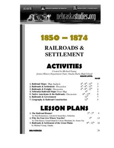
The Railroads and Settlement of the Great Plains
Enhance your American literature unit with this resource, in which readers access the Nebraska Studies website and read about "Railroads and Settlement." They search for a photograph of some aspect of the railroad from the Prairie...
Curated OER
What They Left Behind: Early Multi-National Influences in the United States
Students examine how the European voyages of discovery influence American culture even today. They map eighteenth century Europe's impact on the United States.
Curated OER
What They Left Behind: Early Multi-National Influences in the United States
Learners research the impact of European voyages of discovery and colonial influence on different aspects of American culture. They access a number of online sources and reference maps to trace the influences of England, France, Holland,...
Curated OER
Survey of the Louisiana Purchase in 1815
Students explore the survey of the Louisiana Purchase by creating their own surveying and mapping techniques such as natural maps, pace maps, and orienting. Other students then try to follow the maps.
Theodore Roosevelt Association
Roosevelt's Legacy: Conservation
The legacy of Theodore Roosevelt carries through modern American politics, economics, foreign policy, and society. But his proudest and most profound efforts were in the world of conservation, and in preserving the natural beauty of...
Curated OER
Marine Sanctuaries
Students delve into diverse marine ecosystems and the problems they face. They discover students the national marine sanctuaries found in the Pacific and Atlantic oceans and off the coast of American Samoa.
Curated OER
The Era of Good Feelings
Setting the context for the first part of the 19th century, the slides presented here display the "Era of Good Feelings," including the presidencies of Monroe and Adams. Maps and photographs help students to contextualize the concepts of...
Curated OER
Trekking to Timbuktu: The Geography of Mali -Teacher Version
Learners investigate the geography of Mali. They locate Mali on a satellite map, explore various websites, describe the landscape and climate, label a map, and write an essay about the Niger Riger.
Curated OER
South Carolina Jeopardy
One of the better PowerPoints I've come across is a "Jeopardy"-style game whose focus is South Carolina. Some excellent photographs and maps make the slides especially good. The "Final Jeopardy" clue is especially challenging. An...
Curated OER
Wildlife
First, biology pupils research land and marine habitats along the route of skipper Rich Wilson's Great American II. Then, using colored paper clips scattered across a colored paper background, they play the predator-prey game to...
American Battlefield Trust
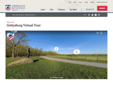
Gettysburg Virtual Tour
Step into one of the most iconic battlefields of the American Civil War with an educational interactive resource. Young historians learn about key moments, locations, soldiers, and turning points in the battle with a clickable map and...
Curated OER
Language Families
Fourth graders identify and locate the three language families of North Carolina. They calculate the physical area covered by each language family and label them on a map.
Curated OER
The Historical and Economic Impact of the Civilian Conservation Corps in South Carolina
Eighth graders explore the effects of the Civilian Conservation Corps. In this lesson, 8th graders use primary sources to examine how the CCC impacted North Carolina. Students will locate National Parks on a map, write a summary and...
Curated OER
The Reservations
Third graders investigate the concept of a reservation and how it effects the lives of Native American indian tribes. They conduct research with the help of guiding questions to find the correct type of information. Students take notes...
Curated OER
Tracing Our Own Family Pilgrimages
Students observe a world map and are introduced to vocabulary like: cities, continents, rivers, lakes, and oceans. They discuss the names of the cities they live in and locate them on the map; then using a colored pushpin indicate: the...
Curated OER
The Kanaka Village at Fort Vancouver: Crossroads of the Columbia River
Young scholars study the interaction between Native American and European cultures in the Pacific Northwest in the 1800s. They focus their study on the Hudson's Bay Company and Fort Vancouver.
Curated OER
Mesoamerica
Students demonstrate knowledge of early Middle American civilizations. They study Mesoamerican i religions, governments, and achievements. They identify geographies of North and South America.
Curated OER
Natural History of Costa Rica
Young scholars use outline maps to become acquainted with Costa Rica. They see how it was formed and how its origin has created very diverse environments. Students then use atlases and compare their physical maps with maps of climate and...


