Curated OER
From the Farm to Your Table: Where Does Our Food Come From?
Students discover where the food they eat comes from. Using maps, they identify the agricultural areas of the United States and the products that are grown in each area. Using the internet, they research how food gets to America from...
Curated OER
Family Heritage
Middle schoolers research their family heritage by interviewing family members. Using their responses, they record them in an organized fashion and develop a presentation. Using the Internet, they locate an artistic representation of...
Curated OER
ADULT ESOL LESSON PLAN--Environment and the World
Students locate and trace Florida on a United States map as well as their local counties and city of residence on a state map. In addition, they label all the directions north, south, east and west on each map.
Curated OER
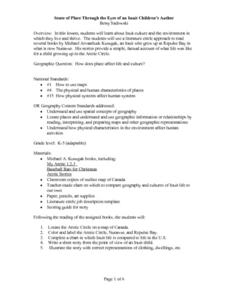
Sense of Place Through the Eyes of an Inuit Children's Author
Students read books by Michael Arvaaluck Kusugak to explore life in the Artic Circle. After reading the books, students compare and contrast life in the Artic Circle to life in the United States. They write and illustrate a story about...
Curated OER
This Land is Your Land? This Land is My Land!
Students research the various territory acquisitions in United States history and create an annotated map that tells the history of U.S. expansion. Working in small groups, students outline the land acquisitions and purchases made by...
Curated OER
Our Country's Landforms
Learners investigate the many different landforms that are found throughout the United States. They use the internet and other resources to gather information. The information is used to prepare a multimedia slideshow and to create a...
Curated OER
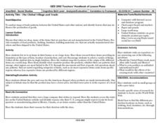
The Global Village and Trade
Pupils analyze maps of trade patterns between the United States and other nations and identify factors that may influence the production of goods.
Curated OER
Integration of Education
High schoolers explore the history of Civil Rights and how the struggle for Civil Rights and the Second Reconstruction, transformed society and politics in the United States in the 1950s. Then they identify why American Schools are...
Curated OER
Lots of Lakes: Greater Than, Less Than
To set up this activity, your class explores Minnesota's nickname as the Land of 10,000 Lakes, and the back of the state quarter that features a Minnesota lake. Young mathematicians compare the number 1 to the number 10,000 with support...
Curated OER
Immigrating to America
Students study the American immigration experience. In this Ellis Island lesson plan, students research primary documents from the immigration station, take a tour of the station, and then prepare and perform dramatic presentations based...
Houghton Mifflin Harcourt
Off to Adventure!: Challenge Activities (Theme 1)
Off to Adventure! is the theme of an English language arts unit comprised of a variety of challenge activities. Scholars enhance skills and reinforce concepts by taking part in a grand book discussion, giving an oral report, and writing...
Curated OER
Let's Play Geography Twister
Young scholars practice geography skills by playing a game based on Twister. Students manipulate their position on a map by placing their arms and legs on the appropriate state or country called out by the teacher.
Curated OER
OPEC and the Energy Crisis
Learners color the Middle East Nations of OPEC on outline maps. They discuss and watch a video about the United States reliance on oil producing nations of the Middle East. They participate in a discussion of the problems of the gas...
Curated OER
A Place Called Fairfax
Students use maps to locate Virginia, its surrounding states and Fairfax County. Individually, they describe the absolute and relative location of the county and why it is important to know both. As a class, they brainstorm the...
Curated OER
The Bozeman Trail
Eighth graders are introduced to the Bozeman Trail. Using the internet, they research the trail to discover the forts located on its path. They must also locate and label landmarks on a map using symbols they create. They answer...
Curated OER
Mural Mania
Students create a mural that displays symbols for their home state. They complete worksheets and read a book about their state. They collect images of the state flower, tree and bird for the mural. There are 5 other lesson plans included...
Curated OER
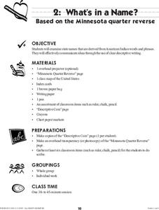
What's in a Name?
Students examine state names that are derived from American Indian words and phrases. They effectively communicate ideas through the use of clear descriptive writing. The reverse of the Montana Quarter is used as inspiration for this...
ReadWriteThink
Biography Project: Research and Class Presentation
I Have A Dream ... that after the lesson, all individuals master the reading, writing, researching, listening, and speaking skills the biography project helps them develop. Martin Luther King, Jr. serves as a topic example for a model...
Novelinks
The View From Saturday: Concept/Vocabulary Analysis
Design your unit on The View From Saturday by E.L. Konigsburg with a concept and vocabulary analysis resource. It outlines the plot, literary elements, vocabulary issues, and any possible considerations for planning a differentiated...
Curated OER
BOUND TO BE NEW HAMPSHIRE
Pupils identify neighborhood, town, and state boundaries. They distinguish between natural and man-made boundaries. They identify major state geological features and explain how NH boundaries have changed over time.
Curated OER
Move Around the Map
Fourth graders, while working with a partner, label and identify on a tarp map six major cities and five major rivers in Indiana. They traverse along the rivers utilizing a different locomotor skill (hop, skip, walk, run, leap, gallop,...
Curated OER
Virginia in the Civil War
Students examine the role of Virginia during the Civil War. In groups, they brainstorm ideas about why they believe so many battles took place in Virginia. Using a map, they locate the major battles on land and in the ocean. To end...
Curated OER
Camp Chase Confederate Cemetery
Students use maps, readings and photographs to locate prisoner of war camps in the North during the Civil War. They identify the camp's population sizes and mortality rates and how the camps' uses have changed over time.
Curated OER
I Can Compass, Can You?
Students discover how to use geographic tools. In this compass lesson, students identify cardinal directions by appropriately using compasses along with a number of various maps.


