Curated OER
Quarters from the Coast
Young scholars discuss Fifty State Quarters Program, compare and contrast location of land and water on map of United States, while also becoming aware of physical shape of nation and home state, and explore coastal areas in United States.
Curated OER
Title: Rivers as Borders
Students are introduced to the concept of borders. They read maps and identify rivers that separate different countries and states. They examine how or why a landform such as a river border might be the reason for different cultures.
Curated OER
Edible Resource Maps
Third graders work in groups to create an edible resource map showing locations of at least five resources in the United States. Students research on the internet different regions and the resources that are found in those areas. They...
Curated OER
Name That Place: Cultural Place Names in the United States
Students examine the origin of the people that settled in the United States. In this United States History instructional activity, students work in small groups to complete several activities that explore early settlement, such as a...
Curated OER
How Did the Immigrants Get to the United States?
Third graders search TDC database for images of immigration from other countries, maps, and diaries. They identify the challenges that immigrants had to endure to reach the United States.
Curated OER
The Best Place in the United States to Live
Students, working in small groups, analyze information provided in U.S. maps to make a logical determination of the best place to live in the United States in regards to natural and human-made hazards. Then, working individually, they...
Curated OER
Special Traits: Alabama quarter reverse
Who knew a state quarter could say so much? Alabama's quarter is embossed with an image of Helen Keller, pupils will use this image to think about what the phrase "Spirit of courage" means. They will use a graphic organizer to...
Curated OER
Push or Pull?
Utilizing the Nebraska State Quarter, pupils learn about the pioneers who had wagons that were pulled across Nebraska by oxen during the westward movement. Excellent worksheets are embedded in the plan that guide them through this fine...
Curated OER
Zoo-Goers Ready to Greet Baby Panda
The Smithsonian's National Zoo, also known as the Washington Zoo, is one of the oldest zoos in the United States. Youngsters read and discuss a news article about Tai Shan, baby panda that was one of the zoos most famous residents. They...
Curated OER
The Physical Geography of Australia, Oceania, and Antarctica
Students access information from the United States Geological Survey's Web site This Dynamic Earth to research the Ring of Fire. They answer four questions and then apply what they have learned to create a bulletin board display.
Curated OER
From Sea to Shining Sea
Students study the geography of the United States of America. Students write letters, create travel brochures, make maps, graph population numbers, read fiction and nonfiction selections, complete KWL charts, and watch films.
Curated OER
Balanced Literacy: Presidents
Pupils participate in a unit (all lessons on the same page) to explore the Presidents of the United States. They choose one President to write a mini-book about, create a puppet and an original puppet show to perform about their chosen...
Curated OER
Grade 8 Unit 4
Eighth graders analyze aspirations and ideals of the people of the new nation, in terms of its physical landscapes and political divisions, and the territorial expansion of the United States during the terms of the first four presidents.
Curated OER
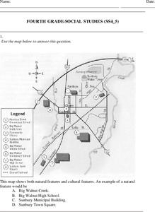
Fourth Grade Social Studies
In this social studies worksheet, 4th graders answer multiple choice questions on state maps, city maps, road maps, political maps, and more. Students complete 25 multiple choice questions.
Curated OER
The American Prairie
Students design an animal. In this prairie activity, students learn about physical and behavioral adaptation, locate the Great Plains on a map, and design an animal that would be perfectly adapted for life on the prairie. Students...
Curated OER
Our States, My State
Students examine the Louisiana state quarter and locate Louisiana on a map of the U.S. They relate the location of Louisiana to other states (and vise versa) using directions and the compass rose.
Curated OER
Map Reading
After examining a map from 1803 and 2003, they explore how to become map readers. They describe what they see on the map from 1803 and compare the information to the map from 2003. Learners create their own map of the neighborhood that...
Curated OER
Maps as Models of Earth
Eighth graders use different types of maps to find locations and surface features. For this map-reading lesson students use a compass to find direction.
Curated OER
George Washington and the Beginnings of the French and Indian War
Students read about the causes of the French and Indian War. In this French and Indian war lesson plan, students read about the physical and human problems that lead to the war. They also learn about George Washington's role in the war.
Curated OER
Reading distance on maps
Eighth graders complete worksheets on reading the distance on maps in miles or kilometers. In this maps lesson plan, 8th graders use a calculator and ruler.
Curated OER
Planning a Garden Using a Grid
Third graders plan for a garden. In this garden planning lesson, 3rd graders investigate the use of a grid to accurately map out and plan for a vegetable garden. Students predict the space requirements for different vegetables.
Curated OER
Japan
First graders investigate the similarities and differences between Japan and the United States. They develop a KWL chart, locate Japan and the U.S. on a globe, conduct Internet research on life in Japan, conduct an interview, and create...
Curated OER
Canada, O Canada
Students study the similarities and differences between Canada and the United State in this unit. They examine geography, government and culture as they "travel" through Canada.
Curated OER
Population Density
Students examine world population density and population distribution. They create pie charts showing population distribution and analyze population patterns in the United States and major regions of the world. They identify...


