National Endowment for the Humanities
Hopi Place Names
What's in a name? Historians consider the question as they examine places important to the Hopi people and the meanings of their place names. Included worksheets include maps and charts to help class members examine the geography of Hopi...
Smithsonian Institution
Borders with the World: Mexican-American War and U.S. Southern Borderlands
The Mexican-American War created social borders—not just physical ones. Scholars learn about the effects of the Mexican-American War on the people living in the borderlands using text excerpts, maps, and partnered activities. Academics...
Curated OER
Arbor Day Across the United States
Students perform research about hardiness zones used to guide planting. They read a hardiness zone color-key map and create their own color-key maps to show when different states celebrate Arbor Day.
Curated OER
United States & Canada: How Are We The Same? How Are We Different?
Pupils compare and contrast similarities and differences between Canada and the US. In this geography lesson, students read various articles and identify similarities and differences in economies, cultures, geography, climate, and...
Curated OER
Geomnemonics: Facilitating the Teaching of Social Studies Content with Geography Skills
Students explore how to draw a world map by hand and how to locate countries.
Weebly
Ancient China
From China's physical geography and earliest beginnings of civilization to the Qin and Han dynasties, here is a nicely designed worksheet on ancient China, which includes a graphic organizer and timeline to summarize the reading material.
Curated OER
Journey to America
Fifth graders carefully analyze the artwork, Les Emigrants, and explore the reasons that people emigrated to the United States, and what life was like for new arrivals. They discuss what things immigrants were able to bring with them and...
Curated OER
Will There Be a White Christmas This Year?
Students examine historical weather data, and create map and color key that illustrates the likelihood of a white Christmas in different locations across the United States.
Curated OER
Train Of States
Fourth graders create a class book with information about each of the United States. After students draw a state name out of a hat, they use various resources to fill in a facts chart about their state. Students draw the state flag and...
Curated OER
Name That Place: Cultural Place Names in the United States
Students examine the origin of the people that settled in the United States. In this United States History instructional activity, students work in small groups to complete several activities that explore early settlement, such as a...
Curated OER
Zoo-Goers Ready to Greet Baby Panda
The Smithsonian's National Zoo, also known as the Washington Zoo, is one of the oldest zoos in the United States. Youngsters read and discuss a news article about Tai Shan, baby panda that was one of the zoos most famous residents. They...
Curated OER
Geography And The Revolutionary War
Students gain a deeper understanding of both geography and the Revolutionary War. They practice using on line research in examining historical events and using political, physical, and topographic maps.
Curated OER
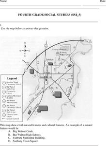
Fourth Grade Social Studies
In this social studies worksheet, 4th graders answer multiple choice questions on state maps, city maps, road maps, political maps, and more. Students complete 25 multiple choice questions.
Curated OER
U.S. Geography- The Northeast
Learners investigate the geography of the Northeast states. In this map skills lesson, students are shown a map of the Northeast states and identify the state names and borders. Learners construct individual maps of the Northeast using...
Curated OER
George Washington and the Beginnings of the French and Indian War
Students read about the causes of the French and Indian War. In this French and Indian war lesson plan, students read about the physical and human problems that lead to the war. They also learn about George Washington's role in the war.
iCivics
County Basics
To understand the concept of a county government system, scholars read a short passage, view a helpful visual aid, use the web to conduct some research about their local areas, and then answer related questions online.
Curated OER
Canada, O Canada
Students study the similarities and differences between Canada and the United State in this unit. They examine geography, government and culture as they "travel" through Canada.
Curated OER
U.S. and Canada: How are We the Same? How are We Different?
Get high school geographers to compare and contrast Canada and the United States. They begin by drawing a freehand map of North America, then complete readings to gain insight into Canada. The text is not provided; however, another text...
Curated OER
Using Different Kinds of Maps
Third graders explore the landforms and population diversity. They read maps and examine geographic terms. Students create their own map of the United States and answer questions about the location of people. After exploring the map, 3rd...
Curated OER
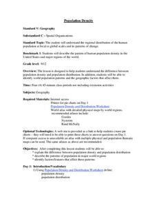
Population Density
Students examine world population density and population distribution. They create pie charts showing population distribution and analyze population patterns in the United States and major regions of the world. They identify...
Curated OER
Summertime Travel
Third graders write about a summer event they participated in. In this paragraph writing lesson, the teacher models how to write about a place they have visited. Students then write their own paragraphs. Students will point out on the...
Curated OER
Living Swamps, Bayous and Forests
Third graders explore interesting environments by exploring Louisiana. In this wetland lesson, 3rd graders utilize the web to research the State of Louisiana, the bayous in the area, and the Gulf of Mexico. Students write a journal entry...
Curated OER
Know Your Area
Students investigate transit by analyzing their school surroundings. For this local geography lesson, students identify their school in relation to the rest of their state, country and globe. Students discuss their personal travel habits...
Curated OER
From Bolls to Bolts
Fifth graders explore the economic effects of the colonization of North America. In this Social Studies lesson, 5th graders examine the economic and cultural results that occurred due to North America entering the market. Students...


