Oregon State
World Map of Plate Boundaries
Young geologists piece together the puzzle of plate tectonics in an earth science lesson. Given a physical map of the world, they search for land formations that indicate the location of different types of plate boundaries.
Lrymple Secondary College
Plate Boundary
Scholars examine diagrams and complete a concept map to discover key details about convergent, divergent, and transform plate boundaries.
NOAA
Plate Tectonics I
Young geologists get a glimpse beneath the earth's surface in this plate tectonics investigation. After first learning about the different layers of the earth and the constant movement of its plates, young geologists work in small groups...
It's About Time
Effects of Plate Tectonics
Explore our world from within as you lead young scientists on a thrilling adventure. Pupils examine the location of plate boundaries to determine earthquake and volcano distribution around the globe and explore the cause of hot spots in...
Teach Engineering
Earthquakes Living Lab: The Theory of Plate Tectonics
Find out if your class agrees with Ice Age: Continental Drift ... or if it's just a fun family movie! Class members research the theory of continental drift, examine evidence of plate tectonics, connect this information to engineering,...
Curated OER
Predicting Plate Movement
In this plate movement worksheet, students review the 3 types of plate boundaries and predict where plates will be as they continue moving along their current path. This worksheet has 2 short answer questions.
Curated OER
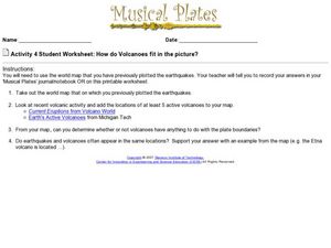
How do Volcanoes Fit in the Picture?
In this volcanoes worksheet, students look at maps and answer short answer questions about volcanoes, plate boundaries, and earthquakes. Students complete 4 questions.
Curated OER
Exploring Plate Tectonics
In this plate tectonics worksheet, students answer questions about plate movement, the types of boundaries, the history of Earth's crusts and plate tectonics. They use an on line source to get their answers.
Curated OER
Plate Tectonics Lab
For this plate tectonics worksheet, students cut out plates given a map of the world. They construct an accurate model of the tectonic plates and answer questions about plate tectonics. They also color a map of the world to show the...
Curated OER
Volcanoes and Plate Tectonics
In this earth science worksheet, students read and study about divergent and convergent boundaries, tectonic plates and volcanoes to complete 1 data chart 7 short answer questions.
Curated OER
Look for Patterns
For this earthquakes worksheet, students look at maps of earthquake patterns and answer short answer questions. Students answer 12 questions.
Curated OER
Exploring Plate Tectonics
In this plate tectonics worksheet, students complete 8 fill in the blank questions on plate boundaries, 9 short answer questions on the Earth's crust and 5 fill in the blank on continental drift. There are 3 follow questions at the end.
It's About Time
The Changing Geography of Your Community
Lead your class in exploring their local communities as well as the general environment. As they determine continental distributions by investigating minerals, rocks, and fossils located in their local region, pupils construct a...
Curated OER
Anatomy of an Earthquake
In this earthquake worksheet, students read and study earthquake maps and statistics. They complete 8 short answer questions that follow.
Curated OER
Plotting Earthquakes and Volcanoes
In this earthquakes and volcanoes learning exercise, students are given the latitude and longitude of earthquakes and volcanoes and they plot them on a world map. They answer questions based on their results.


