Curated OER
How Many Ways Can You Say Merry Christmas?
Students create a multicultural holiday bulletin board map! students research and study saying Merry Christmas in different languages. They correctly locate the countries on a world map.
Curated OER
World Map and Globe - Four Main Directions
Learners study the four main directions on a map. In this map instructional activity, students locate the North and South pole, and learn the four cardinal directions. They use the compass rose on a map to help with the directions. (Map...
Curated OER
Our Class Is On the Map
Second graders review map keys, symbols, and the purpose of maps, then students design a poster size map of their classroom.
Curated OER
Breaking News English: Map Shows Chinese Discovered America
In this English worksheet, students read "Map Shows Chinese Discovered America," and then respond to 47 fill in the blank, 7 short answer, 20 matching, and 8 true or false questions about the selection.
Curated OER
Breaking News English: Map Shows the Chinese Discovered America
In this English worksheet, learners read "Map Shows the Chinese Discovered America," and then respond to 47 fill in the blank, 7 short answer, 20 matching, and 8 true or false questions about the selection.
Curated OER
Tooling Around Arizona: Reading Arizona Maps
Students study geography. In this Arizona maps lesson, students develop their map reading skills. They have class discussions and work independently with various copies of Arizona maps to practice those skills. This lesson mentions...
Curated OER
THE GULF STREAM
Students explore how to describe the Gulf Stream, how Benjamin Franklin charted it, and correctly plot it on a map.
Curated OER
Capitals, Oceans, And Border States
Students investigate geography by completing games with classmates. In this United States of America lesson, students examine a map of North America and identify the borders of Mexico and Canada as well as the Pacific and Atlantic....
Curated OER
Geography and Culture in South Carolina
Students explore South Carolina. In this cultural heritage lesson, students investigate the topography of South Carolina using maps. Students are engaged in identifying the different regions of the state and examine the cultural heritage...
Curated OER
Studying Snow and Ice Changes
Students compare the change in snow and ice over a 10 year period. In this environmental science activity, students use the live data on the NASA site to study and compare the monthly snow and ice amounts on a map of the entire Earth. ...
Curated OER
Lions at Lunchtime
In this literature study unit, 4th graders read the book Lions at Lunchtime and match ten vocabulary words to the definitions and seven short answer questions based on chapters 1 and 2. Students read chapters 3,4, and 5 and answer twelve...
Curated OER
A Month of Mapping Literature
Explore the world through literature! With push pins to mark where each story came from, learners examine cultural differences, geographical location, and how those elements affect story content. This lesson could use deeper development,...
Curated OER
Immigration and Ellis Island
Fourth graders explore family histories. For this social studies lesson, 4th graders identify the countries from which their ancestors came and locate them on a map. Students discuss the role that Ellis Island played in immigration in...
Curated OER
Equator, North Pole, and South Pole
Students identify the Equator, North Pole, and South Pole on the globe. In this map skills lesson, students use a globe marker to locate specific locations on the globe. Students find where they live in relation to the Equator.
Curated OER
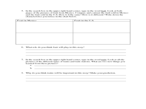
Esperanza Rising - Anticipation Guide
Learn about Mexican culture while simultaneously strengthening reading, writing and computer skills. In order to get the most out of Esperanza Rising, pupils should have prior knowledge of Mexican culture. Therefore, there are links to a...
Curated OER
Our City
Second graders familiarize themselves with the town they live in by practicing their imagination, library research and writing skills.
Curated OER
Weather With a Latitude
Young scholars read the temperature from a thermometer. In this weather lesson, students read a thermometer and record the temperature at twenty minute intervals. Young scholars discuss results.
National Geographic
Measuring Elevation Past and Present
After viewing a short video about a climb up Mount Everest, high schoolers read about triangulation for measuring distant elevations. Have your class work in groups to construct an inclinometer and then use it to measure the height of...
Curated OER
Winter Holidays Around the World
How much do you know about the holidays around the world? Second graders put their knowledge to the test with a 14-day activity about global celebrations. They read informational text, employ KWL charts, and compare and contrast the many...
Curated OER
"The Drum"
Second graders read and discuss the folktale "The Drum" from India. They also answer story comprehension questions, complete an adjectives and verb worksheet, and label a map of India. Students sequence events from the story and make...
Curated OER
Language Arts: Let's Take a Trip!
Students examine various books and discover how to locate places on maps and globes. While reading the story, "Toot and Puddle," they trace the locations visited on maps. At home with parents, students prepare for an imaginary trip by...
Core Knowledge Foundation
Thanksgiving with the Pilgrims
Teach kindergartners about the First Thanksgiving with a series of lessons about the Pilgrims' journey to the New World. As they practice handwriting, CVC words, reading comprehension, and fun Thanksgiving songs, they learn about what...
Curated OER
Barrels and Buckets: Access to Water - What Would It Be Like to Live in Africa?
Students compare water access in the United States with that of Africa. In this water access lesson, students located Ghana and Kenya on a globe before reading Peace Corps Volunteer accounts of the difficulty of accessing clean water....
Orange County Water Atlas
Location, Location, Location…
Young geographers discover not only how to read and recognize coordinates on a map, but also gain a deeper understanding of latitude and longitude and how climate changes can vary significantly across latitudes.


