Mathematics Vision Project
Module 1: Getting Ready Module
This fabulous resource is a must-have for any algebra teacher's arsenal of lessons. Developing the idea of equations and use of variables from basic physical scenarios, learners gain valuable intuition in the structure and meaning of...
Curated OER
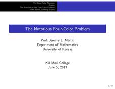
The Notorious Four-Color Problem
Take a walk through time, 1852 to 2005, following the mathematical history, development, and solution of the Four-Color Theorem. Learners take on the role of cartographers to study a United States map that is to be colored. One rule: no...
Australian Government
The Great Artesian Basin
Covering 23% of the continent and holding 64,900 cubic kilometers of water, the Great Artesian Basin is the primary source of water for much of inland Australia. Using detailed student worksheets, experiments, and case studies, young...
Little Kids Rock
The Influence of Latin Music in Postwar New York City
Music has often been called the international language that transcends cultures and regions. Scholars analyze the impact of Latin American music on New York City culture in the years following World War II. They research music, video,...
Curated OER
Mapping Electricity
Students complete Internet research and use their map reading skills to learn about how the United States creates and uses electricity in different states. In this energy sources lesson, students study the mini map of energy usage in the...
Curated OER
Welcome to New York State
Students choose one region of New York state, and create a travel brochure that includes information such as geographical features, tourist attractions, accesibility, economic features, and historical events that occured in that region.
Curated OER
African American Life in the Pee Dee Before the Civil War
Third graders examine the life of the African American in the Pee Dee region during slavery. In this slavery lesson, 3rd graders explore primary and secondary documents related to the topic and create a timeline of when slavery first...
Curated OER
United States Geography and Topography
Fifth graders recognize the major regions of the US while reading a map. Students study the physical features of the US. Student research and report on states and their capitols.
Curated OER
The Causes of Prohibition
Eleventh graders explore the origins of the Prohibition Movement in the United States. In small groups, they analyze the influence of World War I in the passage of the eighteenth amendment. Students explain how different demographics of...
National Wildlife Federation
When It Rains It Pours More Drought and More Heavy Rainfall
Which is worse — drought or flooding? Neither is helpful to the environment, and both are increasing due to climate change. The 16th instructional activity in a series of 21 covers the average precipitation trends for two different...
Curated OER
Africa's Climatic Regions
Learners are introduced to the different climates and vegetation of Africa, and compare them to similar climatic regions found in the United States.
Curated OER
Climate Types
In this weather instructional activity, students identify the type of vegetation found in particular regions across the United States. Then they list the six groups of climates in the Köppen Classification System. Students also describe...
Curated OER
A House Dividing: The Growing Crisis of Sectionalism in Antebellum America
Students trace the development of sectionalism in the United States. They explore slavery, freedom and the Constitution. Students identify influential opponents and defenders of American slavery. They explain different solutions to...
Curated OER
Weather in the USA
Students identify the different types of weather conditions that occur in the United States. They discover how to adapt to weather and explain forecast and warning signals.
Curated OER
Jazz in America Lesson Plan 6
Students survey bebop, cool jazz, and hard bop. They explore how bebop, cool jazz, and hard bop reflected American culture and society in the 1940s and 1950s.
National Wildlife Federation
Hot, Hotter, Hottest: Extreme Weather's Impact on Our Resources
How dry is it? It's so dry, the river only runs twice a week! Through an analysis of maps and discussions, pairs learn about droughts across the United States in the ninth of 12 lessons. They then read about, answer questions, analyze...
Curated OER
Jazz in America Lesson Plan 7
Students survey free jazz and fusion. They explore how free jazz and fusion reflected American culture and society in the 1960s and 1970s.
Curated OER
Language and Dialect
Practice listening skills while studying oral story tellers from different parts of Louisiana. Consider the regional dialects and insider language of folk groups with your class. Identify language as part of folk life and recognize that...
Curated OER
Jazz In America
Students gain a fundamental understanding of the role of jazz in the Harlem Renaissance. They explain its historical significance and cultural implications.
California Academy of Science
California's Climate
The United States is a large country with many different climates. Graph and analyze temperature and rainfall data for Sacramento and Washington DC as you teach your class about the characteristics of Mediterranean climates. Discuss the...
Curated OER
Natural Resources and Transportation in the United States
Students study thematic maps (included with the lesson) to determine possible relationships. They develop three hypotheses about the relationship. Students choose one of their hypotheses to explain. The explanation is to include reasons...
Curated OER
The Meat-Packing Industry in Chicago During the Progressive Era
Students examine maps showing the hog and corn distribution of the United States. In groups, they research the reasons why Chicago became the natural hub for meat-packing processing in the United States. They examine changes in...
Curated OER
King Andrew And His Critics
In this United States history worksheet, learners utilize a word bank of 10 terms or phrases to answer 10 fill in the blank questions about the Andrew Jackson and his critics. A short answer question is included as well.
Curated OER
USA: Average Precipitation and Temperature Map
In this United States map worksheet, students make note of the average precipitation and temperature in regions of the country.


