Curated OER
Passport to the World
Eighth graders investigate the process for obtaining a United States passport. They plan a trip to a foreign country looking at important information including the climate, geography, culture, money, and language. They complete the...
Curated OER
South US Region
In this United States political map worksheet, students examine the Southern Region state boundaries. The map also highlights each of the state capitals denoted by stars. The states, capitals and major landforms are labeled.
Curated OER
US: Midwest Region
In this United States political map worksheet, students examine the state boundaries of the Midwestern Region. The map also highlights each of the state capitals denoted by stars.
Curated OER
South US Region Map
In this United States regional outline map, students examine the state boundaries of the states in the Southern Region. Capital cities are denoted with stars.
Curated OER
Naming the States of the U.S
Fifth graders study the 50 states on a map. In this social studies activity, 5th graders identify the names of the states and location. Additionally, students work in small groups to name and locate as many states as they can on a blank...
Curated OER
US: Northeast Region Map
For this United States political map worksheet, students examine the state boundaries of the Northeast Region. The map also highlights each of the state capitals denoted by stars.
Curated OER
US: Northeast Region: Unlabelled
In this United States political map worksheet, students examine the Northeast Region state boundaries. The map also highlights each of the state capitals denoted by stars.
Curated OER
Egg Hunt: Review of States and Capitals
Fourth graders participate in an Easter egg hunt that gives them clues to states and their capitals. In this states and capitals lesson plan, 4th graders use clues to figure out the states described.
Curated OER
Flat Stanley Travels to U.S. Regions
Fourth Graders read the book Flat Stanley by Jeff Brown. In the story a bulletin board flattens the main character. He is then sent in an envelope to a friend in California. During a fantasy genre language arts unit, groups of students...
Curated OER
How did Geography Affect the Economy of the Colonies
Eighth graders examine the impact of geography on a region. In this geography lesson, 8th graders study the themes of geography. Students write an open response to a question.
Curated OER
Taming Wild Land
Third graders consider the habitat needs of living things and how extensive farming in an area can affect the plants and animals of a region. They participate in a simulation to show how changing the habitat in one area can greatly...
Curated OER
Learning the 50 States
Students become familiar with all 50 states over the course of ten days.
Curated OER
Key Ingredients: America by Food
Students participate in a series of activities to explore the types of food Americans eat, how food choices differ in various parts of the country, and how the availability of various foods has changed over time.
Angel Island Immigration Station Foundation
Immigration Case File Investigation
Case files for Angel Island immigrants are kept at the regional archives in San Bruno, California. Groups study one such case file to understand the life histories and different experiences of the internees and then report out their...
Curated OER
Regions of the United States
Middle schoolers research maps in order to propose geographic reasons for geographic patterns such as state boundaries, interstates and elevations.
Curated OER
Backseat Travelers
Fourth graders investigate the geography of the Southeast regions of the United States. They conduct Internet research, listen to the book "No Star Nights," and plan and write a trip through this regions.
Curated OER
Southeast States
Fourth graders explore the Southeast States. In this social studies lesson, 4th graders study agriculture in the Southeast region of the United States. Students read about the Southeast region and discuss with a partner what they learned.
Curated OER
Mapping the United States
Fifth graders research assigned states. They identify the capital, the climate, industries,rivers, and native animals.
California Polytechnic State University
Australian Geography Unit
At the heart of this resource is a beautifully detailed PowerPoint presentation (provided in PDF form) on the overall physical geography of Australia, basic facts about the country, Aboriginal history, and Australia culture and lifestyle.
Curated OER
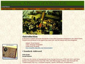
Immigration - A Promise of Better Life
What a great way to discuss European immigration in the 1700's to 1800's in America. Learners identify regions where immigration occurred, list the reasons people moved to the United States, and interview an immigrant about their...
Education World
Edible Resource Maps!
Young scholars discuss resource maps and examine examples from library resources. Working in groups, they create edible resource maps by drawing examples, such as popcorn on the border of Iowa and Nebraska. Then they use cookies in the...
K12 Reader
National Symbols
What are the most prominent symbols of the United States? Learn about the bald eagle, the American flag, and the Statue of Liberty in a reading comprehension activity that includes a short passage and five reflective questions.
Curated OER
Will There Be a White Christmas This Year?
Students examine historical weather data, and create map and color key that illustrates the likelihood of a white Christmas in different locations across the United States.
Curated OER
Local Motives
Investigate current local elections across the United States with this New York Times reading activity. Using informational text, middle and high schoolers research local elections and create their own news reports about what they...
Other popular searches
- United States Regions
- United States Maps Regions
- 5 United States Regions
- United States Regions South
- Seven United States Regions
- Unites States Regions
- 5 Regions of the United States
- United States Economic Regions
- United States Climate Zones


