Curated OER
Understanding Weather and Climate Patterns
Students research the climate patterns of various locations and make predictions based on their findings. They determine the importance of latitude and longitude in weather and climate. Students create graphs displaying their collected...
Curated OER
A Dollar Goes A Long Way
Investigate life along the Old Spanish Trail! They visit websites and identify the history and environment. They create journals, dramatic enactments, and maps to discover the role individuals played in society. They also explore the...
Curated OER
Molly Pitcher -- "Out of Many, One"
Students research, brainstorm and analyze the events that lead up to the Revolutionary War. They critique a piece of artwork depicting a scene from the Revolutionary War. Each major battle is plotted on a map to show a visual...
University of North Carolina
Political Science
The right to vote and freedom of expression are democratic principles that fall under the study of political science. A handout describes writing assignments that are common in political science college classes and gives tips and...
Stanford University
Hurricane Katrina
The adage says that journalism is the first draft of history. How should people evaluate these sources of information? Taking into account various sources, including those from various perspectives and different creators, learners...
Curated OER
Jazz In America
Students gain a fundamental understanding of the role of jazz in the Harlem Renaissance. They explain its historical significance and cultural implications.
Curated OER
South Carolina Jeopardy
One of the better PowerPoints I've come across is a "Jeopardy"-style game whose focus is South Carolina. Some excellent photographs and maps make the slides especially good. The "Final Jeopardy" clue is especially challenging. An...
Science Friday
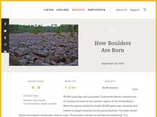
How Boulders Are Born
Want your class to rock? Then try this boulder activity. Pupils learn about a specific boulder field and use edible materials to demonstrate the geological processes that formed this unique feature. Weathering, erosion, and mass wasting...
EngageNY
Modeling an Invasive Species Population
Context makes everything better! Groups use real data to create models and make predictions. Classmates compare an exponential model to a linear model, then consider the real-life implications.
Curated OER
Documenting the Great Depression
Students compare and contrast two photographs from the Great Depression, and identify the ways in which the photographers depicted the hardships of everyday life during this period. They hypothesize about the story behind each photograph...
Curated OER
Connecting Kansas: Past and Present
Upper graders identify five forms of transportation and describe how Kansans are connected to the rest of the country using transportation and communication. They complete a graphic organizer for each type of text structure given to them...
Curated OER
Stamping Coins
Learners demonstrate that they can use a variety of coin combinations to make a single amount. They study all the ways to make 50 cents using coins using different coins.
Curated OER
Making a Cartogram
Students interpret statistical geographic information by creating a cartogram.
Curated OER
Liberty Rhetoric
What is liberty rhetoric? Examine how people have used it in four different time periods and situations. High schoolers investigate original source documents and compare them with the Declaration of Independence to decide how liberty...
Louisiana State University
Phone Skills - Alone and Okay
What do you do when you are alone and the phone rings? How do you handle an emergency situation? Learners discuss and practice how to use the phone when they are home alone. They use clear communication, look up phone numbers, and talk...
Student Handouts
Foreign Affairs
Inform your class about foreign policy during the Reagan administration. The resource includes a reading passage that gives an overview of foreign policy decisions made during the Reagan administration and nine questions for pupils to...
It's About Time
Present-Day Climate in Your Community
So what exactly is climate? This first installment of a six-part series introduces the concept of climate using real-world data tables and topographic maps. The timely lesson includes a comprehensive overview of climate, as well as...
Education World
The African American Population in US History
How has the African American population changed over the years? Learners use charts, statistical data, and maps to see how populations in African American communities have changed since the 1860s. Activity modifications are included to...
Curated OER
Sharing African Culture
Students investigate African American culture by reading aloud an African folk tale and illustrating the tale. They use their illustrations to create a book or a bulletin board that retells the folk tale.
Curated OER
Charting History With Pennies
Students collect pennies and sort them in ascending order of dates. For the year on each penny, students research key events in history and pick a single event, explaining its historical significance. Then students use these events to...
Curated OER
Lights, Shoals & Soundings
Students explore nautical charts and their symbols, with a bit of fun thrown in.
Curated OER
How a Writer Conveys Descriptions With a Wallop Lesson 3 for Running (From River Town)
Students examine strategies an author uses to provide qualitative and quantitative aspects of life in China. They apply the strategies to their own writing.
Curated OER
Searching for Meanings Beneath the Surface of the Poem
Students examine poems from Latin America and the Caribbean. They compare different perspectives and subjects in the poems. They research Peace Corps volunteers as well.
Peace Corps
What's Mongolia Really Like?
Understanding different cultural experiences is a challenging and worthwhile objective throughout grade and content levels. This lesson facilitates an appreciation of rural Mongolian life through a simulation of being a nomadic teen as...
Other popular searches
- United States Regions
- United States Maps Regions
- 5 United States Regions
- United States Regions South
- Seven United States Regions
- Unites States Regions
- 5 Regions of the United States
- United States Economic Regions
- United States Climate Zones


