Curated OER
Keep In Touch: Communications and Satellites
Fourth graders explore communications by reading assigned space science text. In this satellite lesson, 4th graders identify the concept of orbiting and examine gravitational pull by viewing diagrams. Students are assessed based on...
Curated OER
What's Up With Updrafts?
Students demonstrate how hail and rain are suspended in the air during a storm. For this lesson on storms and weather, students use a hair dryer and ping pong ball to demonstrate how hail and rain can be suspended in the air during a storm.
Curated OER
Where Am I - Navigation and Satellites
Young scholars explore geography by completing a navigation activity in class. In this satellite positioning lesson, students define terms such as orbit, satellite, GPS and triangulation. Young scholars view diagrams of the Earth's orbit...
Curated OER
Is Global Warming Affecting Hurricanes?
In this hurricane worksheet, learners use data charts showing the number of hurricanes and the severity of these hurricanes to determine if global warming is causing an increase in hurricanes. This worksheet has 2 short answer questions.
Curated OER
Shore is Windy!
Students consider what a hurricane is and how it impacts both land and people, explore the speculations surrounding Hurricane Isabel, research potential target sites and create maps illustrating how Isabel may affect them.
Curated OER
Tsunami
Students examine what causes tsunamis and why they all behave differently. For this tsunami lesson students complete a group activity after viewing a video.
Curated OER
Migration Activation
Young scholars play the role of migrating birds. As a class, they simulate a migration of birds to one place and back again. They relate their habitat size and changes to their current population numbers. They discover the many dangers...
Curated OER
How's The Weather?
Students make a box and whiskers plot using the TI-73 graphing calculator. Each student would have their own calculator but they would work in small groups of two or three to help each other enter the data and make the plots.
Curated OER
The Weather Forecast
Students observe a daily paper to see the temperature forecast looking at a paper thermometer with today's predicted temperature colored in. They predict today's temperature, and paste the second color on the same thermometer to show...
Curated OER
A Walk in the Tundra
Discuss the environment of the Arctic tundra using this resource. The focus of this lesson is the story A Walk in the Tundra by Rebecca L. Johnson. The appealing illustrations are bound to captivate your class! After reading the story,...
National Wildlife Federation
Ghost Town
Around 93 percent of the reefs on Australia's Great Barrier Reef have been bleached, and almost one quarter of them are now dead. Scholars research the sea temperatures, especially around the areas with coral reefs, to make connections...
K12 Reader
Location, Location, Location
Why do some places in the world have more people living there than other places? Learn about the ways the countries have formed around natural resources with a reading comprehension activity. After kids read a short passage, they answer...
Polar Trec
Sea Ice Impact
The arctic seas contain currents that are both warm (with high salinity) and cold (relatively fresh water) that circulate throughout the year. Through discussion, a lab, and a web quest, participants explore the impacts of melting and...
Curated OER
Picnic Possibilities
Fourth graders plan a picnic using weather data. Using accumulated weather data from various sources, they create a graph of the weather conditions in their region for a given period of time. Students interpret this data to predict the...
Curated OER
Climate Change
Students brainstorm types of weather present threats to the world, specifically climate change and the environment. In this climate change instructional activity, students complete and discuss a set of worksheets about "going green,"...
Curated OER
Climate Change
In these science worksheets, 5th graders explore aspects of weather and recycling. In the first instructional activity, students are given five questions about weather which they match to the statement about weather that corresponds to...
Curated OER
Environment: Global Warming
In this ESL activity learning exercise, students consider global warming as they read a paragraph and find its text in the word maze.
Curated OER
How Do Weather Conditions and Lunar Cycles Affect Fishing Success?
Pupils use weather measuring devices to record and study weather conditions at different locations, during different times. They attempt to draw conclusions about the relationship between weather conditions, lunar cycle and fishing success.
Curated OER
Surface Meteorological Observation System (SMOS)
Students monitor local surface weather conditions for at least 30 days. They interpret the data by graphing it and detemining percentages.
Curated OER
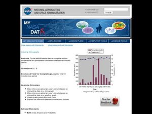
Creating Climographs
Students use satellite data to compare precipitation and surface temperatures on different islands. In this satellite lesson students create graphs and explain the differences between weather and climate.
Curated OER
Storm Clouds-- Fly over a Late Winter Storm onboard a NASA Earth Observing Satellite
Students study cloud data and weather maps to explore cloud activity. In this cloud data lesson students locate latitude and longitude coordinates and determine cloud cover percentages.
KOG Ranger Program
Fire Behavior in Forests
Understanding the ways a fire will act is a key factor in fire safety and fire prevention. Young campers focus on how the weather and terrain can affect the behavior of a fire with topographic maps and different scenarios.
Curated OER
Using Vegetation, Precipitation, and Surface Temperature to Study Climate Zones
Using NASA's Live Access Server, earth scientists compare the temperature, precipitation, and normalized difference vegetation index for four different locations. They use the data to identify the climate zone of each location using...
Curated OER
A Season for Chapters
Art, music, poetry, and the beauty of the seasons is what you'll find in this very nice unit idea. You can use any of the suggested books and activities to engage your second graders in an exploration of the changes that take place...


