Curated OER
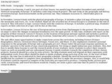
Political Geography of Europe
Fifth graders listen to a lecture that traces the political geography of Europe from 814 through 1997. They incorporate these themes into a research project on Western Europe.
Curated OER
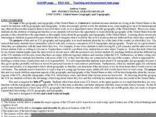
United States Geography and Topography
Fifth graders recognize the major regions of the US while reading a map. Students study the physical features of the US. Student research and report on states and their capitols.
Curated OER
Geography of Southeast Asia
Ninth graders study the geography and culture in ten Southeast Asian countries. They examine the development of the culture of these countries and how it is affected by their geographic locations.
Curated OER
Five Themes of Geography
Students choose one of the five themes of geography and create theme posters.
Curated OER
Geography and World History
Students build off of their current knowledge of geography and world history, while being introduced to new concepts and ideas.
Curated OER
Geography
Learners engage in a study of geography while studying a foreign language. They write complete sentences to identify and describe geographical features. Students also use a map in order to use the key to find geographic features that are...
Curated OER
Connections Between World Events, Geography and the Human Quest for Knowledge
Learners examine the relationship between innovations in geography and world events. Using maps, they report different information from a spatial perspective. They develop hypothesis about how man's quest for knowledge has impacted the...
Curated OER
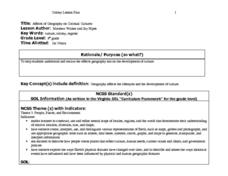
Affects of Geography on Colonial Cultures
Sixth graders examine the effects of geography on the development of culture. They discuss how geography can affect the lifestyles and development of a society's culture. Students examine the geography and climate of New England and the...
Curated OER
GEOGRAPHY OF FOOD & FIBER
Students will explain the ways geography determines the crops grown in the United States and other countries, and the resulting trade relationships.1. Discuss trade routes, both ancient and current. Discuss why the most direct route from...
Curated OER
Influence of Geography on the Migration of Virginians
Sixth graders study how geography influenced the westward migration of Virginians. They review the settlement patterns of early Virginians before discussing reasons why people move away from an area. Looking at maps, they determine how...
Curated OER
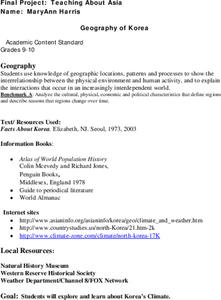
Geography of Korea
Students are introduced to the geography of Korea. Using the internet, they identify the weather and climate in the country and create a week weather chart for Korea's four seasons. They complete an interview with a local weatherman...
Curated OER
Geography
Third graders study the Mediterranean Region by locating and identifying Italy, Greece, France, Spain, North Africa, the Mediterranean and Adriatic Seas.
Curated OER
Geography of the Silk Road And the Tokaido Road
Students examine the geographical features of the Silk Road and the Tokaido Road in this introductory lesson on Chinese geography. Small group learning is emphasized and encouraged.
Curated OER
Virginia Studies
Students describe life in the Virginia colony. They explain how geography influenced the relocation of Virginia's capital from Jamestown to Williamsburg, to Richmond. Students compare/contrast life in Jamestown and Williamsburg.
Curated OER
Virginia Studies
Students describe life in the Virginia colony. They explain how geography influenced the relocation of Virginia's capital from Jamestown to Williamsburg, to Richmond. Students compare/contrast life in Jamestown and Williamsburg.
Curated OER
Geography: Floods on Topical Budget
Students explore, examine and study the causes and effects of flooding to assess floods in the past to understand floods in the present. They view a variety of video clips and discuss them and then divide up into small groups to plan...
Curated OER
New Hampshire Map
In this state maps worksheet, students identify the state map of New Hampshire. Students fill in the state capital, major cities, and other attractions.
Curated OER
Glasgow - a case study 4
Students look at the inner-city and housing in Glasgow today and consider how the city has been redeveloped over time. They answer a GCSE question using Glasgow as the case-study. Students draw a timeline from the 1950s to the present...
Curated OER
Geography: Map Making
Young scholars, working in groups, share notes and maps collected during a study of the Lewis and Clark Expedition. They draw large composite maps of the western United States on butcher paper including land formations, bodies of water,...
Curated OER
Create Your Own Country!
Middle schoolers create their own countries. In this geography skills lesson plan, students establish governments, cultural backgrounds, atlas/geography components, national anthems, and national symbols for a country they create.
Curated OER
Social Studies: Countries and Technology
Students participate in a travel simulation and have just arrived in Canada. After choosing activities to research, they define their methods of exploration and development on plan sheets. Among the scenarios from which they choose...
Curated OER
Using Google Squared to Compare and Contrast Canada and the US
Sixth graders compare and contrast Canada and the United States. In this geography skills instructional activity, 6th graders use Google Squared to research information so that they may compare the geography of Canada and the United States.
Curated OER
World Projections
Learners identify map projections and examine polar maps. In this map skills lesson, students use a flat world map to identify various projections and calculate the distances between locations by using a map scale.
Curated OER
The Global Grapefruit - Representing a 3-Dimensional Globe on a 2-Dimensional Map
Learners compare and contrast world maps and globes. They convert a 3-dimensional globe to a 2-dimensional map. They are introduced to the Mercator map projection. They observe map distortions of shape, area, distance, directions and angle.


