Curated OER
The Hundred Years' War (1347-1453)
Detailing the causes, strategies, and effects of the Hundred Years' War, this presentation will interest even the most reluctant historians in your class. Bright pictures and maps help to put the war into context and allow teachers to...
Curated OER
Early African Kingdoms & Empires
Give your class a thorough view of African history with this series of photographs, maps, and engaging questions. Coupled with a lecture about human migration and religious and European influences on the continent, this presentation will...
Curated OER
The Importance of Place
Is art connected to geography? It sure is! Your class will find out how even clay that comes from a certain location can have deep symbolic meaning. The class will analyze the piece, Mud Woman Rolls On and then research how geographic...
Curated OER
Mapping Your Way Around
First graders identify a map, symbols on a map, and locate places on a map. Finally, they construct a map
Curated OER
Social Studies: Kyrgyzstan Bride Kidnappings
Students examine the Kyrgyzstan bride kidnappings and compare wedding traditions there with those in the United States. They explain these differences and similarities in a fictitious letter to a peer in Kyrgyzstan.
Curated OER
We're Gonna Have A Party
First graders explore map skills. They discuss the map vocabulary and use directions to find a location on a map. Students discuss and use the components of a map to answer a variety of questions. They use the map and directions to find...
Curated OER
Transportation in Indiana
Fourth graders investigate Indiana transportation. In this transportation lesson plan students discover early forms of transportation such as railroads, rivers, boats, and roads. Students compare and contrast the different forms of...
Curated OER
Cardinal Directions
First graders study cardinal directions on maps. In this geography lesson, 1st graders determine and show where North, South, East, and West are on various maps.
Curated OER
Eager to Get to Ancient Egypt
Seventh graders explore the geography of Ancient Egypt, read a story and answer questions on a web site.
Curated OER
The Holocaust: Mapping Survivor Stories
Learners explore the Holocaust through the eyes of survivors. In this Holocaust lesson, students talk with Holocaust survivors and create timelines that feature their stories.
August House
The Clever Monkey
Your clever kindergartners will enjoy a series of activities based on the West African folktale, The Clever Monkey, adapted by Rob Cleveland. They sequence the story with pictures, copy sentences, illustrate idioms about cats, and taste...
Curated OER
Condon National Bank
Use maps, readings, and photographs to analyze the historic, cultural, and social conditions surrounding the activities of the Dalton brothers and their gang. Learners identify how the residents of Coffeyville defended themselves against...
Curated OER
Philanthropic Literature: Quilt to Freedom
A reading of Sweet Clara and the Freedom Quilt by Deborah Hopkinson launches this study of slavery, freedom, and the Underground Railroad. After a discussion of the importance of showing respect for others and of helping each other in...
Curated OER
Baseball in Korea
Seventh graders explore the origins of baseball. In this Geography instructional activity, 7th graders compare Korean baseball teams with other countries. Students create a map of all the baseball teams around the world.
Curated OER
Radio Program #2: Ethnic Mix
Students examine patterns of migration into the area. They complete various map activities and interviews. Students partake in family histories as well. On a map of Europe, identify the countries of immigrant origin mentioned in the...
Curated OER
Geography With Dr. Seuss
Students read the book, The King's Stilts by Dr. Seuss and discuss the geographical information given in the book. Then they discuss and locate on a map the physical features that make up the continent of Africa. They create an original...
Core Knowledge Foundation
Columbus Sailed the Ocean Blue
Young adventurers embark on a journey, setting sail along the blue ocean with Christopher Columbus. Teachers will find that this unit makes their lesson planning smooth sailing!
Curated OER
Immigration Connections: The Squamish Nation and Bainbridge Island Filipino Americans
High schoolers explore ancestry and immigration. In this Canadian immigration lesson plan, young scholars interview their family members to identify their cultural history. They compose an essay that compares Filipino immigration stories...
Curated OER
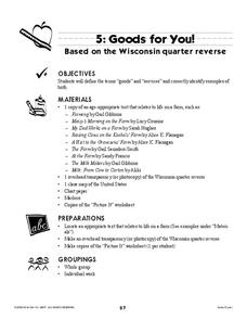
Goods for You!
Have your class learn about Wisconsin and farming. Learners begin by listening to stories that describe farming and engage in a discussion of goods and services. They could also compare the goods and services provided in different states.
Curated OER
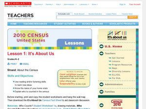
2010 Census Lesson 1: It's About Us
Learners analyze data from the 2000 census to learn how the census works. In this civics lesson, students read a story to find out about the census, then use a map and census data to analyze changes. Lesson includes related resources...
Curated OER
A View from the Ground
Students look at a park from ground perspective. In this map skills lesson, students are introduced to a story about a girl at a park and make observations about the park based on a picture. This prepares students for the next lesson in...
Curated OER
Mexico: One Land, Many Cultures
Students, through a variety of activities, discover the geography and culture of Mexico. They make maps, read folktales, write a journal, create pinatas and other artistic pieces, and review the history of Mexico.
Curated OER
Wales: An Interdisciplinary Unit
Young scholars practice basic map and geographic skills as they compare Oregon to Wales. Students color map of Wales and Oregon using color codes to distinguish between land, water, and bordering nations or states, listen to stories and...
Curated OER
States and Capitals
This map skills PowerPoint features an interactive states and capitals game. The object of the game is to identify the capital cities of each of the 50 states. The excellent presentation includes United States maps, game directions, and...


