Curated OER
Virginia: The Land and its First Inhabitants
Students review the five geographical regions of the state of Virginia. Using a map, they locate and label Virginia, surrounding states and the crops grown in the area. They present their map to the class and complete a worksheet to end...
Curated OER
Water Features - Lesson 2 - U.S. Political Map Grade 4-5
Students locate water features on maps. In this geography lesson plan, students complete worksheets that require them to identify water features on a U. S. political map.
Curated OER
Discovering Prehistoric Trails
Eighth graders examine prehistoric terrain. In this geography lesson, 8th graders discover necessary resources for settlers. Students work in small groups to create a trail crossing the state of Kansas.
Curated OER
Japan: Yesterday and Today
Students study the geography and culture of Japan and discover important historical events. They look at the religions of Japan. They determine similarities and differences in the lives of teenagers in Japan and the US. They read and...
Curated OER
Exploring Ancient Greece
Sixth graders use play dough to create a relief map of Greece and through personal investigation and class discussion, draw conclusions about the impact of the geography of Greece on daily life and culture in Ancient Greece.
Curated OER
Landforms And The Oregon Trail
Fourth graders investigate the historical context for the founding of The Oregon Trail. They conduct research to put together the events that led to the geographical route that was taken. The instructional activity also strengthens...
Curated OER
An Introduction To Southeast Asia Today
Learners investigate the region of Southeast Asia. They research the history, geography, and spread of ethnicity throughout the region. The various lessons consist of class discussion and group work to find common themes shared in...
Curated OER
The Relationships and Cultural Exchanges Between Native Americans and the Hudson's Bay Company at Fort Vancouver
Learners are introduced to the geography of the Columbia River basin and its history. Using the internet, they research the relationships between the Native Americans and the Hudson Bay Company. They also discuss the effects on the...
Curated OER
Lewis Hine
Students define the term Industrialization. They use specific examples, discuss why and how industrialization grew during the early twentieth century in America. Students evaluate the contributions of technological advances, geography...
Curated OER
European Explorers of North and South America
Sixth graders explore the connection between the geography of America and the migration of the Native Americans to the American continents to the future conquering of the continents by the Europeans. They discuss the causes and effects...
Curated OER
Perspectives on Paraguay
Students locate the country of Paraguay on a world map. As a class, they brainstorm how their lives might be different from someone living in Paraguay. After reading an article, they compare the two cultures and compare it with their...
Curated OER
Using Four Main Directions in the Classroom
Students identify the four cardinal directions. In this map skills geography instructional activity, students use a magnetic compass to label the four directions in the classroom. Students use the four directions to locate objects in the...
Curated OER
You've Got My Vote!
Students explore the ruling of the US Supreme Court on the ballot recounting ordered by the Florida State Supreme Court. They work in small groups to research and compare the judicial and electoral processes.
Curated OER
Life in Sahara
Students explore the geography of the Sahara region of Africa and identify characteristics of a desert habitat. They explore the culture of the people living there and how it has adapted to desert life.
Curated OER
Alaska Purchase
In this reading comprehension and geography worksheet, students read a selection about the Alaska Purchase, its origins as a state, and its attributes. They answer 7 fill in the blank questions using information from the selection.
Curated OER
Nebraska Counties
Students explore the counties of Nebraska. In this Nebraska history lesson, students examine maps of the state and determine the location of specific counties and conduct research on them. Students also use the county names to fill in...
Curated OER
British Colonization-Settling the Thirteen Colonies (1607-1733)
Learners study the thirteen colonies: geography, economics, politics, and religious groups. They explore early colonial life, and create a travel brochure, travel guide of the 13 Colonies, and word search.
Curated OER
Holocaust Map Studies
Students analyze maps and answer discussion questions related to WWI. In this geography lesson, students analyze historic maps to determine causes and effects of WWI in Europe. Students read testimonies of Holocaust survivors and label...
Curated OER
Where is the Water?
Learners explore freshwater ecosystems. In this geography lesson, students brainstorm all the lakes and rivers they know then mark them on a map. Learners will then mark all the major freshwater resources on each of the seven continents,...
Curated OER
Colonial Vacation Planner
Learners plan a family vacation to states that were among the original 13 colonies. The groups determine which state they visit, map their route, calculate the mileage, and determine how much money they spend on gasoline.
Curated OER
"Go West, Young Man!"
Students examine reasons why people migrated west. They describe how the geography of the U.S. changed in the 19 th century and design a PowerPoint presentation to convey factors for westward expansion.
Curated OER
Native American Village Days
Students research the tribes of American Indians in Virginia and settled, agricultural tribes in other regions of America. They explain how geography and climate influenced the way various Indian tribes lived, and evaluate the impact of...
Curated OER
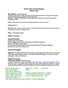
World Cities and the Olympics
Students examine the various cities in which Olympics have been held. Using a map, they describe the reasons why those cities were chosen and choose their own city for the Olympics and state the reasons why. They examine information...
Curated OER
Trading Traditions: Based on the American Samoa Quarter Reverse
Students investigate U.S. Currency by researching American Samoa. In this monetary unit lesson, students define the reverse and obverse of a coin while completing a currency related worksheet. Students identify American Samoa on a...
Other popular searches
- Geography of United States
- Geography United States
- Geography of the United States
- United States Geography Unit
- Physical Maps United States
- United States Geography Maps
- United States Geography 4 6
- Picture United State Maps
- Physical Maps of United States


