Curated OER
Creating a National Park
High schoolers explore how national parks are created, operate and benefit society by creating a new national park for their state.
Curated OER
The Secret Garden
Students research the culture and geography of India and England while reading "The Secret Garden". Using this information, they write at least three predictions about what they believe might happen in the story. Using the Internet,...
Curated OER
A Colony is Born : Lesson 5 - Dear Mem
Discover colonies! Young historians will listen to a primary source journal entry read aloud with a backdrop of wave sounds. They discuss the entry, add historical facts to a chart and personal insights to another. Then they listen to...
Curated OER
Overland Trails To The West
Consider the political, physical, and geographical factors that led to and marked the Westward Expansion. Learners will track the various routes developed during the 1800's. They create a first person journal describing what they see,...
Curated OER
Tissue Paper Geography
Students explore geographic features of the desert and apply their understanding of the topography of the desert by creating a tissue paper painting.
Curated OER
How Does Your Soil Stack Up?
Students examine the soil in their local area and create a soil profile. They record observations in the field and the classroom. They create their own display of the soil profile as well.
Curated OER
On the Road Again": Moving People, Products, and Ideas
In this lesson plan learners learn how to identify modes of transportation and communication for moving people, products, and ideas from place to place. Students also study the advantages and disadvantages of different modes of...
Curated OER
Nebraska: Using Pictures
Students create a scrapbook about Nebraska history focusing on Post Office murals. They choose their favorite murals and write a story to go along with the mural. In groups, students present their murals to the class and visit the...
Curated OER
Biomes: Coastlines and Seas
Students study the different types of coastlines and their territories. In this marine coasts lesson students identify life forms that are in the coastal regions.
Curated OER
A Colony is Born : Lesson 4 - What Went Wrong?
Fifth graders compare and contrast two early colonies and make a T chart. They list examples of worked well and what did not, and significant historical events. They use higher order thinking skills by deducing how different scenarios...
Curated OER
A-Z List
Students practice using vocabulary terms about the Louisiana Purchase by creating a picture dictionary, an ABC book of terms, a word sort, or a game. Each project should include people, places and terms as they relate to the Louisiana...
Curated OER
Terrorism and General Information about September 11, 2001
Students view a variety of pictures from September 11, 2001 either online or a slideshow. They discuss how the pictures make them feel and then complete a KWL chart highlighting what they already know about 9/11, and what they would like...
Curated OER
The Age of Exploration
Students apply computer skills to gain further insight into early exploration. They analyze the role of each explorer and evaluate their importance. Students comprehend the Chronology of Discovery and Trade of early explorers. They...
Curated OER
Regions: Meet the Experts Presentation
Students gather information and create a web site on prairies and plains using a variety of resources, including the internet.
Curated OER
Clean Kansas Water
Students gain an understanding of ways we can be responsible custodians of our water supply. Students explore the governor's clean water initiative involving the Lower Kansas/Republican river basin and the pollutants present there.
Johns Hopkins University
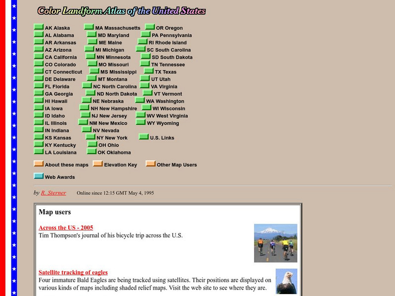
John Hopkins University: Color Landform Atlas of the u.s.
This site from John Hopkins University provides detailed maps of and physical information on each of the 50 states. Maps range from relief maps to satellite images, to historical maps.
Teacher Oz
Teacher Oz: 50 States of the u.s.a.
A site with information such as maps, flags and songs of each of the 50 states in the US.
Other
Civics Online: Map of the 13 Colonies
This colorful map depicts the original thirteen colonies as well as the rest of the eastern part of America, showing the owners of the land at that time.
Curated OER
Etc: Maps Etc: Mexico, Central America, and the West Indies, 1898
A map from 1898 of Mexico, Central America and the West Indies. The map includes an inset map of Cuba and the Isthmus of Nicaragua. "The surface of the Rocky Mountain highland in Mexico is quite similar to that of the great plateau...


