Curated OER
2010 Census Lesson 1: It's About Us
Learners analyze data from the 2000 census to learn how the census works. In this civics lesson, students read a story to find out about the census, then use a map and census data to analyze changes. Lesson includes related resources...
Curated OER
Geography Puzzles
Students study the continents of the world. In this Internet geography instructional activity, students connect to online mapping games. Students collaborate in order to develop their understanding of world geography, including countries...
Curated OER
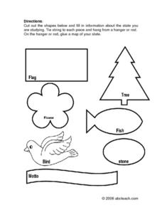
State Information
In these research worksheets, students will discover facts about one of the fifty United States. They are asked to research seven facts about their state including the state bird, state motto, and state flower. Students then create a...
Wells Fargo
Wells Fargo History Museum: Curriculum Guide
Learn about the California Gold Rush from an institution that has been in place since the early days of the American West: Wells Fargo History Museum. From domain-specific vocabulary review to group research projects, an expansive packet...
Alabama Department of Archives and History
From Alabama Farmer to Civil War Soldier
As part of a study of the Civil War, class members conduct a WebQuest to create a timeline of battles fought by the 10th Alabama Infantry Regimen. They then use Google Earth to pinpoint these battles of the Civil War on a map of Alabama.
Curated OER
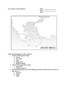
Ancient Greece Map Worksheet
Since the beginning of time, geography has shaped the development of human civilization, and ancient Greece is no exception. This learning exercise supports young historians with exploring this relationship as they first identify key...
Newspaper Association of America
Community Connections with Geography and the Newspaper
Understanding geography and government begins at the local level. Using maps and the parts of a newspaper, a unit plan introduces the concept of community. It starts with the creation of classroom and school maps, and then moves through...
Curated OER
The Kansas-Nebraska Act of 1854: Popular Sovereignty and the Political Polarization over Slavery
Why did Stephen Douglas support the Kansas-Nebraska Act of 1854? Why did Abraham Lincoln oppose it? Young historians examine how the Kansas-Nebraska Act of 1854 affected the political balance between free and slave states and explore how...
All for KIDZ
The Orphan of Ellis Island
Everyone comes from somewhere. An interdisciplinary lesson on Elvira Woodruff's The Orphan of Ellis Island includes discussion starter and writing prompts for the novel, as well as a graphic organizer to help learners begin their own...
American Battlefield Trust
Gettysburg Virtual Tour
Step into one of the most iconic battlefields of the American Civil War with an educational interactive resource. Young historians learn about key moments, locations, soldiers, and turning points in the battle with a clickable map and...
K20 LEARN
Manifest Destiny: U.S. Territorial Expansion
A close examination of John Gast's painting "American Progress" launches a study of the concept of Manifest Destiny used to justify United States' policy of westward expansion. Young historians read statements from persons with different...
Stanford University
Ruby Bridges
A two-part lesson features Civil Rights hero, Ruby Bridges. Part one focuses on the heroic actions of Ruby Bridges then challenges scholars to complete a Venn diagram in order to compare themselves to her. Part two begins with a...
Curated OER
World War I - The War Ends
Your class is in for a treat with this outstanding PowerPoint on World War I. The presentation is loaded with facts, maps, important personalities, and discussion questions on the war. Additionally, there is a wonderful video called,...
Curated OER
U.S. Mint Releases New Jefferson Nickel
Students share their knowledge of Lewis and Clark, then read a news article about the redesign on the U.S. nickel to commemorate Lewis and Clark's expedition. Introduce the article with a discussion and vocabulary activity, then students...
Baylor College
Mapping the Spread of HIV/AIDS
Where is HIV/AIDS most prevalent and what are the current trends regarding HIV? Have groups work together to map the world's HIV/AIDS rates, then create a class map with all the data. Lesson includes cross-disciplinary concepts including...
Anti-Defamation League
Impact of the U.S. Expansion on Indigenous People and Stereotypes About Native American People
The 2004 U.S. bicentennial sparks a discussion about its meaning and importance to United States history. Readings, maps, tables, and reflective writing prompt small groups to explore the westward expansion, Lewis and Clark, and how...
Curated OER
U.S. Geography- The Northeast
Learners investigate the geography of the Northeast states. In this map skills lesson, students are shown a map of the Northeast states and identify the state names and borders. Learners construct individual maps of the Northeast using...
Curated OER
My Summer Vacation
Students study the United States geography using Google Earth. In this U.S. geography lesson, students create travel journals about five U.S. geographical locations. Students research the human and physical characteristics for each region.
Curated OER
In Mr. Lincoln's Shoes
Students demonstrate basic map skills. In this US history lesson, students review cardinal directions and use a compass rose while at the same time discuss what life was like for Abraham Lincoln.
Curated OER
The Underground Railroad
Learners explore the Underground Railroad routes. In this map skills and Civil War lesson, students use map and globe reading vocabulary and skills to track the routes the slaves followed from the Bahamas to the United States and from...
Curated OER
Planting Time
Students research crops grown in the United States. In this agriculture lesson, students identify various crops cultivated across the United States as they create charts and maps that note the information.
Curated OER
Globe Lesson 17 - Alaska and Hawaii - Grade 4-5
Students develop their globe skills. In this geography skills lesson, students explore the area added to the United States when the Alaskan territory was purchased from Russia.
Curated OER
States and Capitals - Lesson 4 - U.S. Political Map
In this U.S. state capitals worksheet, students identify the capital cities of the 50 states using the latitude and longitude coordinates provided.
Curated OER
Country Capitals
Students locate country capitals on a world map. In this map skills lesson, students review the definition of the word country and discuss what a capital is. Students locate and label capital cities on a world map using a map marker.


