Curated OER
Introduction to Age of Absolutism
Who were the absolute monarchs of Europe and what effect did they have on their countries? Young historians begin by naming qualities they believe are important for a monarch to possess. They then take notes on four key factors leading...
Curated OER
Bridge to the Future: Enlarging the European Union
The political, social, and economic challenges the European Union faces as it enlarges is the focus of a six-lesson unit. Class members investigate and craft a presentation about a member country, the treaties member states must sign,...
Pulitzer Center
Peacebuilding: Taking Home Lessons Learned in Africa
Learners take a closer look at one journalist's work on UN Peacebuilding efforts in four African nations: Sierra Leone, Burundi, Central African Republic, and Guinea Bissau. They collaborate to define peacebuilding and discuss the...
Curated OER
Places We Live
With a wonderful bibliography to support this lesson on Illinois, President Lincoln, and rural vs. urban settings, this activity is a motivating experience. The lesson begins with pupils exploring books, such as The Little House by...
McGraw Hill
Study Guide for Island of the Blue Dolphins
Dive your class into a reading of Island of the Blue Dolphins with this in-depth study guide. Breaking the novel into three parts, the resource begins each section with a focus activity that identifies a specific theme or question to be...
PBS
Think Like a Historian: A Viewing Guide
Calling all junior detectives! Scholars use the tools of investigation to determine the causes and impacts of the American Civil War. Using viewing guides, videos, group research, and written resources, they discover what it takes to...
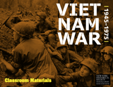
New York Historical Society
The Vietnam War: 1945-1975
Do pupils know that the Vietnam War spanned a period of 30 years? A war that long is bound to leave devastating effects. Help young historians develop a comprehensive understanding of the war through multiple units on the subject that...
The Alamo
A Teacher’s Guide to Sam Houston
Need a teacher's guide all about Sam Houston and how he relates to the Texas Revolution? Look no further! The guide includes a timeline detailing Houston's life, important milestones, and relevant maps that include his movement around...
Curated OER
America’s Early Colonies: John Smith and Jamestown, Va
John Smith's 1616 letter to Queen Anne of England offers ELLs an opportunity to learn about a bit of early American history. The four-page packet includes the full text of the letter. In addition, the packet includes a worksheet that...
Curated OER
The Brief American Pageant: Girding for War
Though too short to be an adequate presentation, the solitary map in these slides would be a good visual aid to a lecture about Southern secession before and during the Civil War. The color coded states on the map make a good timeline...
Miama-Dade County Public Schools
Ancient Rome
This resource outlines several general activities for a study of Ancient Rome, and includes guiding questions, a handout on the story of Romulus and Remus, and ideas for incorporating mapping and timeline activities into your review.
Curated OER
Mapping Meteorites
After reading an article, "Cameras Capture a 5-Second Fireball and Its Meteorite's Secrets," space science superstars use the triangulation method to determine the location of a distant object. In-class activities and homework are...
Curated OER
Migration of the African American Family
Students investigate the influence Africa has had on African-American families as they have migrated from Africa to various sections of the United States. They utilize map skills to locate regions in Africa and in the United States.
Curated OER
Adventure to Alaska
Students use their imagination and research skills to create a virtual tour of the "Land of the Midnight Sun." They are told that Alaska is the largest state in the United States. Students gather information about Alaska to help them...
Curated OER
Summertime Travel
Third graders write about a summer event they participated in. In this paragraph writing lesson, the teacher models how to write about a place they have visited. Students then write their own paragraphs. Students will point out on the...
Curated OER
Native Pottery Replicas
Students study ancient Native American traditions and practices. They select one type of Native American pottery to duplicate in a hand-made replica. Afterward, they create a map of the United States and label where indigenous peoples...
Curated OER
Location, Location, Location!
Twelfth graders locate cities, states and countries on maps. They use the cardinal directions to locate places on maps. They describe where they were born by giving clues without naming the exact state. They trade papers and try to guess...
Curated OER
Using Four Main Directions in the Classroom
Students identify the four cardinal directions. In this map skills geography instructional activity, students use a magnetic compass to label the four directions in the classroom. Students use the four directions to locate objects in the...
Curated OER
Drawing a Bird's Eye View Map
Students make birds-eye view maps and place the compass rose on the map.
Curated OER
Discovering New Mexico
Seventh graders discuss the elements of maps and using basic linear measurement. They calculate the distance between the cities and create a simulated journey around New Mexico using a road map. They write out the directions for their...
Curated OER
American Civil War
Eighth graders read a collection of stories about the Civil War. Based upon their readings, they perform various activities to reinforce facts about the Civil War. Students create time lines, maps and reports about the war. They...
Curated OER
Mystery State #31
In this mystery state learning exercise, students answer five clues to identify the state in question. They then locate that state on a map.
Curated OER
Mystery State #17
In this mystery state worksheet, students answer five clues in an attempt to identify the state in question. Then, they locate it on a map.
Curated OER
Mystery State #16
In this mystery state worksheet, students answer five clues in an attempt to identify the state in question. Then, students locate it on a map.
Other popular searches
- United States Maps Regions
- Northeast United States Maps
- 50 United States Maps
- Create United States Maps
- Western United States Maps
- Custom United States Maps
- Outline Maps United States
- Blank United States Maps
- Maps, United States Rivers
- Maps United States Capitals
- Maps of the United States
- Maps United States


