Curated OER
Mystery State #20
In this mystery state worksheet, students answer five clues to identify the state in question. They then locate that state on a map.
Curated OER
Mystery State #7
In this mystery state worksheet, students answer five clues to identify the state in question. They then locate that state on a map.
Curated OER
Mystery State #8
In this mystery state worksheet, young scholars answer five clues to identify the state in question. They then locate that state on a map.
Curated OER
Mystery State #9
For this mystery state worksheet, students answer five clues to identify the state in question. They then locate that state on a map.
Curated OER
Mystery State #22
In this mystery state worksheet, students answer five clues to identify the state in question. They then locate that state on a map.
Curated OER
Mystery State #48
In this mystery state activity, students answer five clues to identify the state in question. They then locate that state on a map.
Curated OER
Mystery State #50
In this mystery state worksheet, students answer five clues to identify the state in question. They then locate that state on a map.
Curated OER
How the West Was One: A Layered Book
Students create a layered book about the information they learn about the Western region of the United States. In this Western states lesson plan, students create a book about the land, economy, and culture.
Curated OER
Where Do You Live?
Students identify their state and city on a map. After completing a reading of Zoom, students identify various landmarks on a globe and on a map. They begin by identifying the United States and refine their identification until they have...
Curated OER
Mapping Martin Luther King Jr.
Students examine geographic locations that were important in Martin Luther King Jr.'s life. They research Martin Luther King Jr., and create U.S. maps that show the locations important to him.
US Apple Association
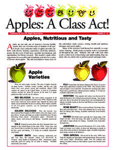
Apples: A Class Act! (Grades 4–6)
Middle schoolers have a bushel of fun as they engage in activities and research core facts about apples. Packed with suggestions for in-class activities and out-of-class research, the colorful 6-page packet is sure to satisfy hungry...
Echoes & Reflections
Studying The Holocaust
While many young scholars are familiar with the Holocaust, they may not understand the specific history that led to the unprecedented atrocity. The first lesson in the unit helps teachers gauge their pupils' background knowledge. A...
Houghton Mifflin Harcourt
Voyagers: Challenge Activities (Theme 5)
Young voyagers face the challenge of the wide dark sea, travel with Yunmi and Halmoni, and even get trapped by the ice as they explore the reading selections offered in these enrichment activities designed for the Houghton Mifflin...
Curated OER
Lesson #3: Internet Map Activity
Learners label assembly centers and relocation camps on a given map of the United States in order to create a better understanding of the relocation experience of Japanese-American citizens and the distance that families had to move and...
Curated OER
Where Are We?
Second graders identify the correct location of their city and state on a map. Through a matching activity, 2nd graders correctly identify their state on a shaped cookie map of the Unites States. They identify their city on a shaped...
Curated OER
Geographic Landscapes and Interstate Freeway Development
Students investigate the topography of the United States through a discovery lesson. They create a hypothetical route for a highway across the United States. Students also conduct research major landforms and define geographic terms.
Curated OER
Mapping the United States
Fifth graders research assigned states. They identify the capital, the climate, industries,rivers, and native animals.
Curated OER
Conflicting Views
Students complete a Venn diagram comparing the United States and Afghanistan. They research the history of the Taliban and how they relate to the United States and its foreign policy. They write a paper on possible solutions.
Curated OER
Popcorn Geography
Students use kernels to create a "Top Corn-Producing States" map or graph. They read and round off numbers. Students identify on a U.S. outline map the location of corn-growing states. They create a visual (map or graph) illustration...
Curated OER
All Across America
Students share experiences of places they have visited or would like to visit. They create travel guides for trips to take in the United States based on themes from their studies, incorporating both historical and current data about...
Curated OER
U.S. And Global Deforestation
Young scholars analyze graph showing global deforestation, view photograph of deforestation in Brazil's interior rain forest and examine three maps showing deforestation within the United States, describe political, economic, and social...
Curated OER
Discovering Your Heritage
Students interview a family member about their heritage. They listen to and record part of their family's oral history. Students also create and label a family tree going back a minimum of two generations and compare and contrast...
Curated OER
Volcanic Activity in the U.S.
Students locate and map ten volcanoes in United States, create chart comparing volcanoes by last eruption, type of volcano, location, and interesting fact, and create Powerpoint slide show describing basic
information about volcanoes and...
Curated OER
Journey of Discovery and Rivers
Young scholars investigate the rivers encountered and mapped by the Corps of Discovery. They analyze maps, outline and label rivers on a blank map, complete a chart, and answer discussion questions while watching a National Geographic...
Other popular searches
- United States Maps Regions
- Northeast United States Maps
- 50 United States Maps
- Create United States Maps
- Western United States Maps
- Custom United States Maps
- Outline Maps United States
- Blank United States Maps
- Maps, United States Rivers
- Maps United States Capitals
- Maps of the United States
- Maps United States


