Curated OER
North American Biomes
In this Science worksheet, learners color a biome map of North America. Students color the map by solving the clues listed on a separate sheet of paper.
Curated OER
State My Name
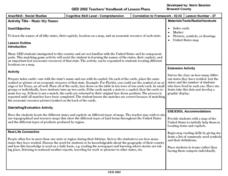
Students study the names of all fifty states, their capitols, location on a map, and an economic resource of each state. They complete a matching game activity.
Curated OER
African American Life in the Pee Dee Before the Civil War
Third graders examine the life of the African American in the Pee Dee region during slavery. In this slavery lesson, 3rd graders explore primary and secondary documents related to the topic and create a timeline of when slavery first...
Curated OER
How Big is Big?
Geography learners compare and contrast population densities throughout the world. Using maps, they estimate the relative size of the world's regions and populations. They develop analogies to discover the world they live in and...
Curated OER
Find a Cave
Students locate their own communites and the nearest caves on a United States map. They calculate the distance to the nearest cave using rough scale.
Curated OER
Canada, O Canada
Students study the similarities and differences between Canada and the United State in this unit. They examine geography, government and culture as they "travel" through Canada.
Curated OER
Population Density
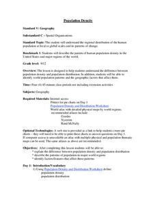
Students examine world population density and population distribution. They create pie charts showing population distribution and analyze population patterns in the United States and major regions of the world. They identify...
Indian Land Tenure Foundation
Indian Trust Lands
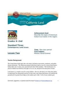
An important aspect of studying Native American history is understanding the nature of trust lands. Budding historians will learn that as Native Americans were removed from their home lands, trust lands were provided in the form of...
Curated OER
Across Five Aprils
Eighth graders are introduced to the novel "Across Five Aprils" written by Irene Hunt. They become familiar with the people, places, and events referenced in the story and comprehend the story of the Civil War. Students are given a...
Curated OER
Creating and Comparing Climographs
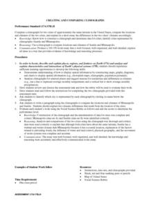
Students are introduced to the importance and usefulness of climographs. In groups, they create a climograph of two cities on about the same latitude. They compare and contrast the locations and climates of the two cities and write a...
Curated OER
Representing Our Nation
Students use pennies to illustrate how our states are represented in Congress. This instructional activity is to be implemented during a unit covering the branches of United States government.
National Endowment for the Humanities
The 1828 Campaign of Andrew Jackson: Territorial Expansion and the Shift of Power
Young scholars make connections between changes in voting participation and the election of 1828, and describe regional factors evidenced by the voting results of the election of 1828.
Curated OER
Civil War and Reconstruction
Learners examine the differences between the North and South during the pre-Civil War era. In this Civil War era lesson plan, students spent 7 days looking at things that were different between the Union and Confederate state before the...
National Endowment for the Humanities
The 1828 Campaign of Andrew Jackson and the Growth of Party Politics
High schoolers analyze changes in voter participation and regional power, and review archival campaign documents reflecting the dawn of politics as we know it during the critical years from 1824 to 1832. Students utilize worksheets and...
Curated OER
Cadron Settlement and the Trail of Tears
Young scholars examine the reason for removal of the Cherokee and other Indian nations. They map the water route of the Trail of Tears from its origination in the east and through the Arkansas River Valley to Indian Territory.
Curated OER
Quarters from the Coast
Students examine the Maine state quarter and discuss the features on the quarter that identify Maine as a coastal state. They identify coastal states and inland states on a map.
Curated OER
Mapping My World
Students are introduced to simple maps and view a map of a classroom and compare distances of items shown.
Curated OER
The 1828 Campaign of Andrew Jackson: Issues in the Election of 1828 and Beyond
Students research the campaign and election issues of Andrew Jackson. In this presidential election instructional activity, students research the campaign of 1828. Students then list the important issues. Students discuss the political...
Curated OER
Mapping the Many Underground Railroads
Students determine the beginning and the end points of the enslaved person's journey to freedom, noting landmarks mentioned along the way such as cities, towns, rivers, mountains, and other geographic features.
Advocates for Human Rights
A Global Perspective on Immigration
To gain a global perspective on immigration, groups investigate and create a map of the migration patterns in Africa, Asia, Europe, Latin America, and the Middle East. Class members then examine the background, immigration history, and...
Syracuse University
Erie Canal
While canals are not the way to travel today, in the first half of the nineteenth century, they were sometimes the best way to move goods and people. Scholars examine primary sources, including maps and pictures, to investigate the role...
Curated OER
E-mailing the Chamber of Commerce
Encourage effective internet research and e-mail correspondence as scholars investigate a US capital city they've never visited to find pertinent and relevant information. They begin by picking a city, then visit that city's chamber of...
Polar Bears International
Top of the World
Learn about polar bears and the Arctic circle with a lesson about the countries and conditions of the region. After examining how the area differs from Antarctica, kids explore climates, animals, and geographical position of countries in...
Curated OER
Searching the Net
Students create a Native American Nation flip book. In this Native American lesson, students choose one of four Native American Nations: The Iroquois, Hopi, Seminoles, Sioux. They research them on the Internet using teacher given...


