Curated OER
HIV/AIDS And Contemporary Population Dynamics
High schoolers describe the spread and occurence of HIV/AIDS at multiple scales. They explain global and regional variations in the occurence of HIV/AIDS and explain the spread of HIV/AIDS in the United States.
Curated OER
The Desert Alphabet Book
Learners explore world geography by researching a science book with their classmates. In this desert identification lesson, students utilize a U.S. map to locate the geographical locations of deserts. Learners create an oral report based...
Curated OER
Rollin' on The River - the Hudson River!
Students examine how the Hudson River was important to the development of the United States. They examine the role of steamboats played in the development of the Hudson River Valley.
Curated OER
Out On A Limb In The Pacific Rim?
Students act as cultural attachés to investigate and present briefings on the post-1945 histories and United States diplomatic relationships with East Asian countries. They articulate their foreign policy findings.
Curated OER
Monumental Disappearance
Fourth graders compare the emissions listed on the EPA isopleths over the past five-year period for ten key states. They use this information to rank each region according to the degree of acid rain problem in those parts of the United...
Curated OER
Globe Skills Lesson 5
In this map skills learning exercise, learners read a text selection about locations during the American Revolution and then respond to 8 fill in the blank questions.
Curated OER
The Bread of the Sandwich
Students create relief maps of Canada and Mexico out of everyday objects like dried macaroni, dry rice, sand, etc. They create a clue card for a location game and try to stump their classmates. They host a travel fair to display their...
Curated OER
Northwest Ordinance
Students examine the area where the Northwest Territory was located. They discover the steps territories need to follow to become states. They create a map of the Northwest Territory and label the states that came out of that region.
Curated OER
U.S. Geography- The Northeast
Learners investigate the geography of the Northeast states. In this map skills lesson, students are shown a map of the Northeast states and identify the state names and borders. Learners construct individual maps of the Northeast using...
Curated OER
Traveling with Flat Stanley
students use the internet to gather geographical data about a state of their choice. Using new vocabulary, they describe the features present in the state, its climate and attractions. They develop a PowerPoint presentation to share...
Curated OER
Third Grade Social Studies Quiz
In this social studies activity, 3rd graders complete multiple choice questions about communities, maps, distances, and more. Students complete 11 questions.
Curated OER
Globe Skills Lesson 4 The Colonial Period
Students practice their map skills. In this Colonial geography lesson, students complete an activity that requires them to locate English colonial locations using latitude and longitude coordinates.
Curated OER
Exploring the USA and the World with Cartograms
Middle schoolers investigate cartograms in order to explore the different countries on Earth. In this world geography activity, students use the Internet to analyze data on different cartograms. Middle schoolers compare data, such as...
Curated OER
Climb a Mountain, Raft a River on Your Own Land
Students are introduced to the characteristics of a map. As a class, they discuss the uses of public lands in their community and develop symbols for each feature. They use the symbols to create a map showing the recreational uses of...
Curated OER
Trailblazers - Now and Then
Students, working in pairs, use maps to determine the most efficient routes between two cities. They research which route would have been used by early trailblazers. They present a first person account of one of the trailblazers place in...
Curated OER
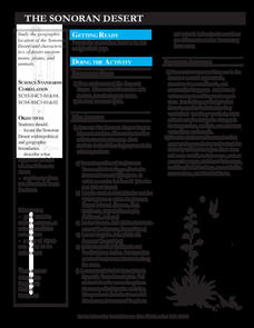
The Sonoran Desert
Little learners examine a map of the southwestern United States and identify the Sonoran Desert. They locate different cities and rivers, determining whether or not each is found within this special ecosystem. A student handout is...
Curated OER
Geomnemonics: Facilitating the Teaching of Social Studies Content with Geography Skills
Students explore how to draw a world map by hand and how to locate countries.
Curated OER
A Season for Chapters
Art, music, poetry, and the beauty of the seasons is what you'll find in this very nice unit idea. You can use any of the suggested books and activities to engage your second graders in an exploration of the changes that take place...
Curated OER
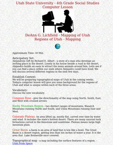
Regions of Utah - Mapping
Fourth graders draw a rudimentary map of the state of Utah, dividing it into the three regions: the Great Basin, the Colorado Plateau, and the Rocky Mountain Region.
Curated OER
Lesson #3: Internet Map Activity
Learners label assembly centers and relocation camps on a given map of the United States in order to create a better understanding of the relocation experience of Japanese-American citizens and the distance that families had to move and...
Curated OER
Sailin' Through Time...Rhode Island, The Ocean State
Fourth graders explore the history of Rhode Island. They research famous people who brought change to the state. They explore the state song, natural resources, and colonies of the state. In groups, 4th graders create a travel brochure...
Curated OER
Spatial Connections
Students use maps, scales, and describe locations in order to learn about spatial sense. In this spatial sense lesson plan, students participate in many activities for this spatial sense unit that should last throughout the year.
Curated OER
What and Where is Puerto Rico?
Learners explore Puerto Rico. They create K-W-L charts of their prior knowledge of Puerto Rico and observe maps of Puerto Rico. They code the map for measurements and land and water forms. They explore websites to gain background on...
Curated OER
Studying the States!!!
Students explore the fifty states of America. They also learn the capitals and locations of the states. They also study the population, mottos, flags, and interesting historical facts about each state.


