Curated OER
Activities to Enhance STEDII Data
Students develop an understanding of related weather processes such as wind, cloud cover, and temperature using STEDII data and instrumentation. In addition, they integrate mathematical calculations to produce a forecast map.
Curated OER
Air Masses & Fronts
Students use a set of maps depicting a front passing through the state to identify two distinct air masses and the frontal boundary. They then deterine whether the front is moving in time and in what direction the front is moving.
Curated OER
Hot, Wet, and Cold
Pupils research climate data for a city in each of the 5 major geographic sections of Texas. They use data to describe the climate and what influence the geography of that section has on the weather.
Curated OER
Introducing The Gulf Stream
Sixth graders research the average temperatures of different places on Earth. In this earth science lesson, 6th graders explain how the sun's heat cause ocean movement. They discuss how temperature change affects the weather we experience.
Curated OER
Rain Shadows and Sea Breezes
Students plot the average rainfall for a variety of cities in the United States. Using the map, they work together to determine patterns on which toxicants are transported through the air. They determine the impacts of various weather...
Curated OER
Baltimoreans in the California Gold Rush
Eleventh graders explore the reasons for migration to California during the Gold Rush. In this American History lesson, 11th graders read letters about the opportunities and obstacles people faced. Students create a map of migration...
Curated OER
Climate Patterns across the United States
High schoolers articulate differences between climate and weather using examples in a written statement. Using climate data from across the country, they describe climate patterns for various parts of the United States on a map. Students...
Curated OER
Cold Fronts
Students determine its' direction of movement, and list at least five weather conditions associated with the specific front, given animations of several atmospheric variables during a cold front passage. They list at least three weather...
Curated OER
At Home On The Range
Young scholars explore the history and domestication of the Bovidae family and their importance to our prairie ecosystem. Using a map of the United States, students located the American Great Plains. They complete worksheets and...
Curated OER
Arctic Microclimates
Students identify, measure, and average micro-climatic temperatures in a particular region. They draw a small-scale map of an area to be sampled (classroom, playground, park, backyard) and identify potential locations for...
Curated OER
At Home on the Range
Fifth graders complete a worksheet. In this bison and great plains lesson, 5th graders read information about bison and complete a worksheet of comprehension questions. Students locate the American Great Plains on a map and answer the...
Curated OER
Isotherms and Fronts
In this weather activity, students draw in isotherms on a temperature map. Students indicate the location of cold fronts, warm fronts, and stationary fronts. This activity has 2 drawing questions.
Curated OER
Hurricanes
Eighth graders gather information on hurricanes that are affecting the world at the time of the lesson. They work together in groups to collect the data and record their information in a table. They are asked questions to finish the lesson.
Curated OER
Celebrating the Solstice and Equinox
Fourth graders graph the number of daylight hors throughout the year and examine why day length varies. They discover that seasonal changes and latitude on Earth affect the number of hours of daylight in each day. Students listen to...
Curated OER
Earth's Surfaces
Students identify and define geology and earth surface vocaulary and their meanings to classify rocks and explore caves and their properties. Students find rocks and test them according to Moh's scale. They create a color coded earth...
Curated OER
Air Masses
Students examine the physical characteristics of several types of air masses to discover how air masses can be identified and defined by their temperature and moisture content.
K12 Reader
Meteorologists
Meteorologists and the tools they use are the subject of a reading comprehension instructional activity that asks kids to read the attached article and respond to a series of comprehension questions.
Curated OER
Central Park Field Trip
Students visit the park to observe signs of spring in the forest and pond environments. For this field trip lesson, students explore the park for various items
Calvin Crest Outdoor School
Survival
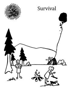
Equip young campers with important survival knowledge with a set of engaging lessons. Teammates work together to complete three outdoor activities, which include building a shelter, starting a campfire, and finding directions in the...
Disney
Where Do Brown Bears Live?
What do brown bears in Alaska's Katmai National Park need to survive? Pupils explore the unique habitats, diet, and survival needs of this animal. They predict the consequences of removing any integral part of the bear's survival, and...
Curated OER
The Prairie Climate
Ninth graders research the average temperature and precipitation of a prairie region to determine the type of climate it is, and how it differs from other biomes. They examine the types of adaptions animals have made to live in the...
Curated OER
Third Grade Science
In this science worksheet, 3rd graders answer multiple choice questions about measurement, plants, water, fossils, and more. Students complete 25 questions.
Curated OER
Alice World:Tornado
Seventh graders use the Alice program and complete a world that is damaged after a tornado. In this atmospheric conditions lesson students complete an activity using the Alice program.
Curated OER
How Mountains Shape Climate
Students use raw data to make a climatograph; they explain the process of orographic precipitation and the concept of a rain shadow.


