EngageNY
Reading Maps: Locating the Countries We Have Been Reading About
Show your class how to read a map and decipher all of the markings and features. Start out by connecting maps to their homework from the night before and their current reading, in this case That Book Woman, and a related informational...
Curated OER
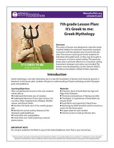
It’s Greek to Me: Greek Mythology
Here you'll find a great collection of worksheets to supplement your instruction of Greek mythology, including informational texts on the Olympian gods and goddesses, a matching quiz, graphic organizers, and myth-writing activities.
Brooklyn Children’s Museum
Inside India
What can a Ganesh statue, hand ornament, and print block tell you about India? Introduce your learners to the geography, history, and culture of India by analyzing primary sources and using the well-designed worksheets provided in this...
Curated OER
The Big Circle
Students explore geography by participating in a mapping activity. In this concentric ring lesson, students utilize a poster board, string and markers to identify their current location within the entire world. Students write about their...
Curated OER
Ring of Fire
Students locate some of the 1,500 active volcanoes on a world map. Then by comparing their maps with a map of the world's tectonic plates, they discover that volcanoes occur because of the dynamic nature of the Earth's lithosphere.
Curated OER
ESRI Live Earthquake Site
Students examine a World map and find earthquakes near plate boundaries. They locate and describe earthquakes in the United States and California.
Curated OER
Where Am I?
Young scholars identify volcano locations by latitude and longitude. They analyze a world map, and complete a "Volcano Event Locations Chart."
Curated OER
Schools Around the World
Students discover how schools around the world are the same and different. In this international school lesson, students learn about different types of schools from all around the world and the items and activities within these schools....
Curated OER
Breads Around the World
Sixth graders explore world cultures by researching dietary habits. In this bread identification lesson, 6th graders explore different regions around the world and the types of breads they produce. Students read assigned text about the...
Curated OER
Around The World
Students identify the capitals of the target countries. They locate the target countries on a world map. Students describe one major issue facing the inhabitants of each of the target countries.
Curated OER
Four Corners Mystery: Where In The World Are We?
Students research and describe various locations around the world using five fundamental themes of geography.
Curated OER
Coral Reef Geography
In this coral reef geography worksheet, learners find locations of reefs on a globe or map. There are 10 instructions to follow. There is no map provided--an atlas, globe or map is needed.
Curated OER
A Passport to WWII and the Holocaust
Students explore the Holocaust. In this interdisciplinary lesson, students research Hitler's rise to power, the terror of concentration camps, and World War II. Students read The Diary of Anne Frank , listen to a Holocaust survivor, and...
Curated OER
Where in the World is Tacky the Penguin?
Students complete an art activity and a classroom graph that coincides with the Tacky the Penguin Series by Helen Leste.
Curated OER
GEOGRAPHY: SPACE CENTERS
Young scholars examine the descriptive science dealing with the surface of Earth, its division into continents and countries, climate, natural resources, inhabitants and industries of the various divisions and analyze the political...
Curated OER
How To Make an Apple Pie And See the World
Students define and discuss global interdependence. They read How to Make an Apple Pie and See the World and keep a list of the countries visited during the story and identify all of the productive resources and natural resource...
Curated OER
The Holocaust
Tenth graders reflect on the effects of the Holocaust and the events leading up to World War II. In this World History lesson, 10th graders complete several activities, including a WebQuest, that analyze the Holocaust and its...
Curated OER
Maps Can Help Us
First graders explore the geography of Montana by analyzing geographic maps of the area. In this Native American reservation lesson plan, 1st graders discuss the similarities and differences between reservations in the state of Montana....
Curated OER
A World of Taste--Louisiana Gumbo
Students discover the multicultural contributions to New Orleans gumbo through participation in cross curriculum activities. In this multicultural diversity and New Orleans history lesson, students shade regions of a map according to a...
Curated OER
Geography Booklet
Sixth graders explore geography terms. Students use resources to find real examples of landforms in the world. They create a map showing the landform. students label the surrounding features, countries and states. Students use each...
Curated OER
City Change As a Result of a War Damage, World War 2 Onward
Seventh graders study how town in England have grown. They look photos in order to see how bombing raids of World War II effect this growth.
Redefining Progress
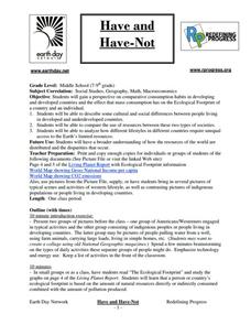
Have and Have-Not
Is there a correlation between a country's wealth and the extent of its ecological footprint? What exactly constitutes an ecological footprint, and how does one country stack up against the rest? This is a unique instructional activity...
Curated OER
Oil: The Problem or Solution to the World's Economic Future
Students map the major oil producing and consuming countries and regions. They identify current and future topographic and political problems that could affect the production and transportation of oil.
Curated OER
Identifying, Mapping, and Personifying Countries Involved in WWII
Get artsy with this WWII group activity, starting with a whole-class assignment. Create a map of Europe, Northern Africa, and the Pacific using geometric shapes cut from construction paper and placed on the floor. Consider splitting the...


