Curated OER
Canada's Geographic Position
Ninth graders investigate the characteristics of the geographic position of Quebec and Canada in the World. They study Canada's land and water boundaries, surface area and time zones.
Curated OER
Art Critic for a Day!
Middle schoolers practice evaluating art by creating a research project and presentation. They use the Internet and library to discover a piece of art or artist whom they feel has an impact on the world of art. Next, they create a...
Curated OER
Physical Education Unit Plan: Soccer - Lesson 10
The concluding lesson in this four-star series is World Cup day! Players come dressed in the colors of the country they are representing for the World Cup tournament. The rules for the mini-games in this tournament are modified to allow...
Curated OER
The Euro in Crisis
The November 14, 2011 edition of the New York Times included an article about debt and the European economy. Critical readers use the article to answer 13 who, what, when, where, and why questions.
It's About Time
Present-Day Climate in Your Community
So what exactly is climate? This first installment of a six-part series introduces the concept of climate using real-world data tables and topographic maps. The timely lesson includes a comprehensive overview of climate, as well as...
Science Matters
A Model of Plate Faults
The San Andreas fault is one of the longest fault zones in the world. In a series of 20 lessons, the fourth lesson has pupils use a paper model to recreate various types of plate faults. Each is held in position then drawn into a science...
Curated OER
The Golden Rule of Reciprocity
Students compare and contrast versions of the "Golden Rule of Reciprocity" as it is stated in several major world religions. They write their own version of the rule.
Curated OER
Climate Survival
Students use information about different world climate regions to plan how to survive in a particular climate zone for one year. They present their survival plans.
Curated OER
Go Ahead, Take a Guess! Estimating in the Real World
Learning how to use estimating to solve real life problems can be a great way for students to apply math skills.
Curated OER
Geomnemonics: Facilitating the Teaching of Social Studies Content with Geography Skills
Students explore how to draw a world map by hand and how to locate countries.
Curated OER
Tools of the Trade: The Use of Geographic Tools
Students examine the tools of demographic analysis and apply them to real-world situations. They analyze maps, define terminology, and write an information paper for the appropriate government agency to recommend an action or policy change.
Curated OER
La Belle Époque [1871-1914]:
Progress through various aspects of the "The Beautiful Era" in this presentation. Political, technological, and scientific contexts surround the time of innovation and change in the world landscape. The short length of this slide show...
Curated OER
ESRI Live Earthquake Site
Students examine a World map and find earthquakes near plate boundaries. They locate and describe earthquakes in the United States and California.
Curated OER
Hello Sun, Goodnight Moon
Students become familiar with different times around the world through the reading of 9 O'clock Lullaby. In this Earth, sun, moon lesson, students recognize the movement of the Earth and the relationship to the sun and the moon. ...
Curated OER
Magnetic Storms
In this magnetic storms learning exercise, students use a graph of data collected over time showing the magnitude of a magnetic storm. Students use the data to solve 6 problems about the graph and they determine the strength of the storm...
Curated OER
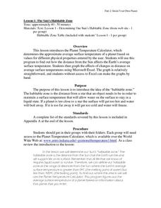
The Sun's habitable Zone
High schoolers explore the average surface temperature of planets. They use the Planet Temperature Calculator to find the average temperature. Students explore how the distance from the sun affects the Earth's average surface...
Curated OER
Interstellar Real Estate - Defining The Habitable Zone
Students explore the orbital characteristics a planetary home needs to support Earth-like life forms. They develop an understanding of critical planetary mass to determine which newly discovered planets might be capable of supporting life.
Curated OER
A SALT WATER-Y WORLD
High schoolers observe a model of the distribution of the earth's water and compare the relative volumes and percentages of types of water on earth.
Curated OER
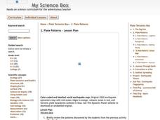
Plate Patterns
Students read about a volcano and use the latitude and longitude information to plot and describe the volcano on the map. They discuss patterns seen on the map. In addition, they color code a map according to zones, plates, etc.
Curated OER
Aquaculture
Learners examine an experiment in which 2 types of commercial fish are fed a new type of fish feed and a commercial fish feed which costs ten times as much. They calculate in the fish grow as well with the cheaper fish feed and then...
Curated OER
Using Vegetation, Precipitation, and Surface Temperature to Study Climate Zones
Middle schoolers begin their examination of the climate zones found around the world. Using a software program, they identify the relationship between the vegetation, climate and temperatures of the different zones. They also plot...
Curated OER
Lesson Plans Using Calendars
Students can learn about the history of calendars and the use of time management skills with these lesson plans.
Curated OER
Medieval African Kingdoms
Seventh graders examine the geography and political history of West Africa. They role-play as applicants to a company that transports customers to any historic time period. Working in teams, they create promotional products encouraging...
Curated OER
Principles of Flight: Flying Paper Airplanes
Students investigate ways to enhance an object's flying ability. In this model construction lesson, students construct two paper airplanes, one of which is twice as big as the first. Students compare and contrast the two separate...




![La Belle Époque [1871-1914]: PPT La Belle Époque [1871-1914]: PPT](http://content.lessonplanet.com/resources/thumbnails/292406/large/cgrmlwnvbnzlcnqymdeymtewoc0zmdqxni1ncdjpenquanbn.jpg?1414487063)


