Curated OER
Geomnemonics: Facilitating the Teaching of Social Studies Content with Geography Skills
Students explore how to draw a world map by hand and how to locate countries.
Curated OER
Tools of the Trade: The Use of Geographic Tools
Students examine the tools of demographic analysis and apply them to real-world situations. They analyze maps, define terminology, and write an information paper for the appropriate government agency to recommend an action or policy change.
Curated OER
ESRI Live Earthquake Site
Students examine a World map and find earthquakes near plate boundaries. They locate and describe earthquakes in the United States and California.
Curated OER
Hello Sun, Goodnight Moon
Students become familiar with different times around the world through the reading of 9 O'clock Lullaby. In this Earth, sun, moon lesson, students recognize the movement of the Earth and the relationship to the sun and the moon. ...
Curated OER
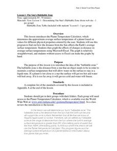
The Sun's habitable Zone
High schoolers explore the average surface temperature of planets. They use the Planet Temperature Calculator to find the average temperature. Students explore how the distance from the sun affects the Earth's average surface...
Curated OER
Interstellar Real Estate - Defining The Habitable Zone
Students explore the orbital characteristics a planetary home needs to support Earth-like life forms. They develop an understanding of critical planetary mass to determine which newly discovered planets might be capable of supporting life.
Curated OER
A SALT WATER-Y WORLD
High schoolers observe a model of the distribution of the earth's water and compare the relative volumes and percentages of types of water on earth.
Curated OER
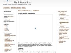
Plate Patterns
Students read about a volcano and use the latitude and longitude information to plot and describe the volcano on the map. They discuss patterns seen on the map. In addition, they color code a map according to zones, plates, etc.
Curated OER
Aquaculture
Learners examine an experiment in which 2 types of commercial fish are fed a new type of fish feed and a commercial fish feed which costs ten times as much. They calculate in the fish grow as well with the cheaper fish feed and then...
Curated OER
Using Vegetation, Precipitation, and Surface Temperature to Study Climate Zones
Middle schoolers begin their examination of the climate zones found around the world. Using a software program, they identify the relationship between the vegetation, climate and temperatures of the different zones. They also plot...
Curated OER
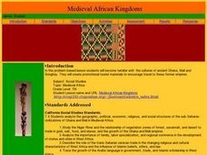
Medieval African Kingdoms
Seventh graders examine the geography and political history of West Africa. They role-play as applicants to a company that transports customers to any historic time period. Working in teams, they create promotional products encouraging...
Curated OER
Principles of Flight: Flying Paper Airplanes
Students investigate ways to enhance an object's flying ability. In this model construction lesson, students construct two paper airplanes, one of which is twice as big as the first. Students compare and contrast the two separate...
Curated OER
Depth Line
Students use adding machine tape to plot increasing ocean depths and deep sea historical events.
Curated OER
Religions
Students study different religions and factions within the religion. They examine the political agenda of religious factions in civil war zones in Africa, Asia, or Latin America. They investigate high crimes against humanity in the name...
Curated OER
Our Water Resources
Students build a model aquifer to study groundwater zones and water table formation. Students use the models to measure the movement of polluted groundwater.
Curated OER
"Lista Negra-The Black Lists"
Students review the history and political motivation behind the U.S. adoption of the Monroe Doctrine and how national security measures collide with the issues of due process and human rights during times of war. They learn about how the...
Curated OER
Exploring the Beach
Students explore the beach. In this marine habitat instructional activity, students inspect sand grains, design beach profiles, classify marine life, and examine natural beach habitats. Students use spreadsheets to record data from their...
Curated OER
Location of Cities 201
Students work in pairs to locate the ancient cities on a world atlas using the longitude and latitude measurements. They examine the physical and human futures that explain their locations.
Curated OER
The Arctic and Taiga Ecozone of Canada
Students examine the various sub-regions of the Arctic and Taiga zones in Canada. Using the online Canadian Atlas, they locate and describe the characteristics of each zone. They organize their information into a chart and share it with...
Curated OER
How Did That Get in My Lunch?
Learners view "The Danger Zone" to learn about food poisoning and the bacterial causes and prevention. Students look at slides, use a worksheet, "Microbial Bugs"and the internet to identify and learn about each bacterium.
Curated OER
Brochures
Students discuss how the climate in their area affects they way they live their life. In groups, they identify the climate zones throughout the world and research one country of interest to them. To end the lesson, they make a brochure...
Curated OER
Views And voices From Within
Students investigate the life and artwork of Estelle Ishigo. They use a timeline and primary sources in order to understand the influence of living in a relocation camp during World War II. The lesson includes an extensive historical...
Curated OER
A Garden in the Mailbox
Learners study seed catalogs to find information about plants and growing seasons. They write letters requesting a seed catalog after using online resources. They use them complete an associated worksheet and discuss zone maps for their...
Curated OER
Plate Tectonics: Recycling the Seafloor
Young scholars classify earth's layers and plates using Ocean Seismicity data. In this plate tectonics lesson, students outline where the plate boundaries are on the world map. They then compare these predicted boundaries with USGS map...


