Curated OER
Map of Africa
Using a completed map (not provided), pupils will use this map to fill in the geographic features of Africa. An appropriate map can be printed using the Internet and placed under a document camera for the class to reference.
Curated OER
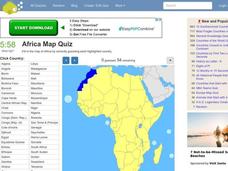
Africa Map Quiz
For this online interactive geography quiz worksheet, learners examine the map that includes all of Africa's countries. Students match each of the country names to the appropriate locations on the map.
Curated OER
Southern Africa Map Quiz
In this online interactive geography quiz worksheet, students examine the map that includes 15 Southern African countries. Students match the names of the countries to the appropriate locations on the interactive map.
Curated OER
Sub-Saharan Africa: Physical Geography
In this geography skills worksheet, students respond to 22 short answer and map skills questions about the location and geographic features of sub-Saharan Africa.
Curated OER
Africa Map Spatial Analysis
For this map skills worksheet, learners complete a graphic organizer that requires them to examine what is represented on different types of maps of Africa.
Curriculum Corner
Earth Day Book
This Earth Day, celebrate our beautiful planet with an activity book that challenges scholars to show off their map skills, complete a crossword puzzle, write acrostic poems, alphabetize, and reflect on their personal Earth-friendly habits.
Curated OER
Africa Map Quiz
In this online interactive geography quiz activity, students respond to 53 identification questions about the countries of Africa. Students have 6 minutes to complete the quiz.
Curated OER
School-Home Link: Maps
In this atlas and parent communication form worksheet, students use an atlas to find several things: the capitol city of Japan, the number of countries in Africa, where to buy a newspaper, the names of Presidents of the United States,...
Curated OER
The Roman Empire-Map Activity
In this Roman Empire worksheet, students complete a map activity in which they label and color civilizations, countries and physical features as instructed. There are no maps included.
Curated OER
Northern Africa Map Quiz
In this online interactive geography quiz worksheet, students respond to 18 identification questions regarding the nations of Northern Africa.
Curated OER
Central Africa Map Quiz
In this online interactive geography quiz worksheet, students respond to 15 identification questions regarding Central African countries.
Curated OER
African Lakes, Rivers, Bays, and Seas Map Quiz
In this online interactive geography quiz worksheet, students examine the map that includes 25 African lakes, river, bays, and seas. Students match the names of the bodies of water and waterways to the appropriate locations.
Curated OER
Tears of Joy Theatre Presents Anansi the Spider
Accompany the African folktale, Anansi the Spider, with a collection of five lessons, each equipped with supplemental activities. Lessons offer multidisciplinary reinforcement in English language arts, social studies, science, and arts...
Curated OER
United States Map Quiz
In this online interactive geography quiz instructional activity, students examine the map that includes all 50 states of the United States. Students match the names of the 50 states to the appropriate places on the map.
Curated OER
Africa Capitals Map Quiz
In this online interactive geography quiz worksheet, students examine the map that includes 53 African countries. Students match the names of the countries to the appropriate locations.
Curated OER
Partition of Africa Questions
In this colonial Africa worksheet, students study a map of Africa from 1885-1914. Students then respond to 9 short answer questions based on the information presented in the map.
Curated OER
Continents and Oceans
In this geography worksheet, students read a paragraph and learn about the seven continents and five oceans of the world. Students study a map of the world and answer 12 short answer questions. This is an online interactive worksheet.
Curated OER
The Treaty of Versailles: An Outside Perspective
In this World War I worksheet, students read an article about the Treaty of Versailles and examine 2 maps. Students then respond to 8 short answer questions based on the information.
Curated OER
North Africa & Southwest Asia Map Quiz
In this geography skills instructional activity, students examine the blank outline map of North Africa and Southwest Asia. Students label the countries located in the region.
Curated OER
Africa: Geography Concept Map
In this geography skills worksheet, students complete a graphic organizer where they list African countries and their geographic features, languages spoken, natural resources, and historical facts.
Curated OER
African Rivers Map Quiz
In this online interactive geography quiz worksheet, students examine the map that includes 15 rivers in Africa. Students match the names of the rivers to the appropriate places on the map.
Curated OER
African Lakes Map Quiz
In this online interactive geography quiz worksheet, students respond to 9 identification questions regarding the lakes of Africa.
Curated OER
African Seas Map Quiz
In this online interactive geography quiz worksheet, students respond to 12 identification questions regarding the seas of Africa.
Curated OER
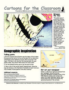
Cartoons for the Classroom: Geographic Inspiration
A wonderfully graphic cartoon entices learners to read more about issues near the Arabian Peninsula. They will use the provided cartoon and critical thinking question to practice building their analytical and critical thinking skills....


