NASA
Outline Maps
Don't miss this gold mine of blank maps for your next geography lesson! Regions include traditional continents such as Asia, Europe, and Africa, as well as other major world areas such as the Pacific Rim and the Middle East.
Curated OER
Blank Europe Outline Map
In this blank outline map worksheet, students explore the political boundaries of the continent of Europe and those of the countries located there. This map may be used in a variety of classroom activities.
Curated OER
Blank Europe Outline Map 2
For this blank outline map worksheet, students explore the political boundaries of the continent of Europe and those of the countries located there. This map may be used in a variety of classroom activities.
Curated OER
Europe Outline Map (Labled)
In this blank outline map worksheet, students study the political boundaries of the labeled European nations.
Curated OER
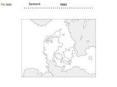
Denmark Outline Map
In this blank outline map worksheet, students explore the political boundaries of Denmark located in Europe. This map may be used in a variety of classroom activities.
Curated OER
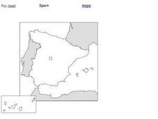
Spain Outline Map
In this blank outline map worksheet, students explore the political boundaries of Spain located in Europe. This map may be used in a variety of classroom activities.
Curated OER
Europe Outline Map
In this blank outline map worksheet, students explore the political boundaries of the continent of Europe and those of the countries located there.
Curated OER
Europe Map
In this blank outline map worksheet, students explore the political boundaries of the continent of Europe. This map may be used in a variety of classroom activities.
Curated OER
European Map
In this blank outline map worksheet, students explore the political boundaries of the continent of Europe and those of the countries located there.
Curated OER
Romania
In this blank outline map learning exercise, students explore the political boundaries Romania located in Europe. This map may be used in a variety of classroom activities.
Curated OER
European Integration: Who and Why?
This French IV-V instructional activity addresses European integration into the European Union. French language learners research, discuss, and present in the target language. Online research, discussion, and presentations will take...
Curated OER
Number the Stars
Students read Number the Stars. In this social studies lesson, students read the story and use a map of western Europe and identify the countries involved in the war. Students locate the cities of Denmark that are discussed in the story.
Curated OER
Roman Empire: Physical Framework - Location, Borders, Dimensions
Young scholars relate the classical world to the modern world. In this map skills lesson, students turn a blank map into a colorful complete map by following step-by-step directions. This lesson allows young scholars to connect our...
Curated OER
China - the Geography of European Imperialism - Spheres of Influence in China
Ninth graders create a map of China. They identify the various spheres of influence carved out by the Imperialist powers of Europe as well as locating geographical features of china and major cities. They explain the global impact of...
Curated OER
European Integration: Who and Why?
Students use the internet to research facts about the members of the European Union. In groups, they use their information to develop a presentation and a fact sheet. They must identify the positives and negatives of their European...
Curated OER
Number The Stars
Students read a book about prejudices that occur in our daily lives. They describe characters in the book. Students discuss real life events of World War II and the Holocaust. Students simulate hiding Jews from the German soldiers. ...


